More Stories
News 12 Storm Watch Team Meteorologist Scott Sincoff says New Jersey will see mostly sunny skies with seasonable temperatures ahead of potential showers for New Year's Eve.
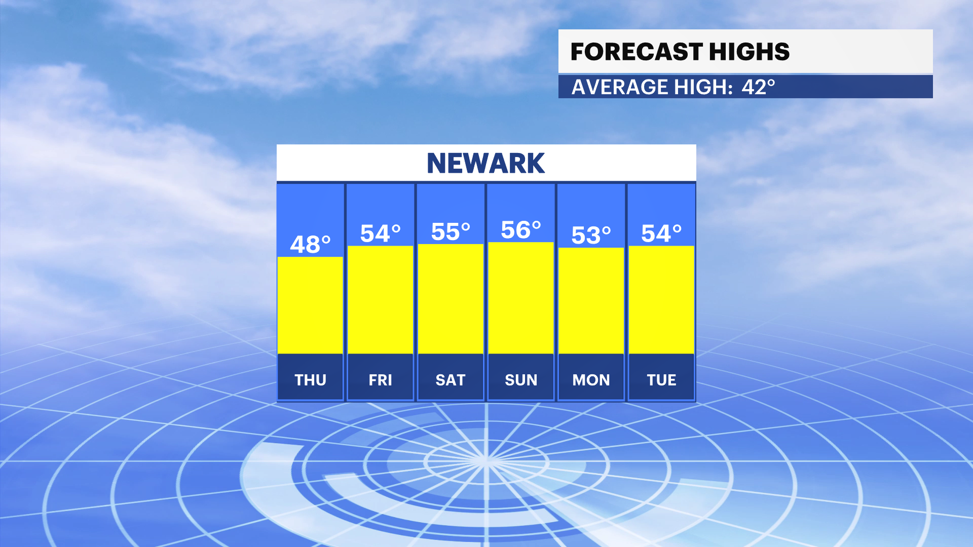
NEW: The warming trend only goes up from there. Temperatures will be in the 40s and 50s into 2023 as temperatures remain above average past New Year's Day.
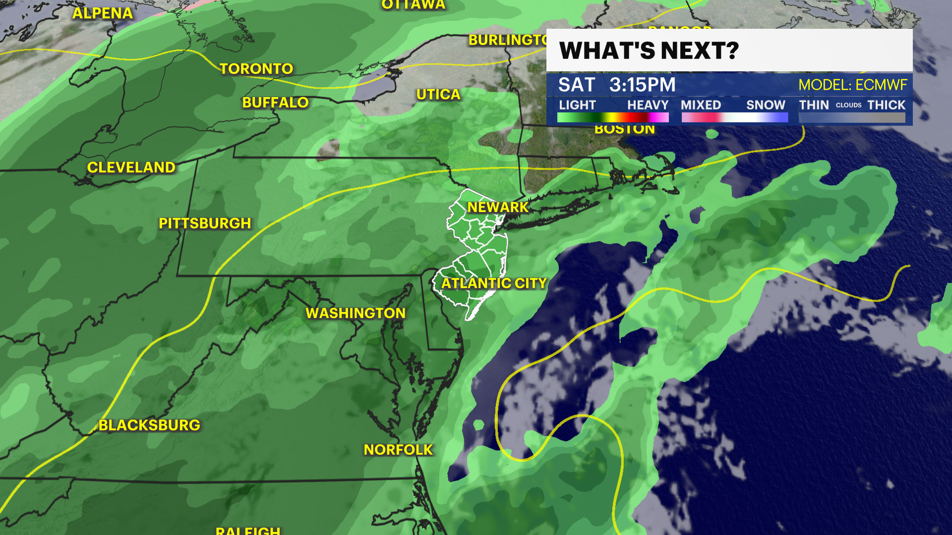
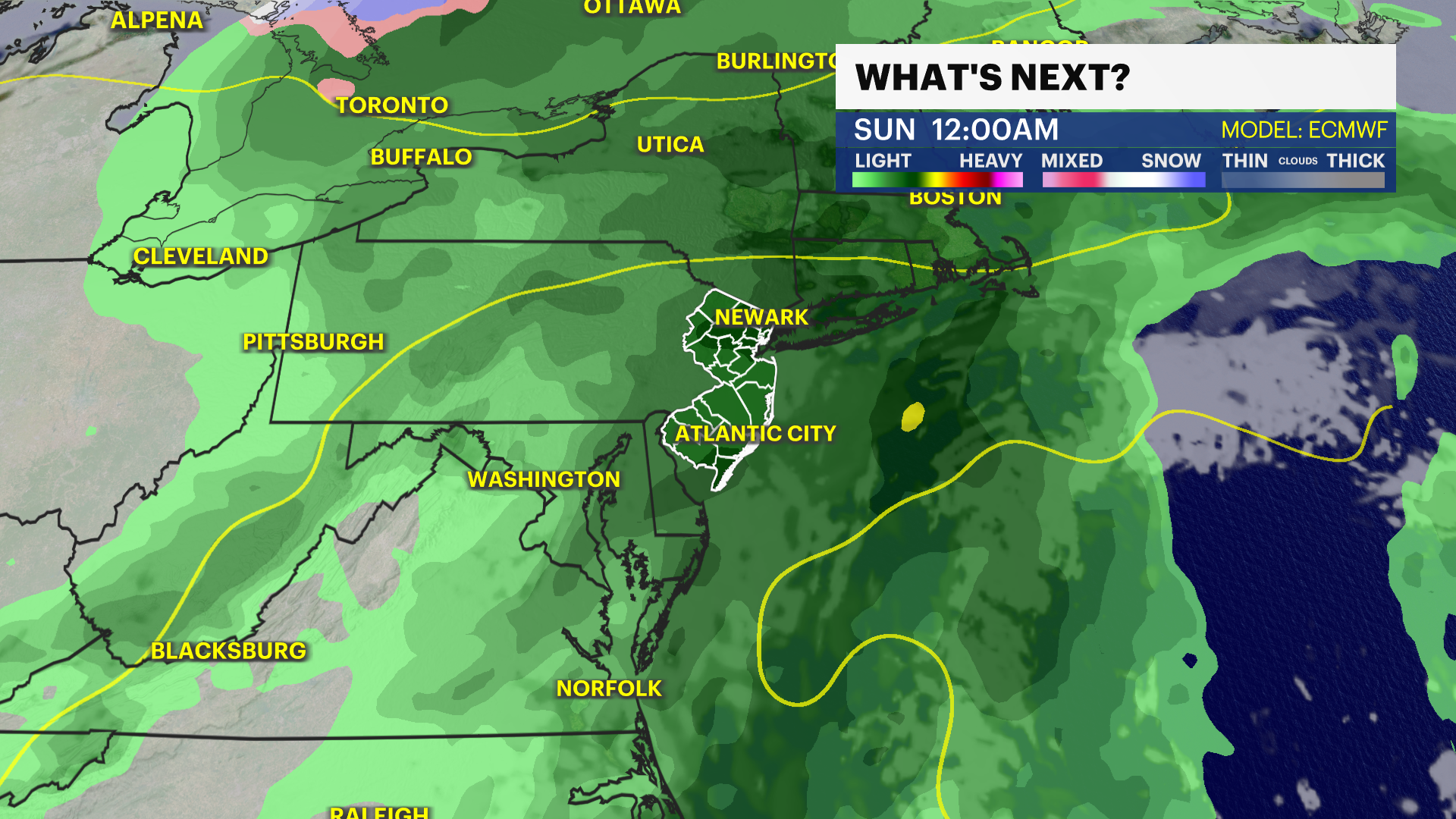
NEXT: Rain chances will start creeping back in starting New Year's Eve with wet conditions possible off and on into next week.
FORECAST
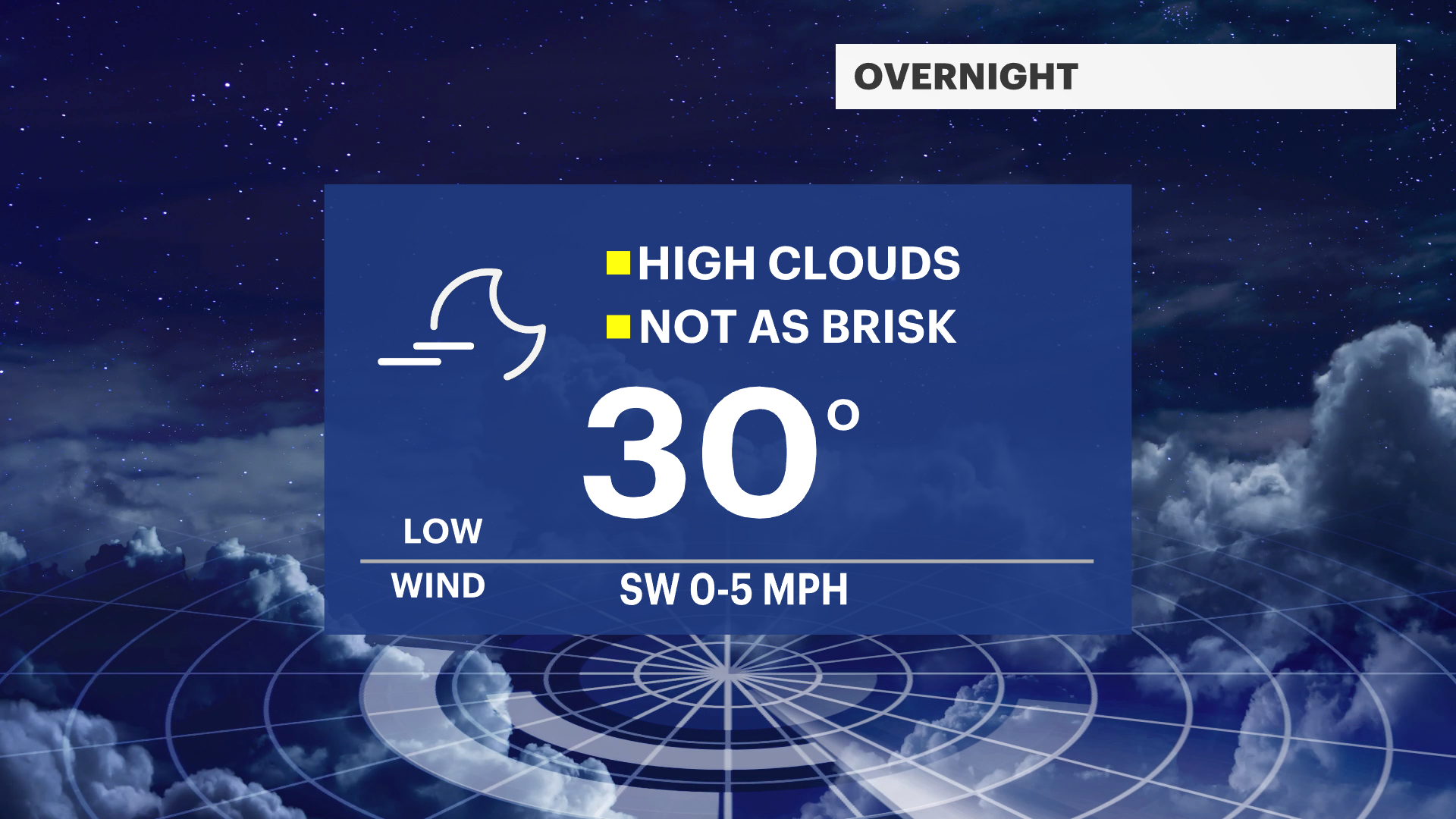
OVERNIGHT: Few clouds and not as chilly. Lows around 30. Light southwest wind.
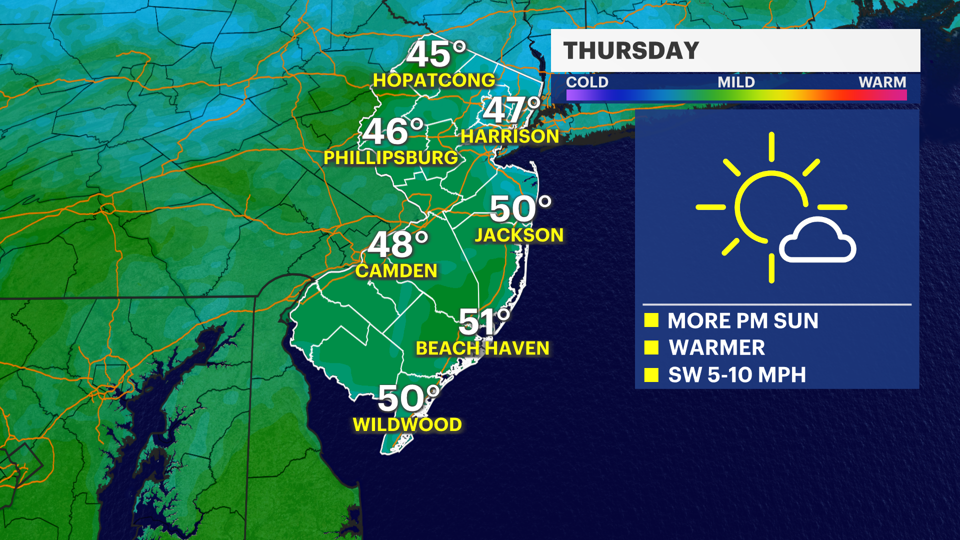
THURSDAY: Partly to mostly sunny and mild. Highs around 50 and lows in the 30s.
FRIDAY: Increasing clouds. Highs in the 50s and lows in the 30s.
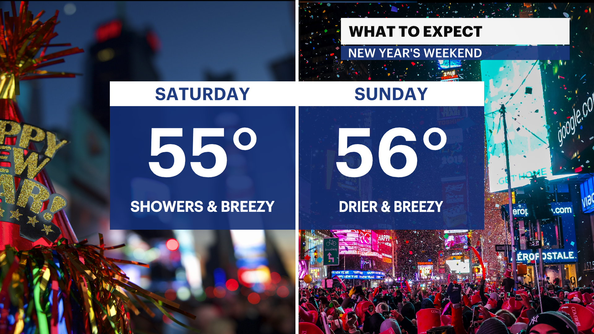
NEW YEAR'S EVE SATURDAY: Mainly cloudy with showers pushing in. Heaviest rain overnight. Highs in the 50s and lows in the 40s.
NEW YEAR'S DAY SUNDAY: Mostly cloudy, drier, and breezy. Sprinkles and light showers possible early. Highs in the 50s and lows around 40.
MONDAY: A mix of sun and clouds. Highs in the 50s and lows in the 30s.
TUESDAY: Showery and breezy. Highs in the 50s. Lows in the 40s.
WEDNESDAY: Warm, wet, and breezy. Highs near 60. Lows near 50.
More from News 12
2:09

NJ resident arrested in plot to firebomb Palestinian activist's home
2:21

Chilled sunshine for Saturday and the winds provide for an extra bite.
0:42

Officials: Suspect, victim face charges in Hackensack stabbing attack
0:21

Passaic man wanted for murder arrested in North Carolina
0:16

Somerset man killed in three-vehicle crash in South Brunswick
0:26
