STORM WATCH: Severe weather will make for a messy Wednesday morning commute
Storm Watch Team meteorologists say these storms will arrive in the overnight hours and last until around 9 a.m. The storms could make traveling around the state difficult.
More Stories


Severe storms arriving in New Jersey Wednesday morning will make a mess of the morning commute.
Storm Watch Team meteorologists say these storms will arrive in the overnight hours and last until around 9 a.m. The storms could make traveling around the state difficult.
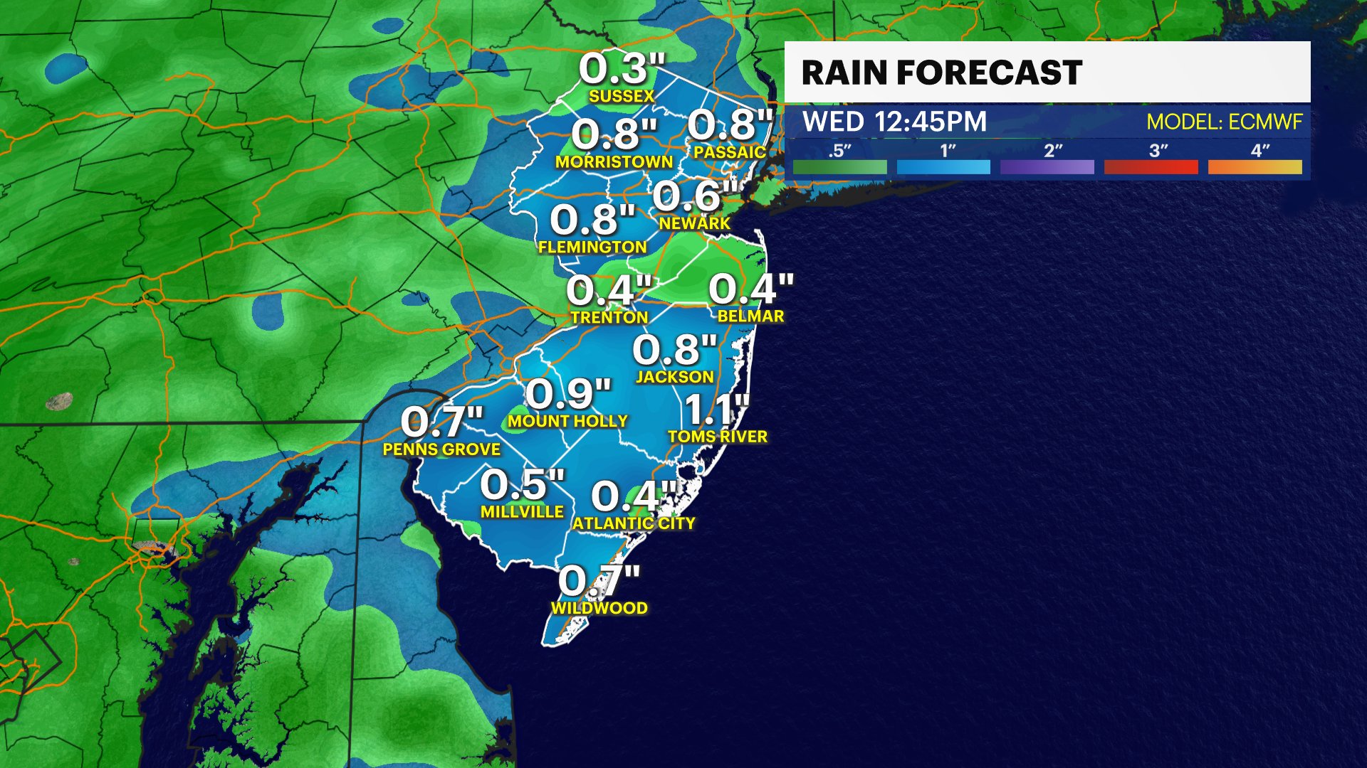
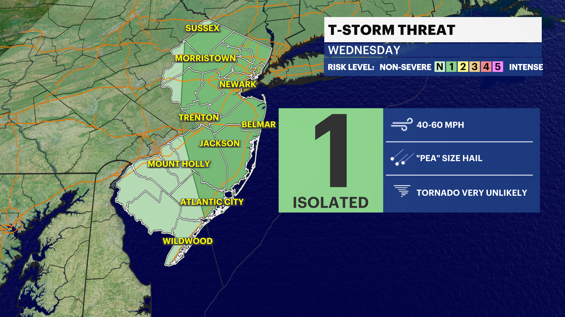
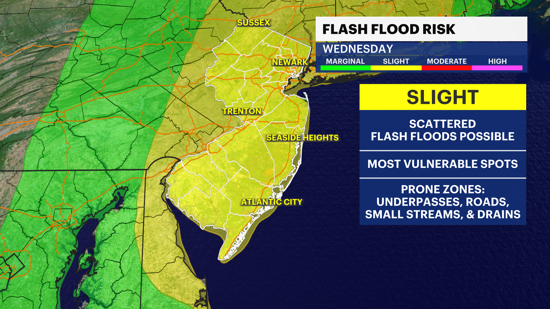
WHAT’S NEXT: Heavy rain, thunder, lightning, strong winds and hail are expected. These storms will be widespread around the state until the late morning hours. Flash flooding is also possible. A second round of scattered storms will be arriving by Wednesday afternoon.

MORE: News 12's local forecast report
TONIGHT: Partly cloudy evening with pleasant weather around 70 degrees. New Jersey residents should take advantage of the nicer weather at night. Storms will develop by around 3 a.m. or 4 a.m.
WEDNESDAY: Stormy weather in the morning and afternoon. Daytime highs in the mid-70s. Overnight lows around 66.
THURSDAY: Mostly sunny with some scattered clouds. Daytime highs around 76 degrees. Overnight lows cool to the upper-50s.
FRIDAY: Plenty of sunshine. Daytime highs around 73 degrees. Overnight lows around 56.
Watch below for this week's beach forecast:
WEEKEND: Partly cloudy Saturday with highs around 74. Mostly sunny Sunday with highs around 80.
COMING UP: The upcoming week should see plenty of sunshine with temperatures in the 70s.

TRACKING LEE
We continue to monitor Lee’s track for changes and potential impacts. The storm still looks well offshore with no major direct impact. Coastal impacts are possible - including rip currents and possible beach erosion.