Mostly sunny Friday ahead with highs in the 90s; tracking potential for some weekend rain
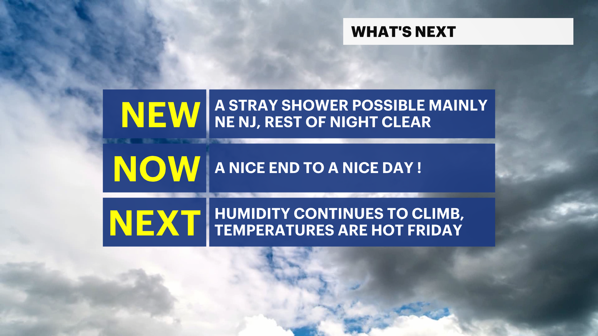
Temperatures fall to the upper-60s tonight. We're staying a little more humid.
More Stories


The end of our week is mostly mellow-- but still hot. Friday temperatures cruise to the upper-80s and low-90s. We're still seeing some wildfire smoke but it won't be impacting our air quality majorly as it is above surface level-- but will impact us haze-wise and will potentially allow for nice sunrises and sunsets.
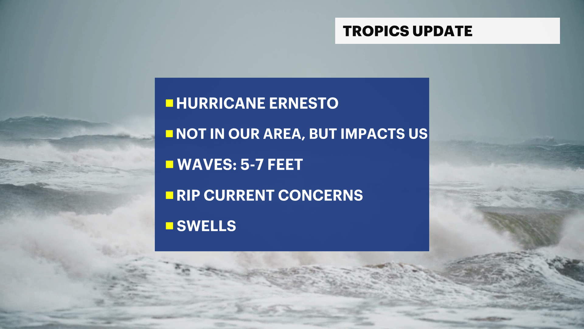
ERNESTO UPDATE: Main impacts will be ocean-related-- swells and high rip current risks for the weekend. This storm will pass hundreds of miles offshore Sunday so not expecting any impacts beyond the ocean concerns.
TONIGHT: Temperatures fall to the upper-60s. We're staying a little more humid. We could see a stray shower in northeastern New Jersey, but most of us will be dry and clear.
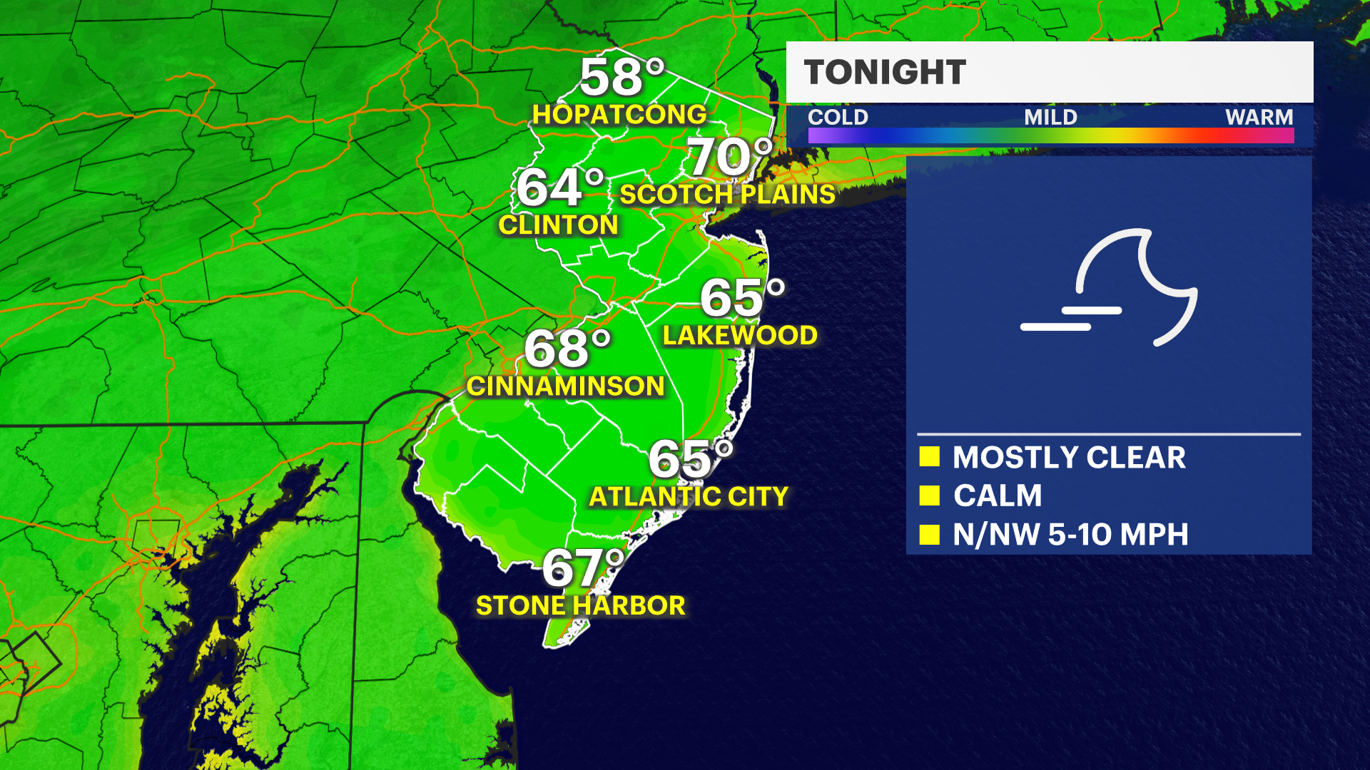
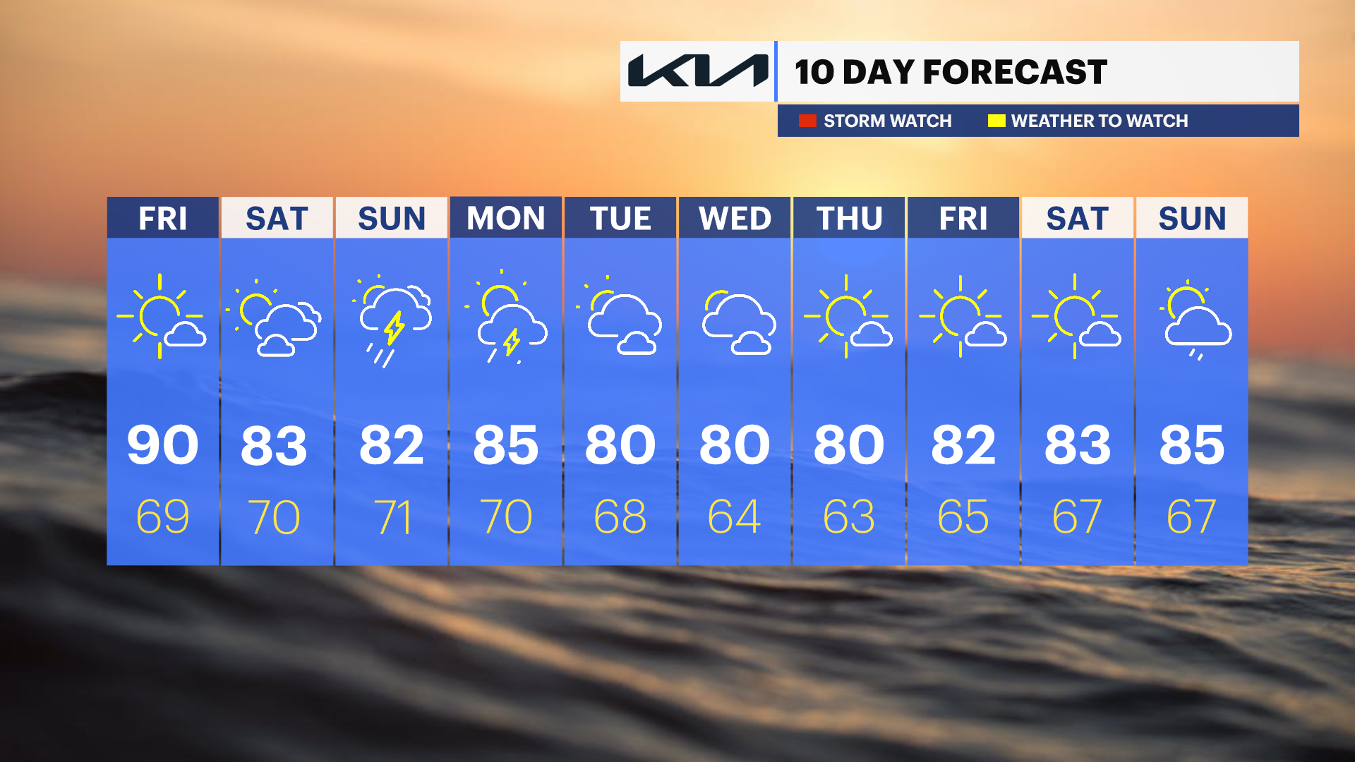
FRIDAY: Mostly sunny. Highs in the low-90s, lows in the upper-60s.
MORE: News 12 New Jersey Weather Center

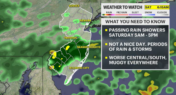
SATURDAY: Sun, clouds and muggy. Could see some rain overnight Friday into Saturday. Highs in the low-80s. Lows in the low-70s.
SUNDAY: Rain and storm chance and feeling very humid. Highs in the low-80s, lows in the low-70s.
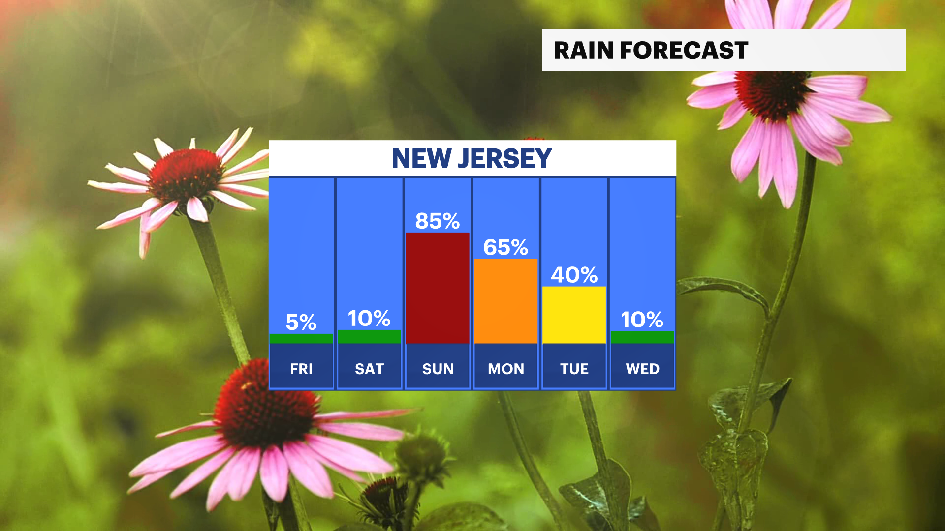
MONDAY: Rain and storm chance! Highs in the mid-80s, lows in the low-70s.
TUESDAY: Clouds and sun. Highs in the low-80s, lows in the upper-60s.
WEDNESDAY: Sun and clouds. Highs in the low-80s, lows in the mid-60s.
THURSDAY: Partly sunny. Highs in the low-80s, lows in the low-60s.