Dave’s Forecast: Clouds develop Thursday afternoon; tracking chance of rain Saturday
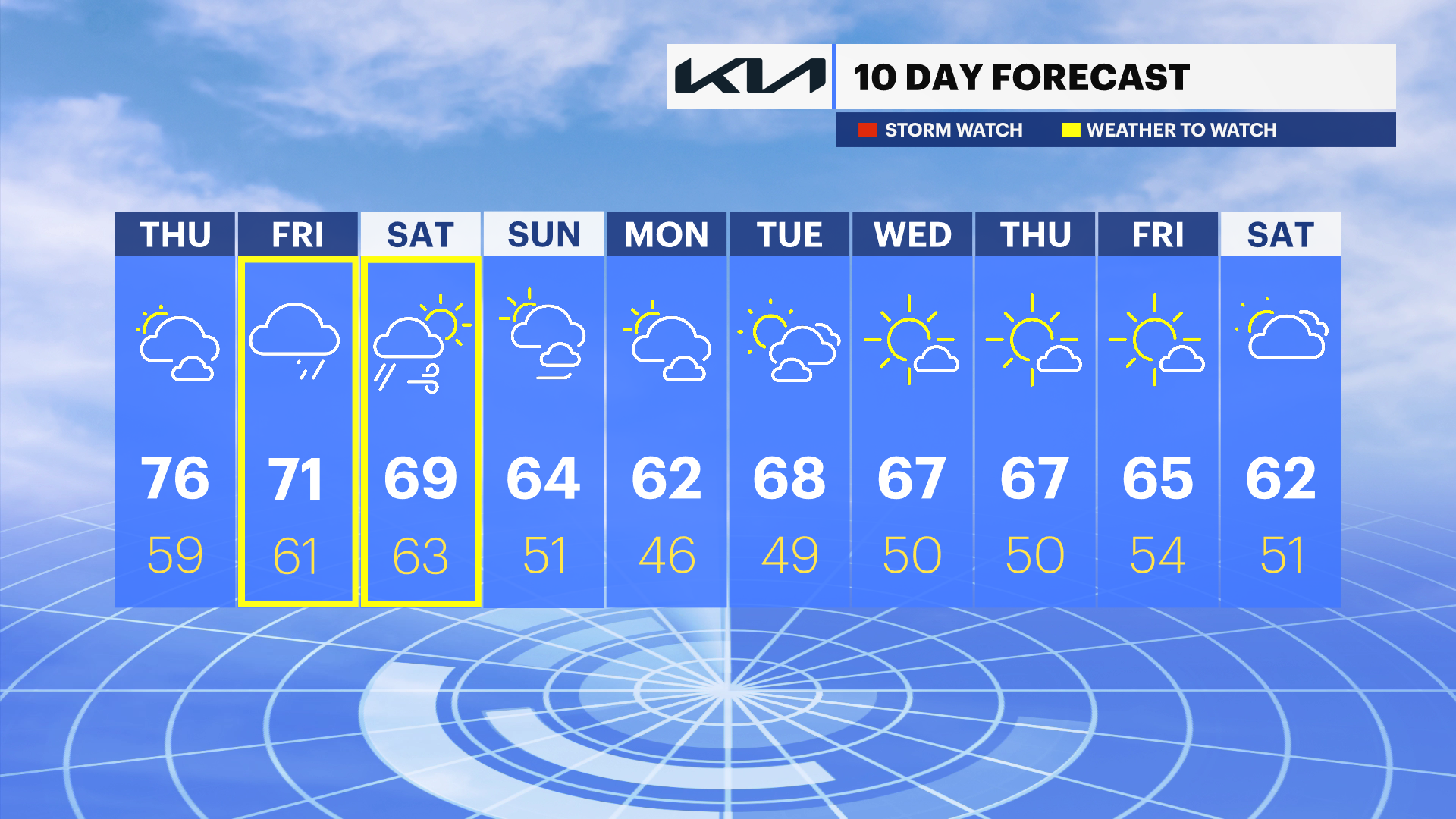
Clouds begin to develop Thursday afternoon and into Friday. Rain is possible Friday night into Saturday.
More Stories
Another day of OctobAHHHHHH weather. Not record-breaking, but for the fourth straight day temperatures have been in the 80s. We are more than eight degrees above the norm for the month. But don't get used to it. Change is right around the corner.
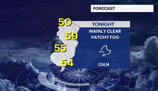
TONIGHT: Clear skies and light wind will allow some shallow fog to develop. Lows between 50 and 60 degrees.
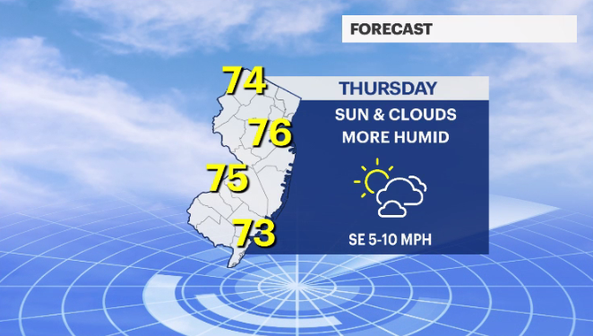
THURSDAY: More sun early in the day. Clouds slowly collect toward the end of the afternoon. You'll notice it's more humid out thanks to that south, southeast wind. It's not as warm as the last couple of days but still above normal in the mid- to upper-70s.
MORE: News 12 New Jersey Weather Center
FRIDAY: Overcast skies. Humid. Wind is light but from the northeast. Highs stay in the low- to mid-70s. Can't rule out a brief nuisance shower now and again.
FRIDAY NIGHT INTO SATURDAY: An upper-level system allows the clouds and an occasional shower to stick around longer than wanted. NOT a washout but the weather doesn't start to clear until much later in the day.
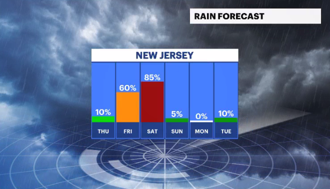
SUNDAY: The winds of change bring cooler/drier weather to the state. Autumnal air at its best. Partly sunny with a high in the low-60s.
COMING UP: Cooler weather takes center billing on the weather marquee next week. The leaves are beginning to change color. I think the warmth, then the cold and the recent spell of heavy rains will really have the vibrant yellows, reds and oranges pop sooner than later this year.
