More Stories
WHAT’S NOW: Turning more humid for the rest of the week. Tonight lows cool into the low-70s under partly cloudy skies and mild conditions.
WHAT’S NEXT: Watching a cold front for the end of the week. Risk of showers/storms Friday. Some could become strong or severe. Main threat will be damaging winds. Pockets of heavy rain. Not widespread heavy rain though, just isolated spots where it pours. Front is slow to clear, so we may revisit storm chance Saturday.
Storm Watch Team Meteorologist Dave Curren says Friday will see isolated and pop-up storms with torrential rains that could pose the risk of localized flooding in some areas.
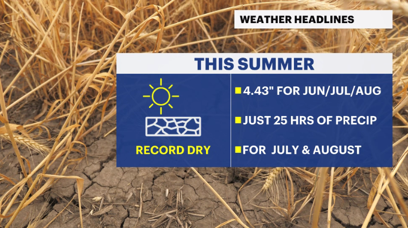
Same old weather song and dance. Very little rain in our future, but when isolated storms do pop-up tomorrow afternoon/ evening in a widely scattered, isolated nature, torrential rains are a fore gone conclusion. The weekend looks good with temps slightly above average and noticeable humidity. Last weekend before before the "unofficial" end to the summer season.
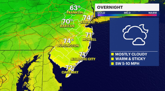
TONIGHT: Overnight lows cool
into the low-70s. Partly cloudy. Mild conditions.
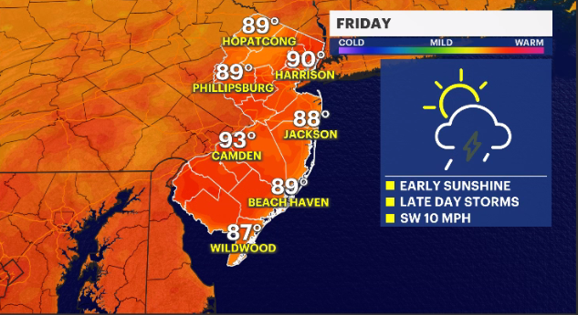
FRIDAY: Day starts off partly
cloudy, with scattered thunderstorms developing for the afternoon. Daytime
highs in the 90s. Stray storm possible into the evening. Overnight lows around
73.
SATURDAY:
Mainly sunny skies with some scattered afternoon clouds. Stay thunderstorm
possible. Daytime highs in the upper-80s. Overnight lows around 73.
SUNDAY: Isolated thunderstorms
possible in the morning, followed by partly cloudy skies. Daytime highs in the
mid-80s. More clouds possible Sunday night, with overnight lows around 73.
More from News 12
2:58

ICE agents accused of leaving New Jersey children unattended after arresting father
1:45

Windy weather in NJ this weekend brings back a seasonable chill
2:03

Will the Portal Bridge make NJ trains more reliable?
2:07

Mount Olive residents fed up with sewage smell
2:19

Zoning board grants Toms River nonprofit organization allowance of a permanent family homeless shelter
1:52
