More Stories
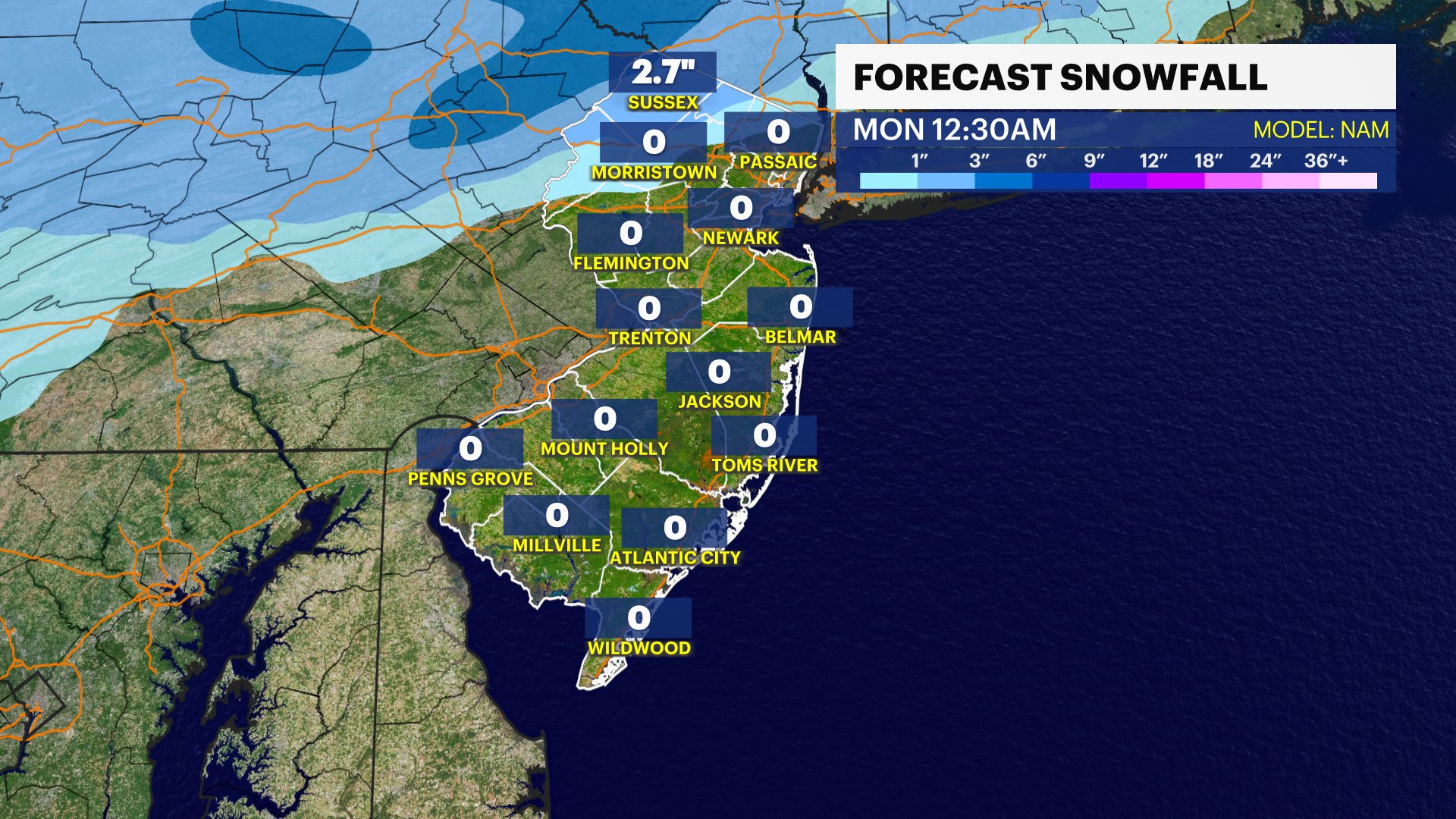
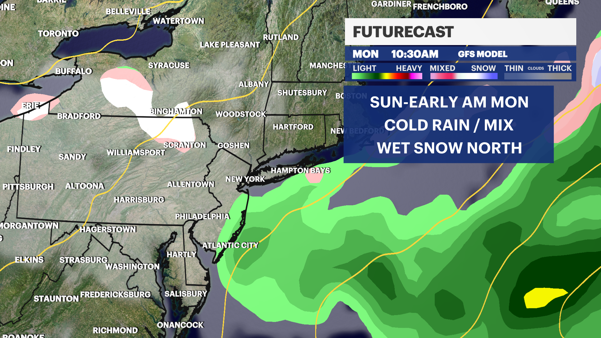
NEW: Light snow and mixed precipitation north of Route 80 is possible later Sunday and into Monday.
NOW: A cold start this morning with temps dipping into the 20s in NW Jersey. Isolated pockets of frost are possible as well.
NEXT: All are watching for the potential of wintry precipitation later Sunday and into Monday. As of now, the potential for snow is confined to a very small area of SUSSEX COUNTY. In the affected area, as much as 1-2 inches of snow could fall. Rain could reach as far south as Monmouth County, while this is a non-event for South Jersey.
SCHOOL CLOSINGS: Monitor school closings in your community (For school closing assistance please email NJSchoolClosings@News12.com)
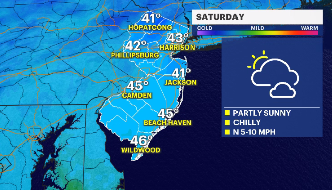
Storm Watch Team Meteorologist Dave Curren says temperatures Saturday will be dry before the chance for a wintry mix moves in Sunday night.
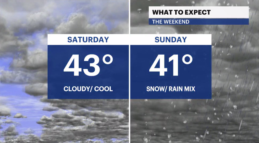
SATURDAY: Mostly cloudy skies with some sun. Daytime highs around 43 degrees. Overnight lows around 35
SUNDAY: Mostly cloudy skies with snow and rain developing by the nighttime hours. Daytime highs around 42 degrees. Overnight lows around 36.
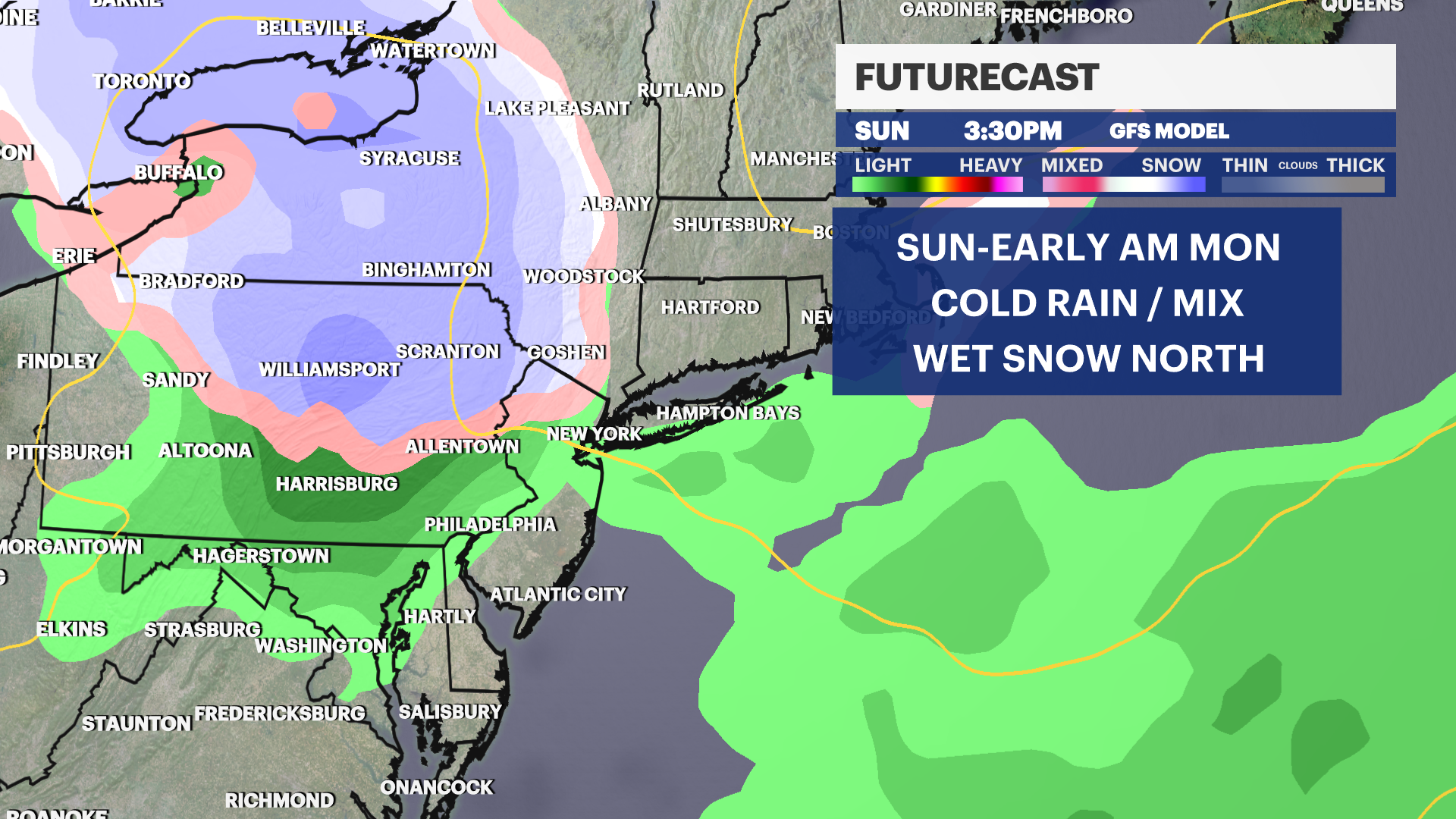
MONDAY: Flurries and rain continue in the morning, followed by a bit of clearing. Daytime highs around 41 degrees. Overnight lows around 29.

COMING UP: The rest of the upcoming week will see temperatures around the mid-40s with a mix of sun and clouds. There is a potential for some more snow on Thursday. But the timing and impact is still too far away to accurately predict.
More from News 12
1:46

Thousands across New Jersey lose power as storms topple trees and wires
2:20

Gusts up to 30-40 mph continue today before a calmer midweek

Firefighters stop exterior blaze from spreading at unoccupied Toms River home

Tree crashes through cab of train as storms move through NJ
0:27

Elizabeth man sentenced in fiancée stabbing death
1:42
