Sun and clouds this weekend; midday storms and flooding on Monday
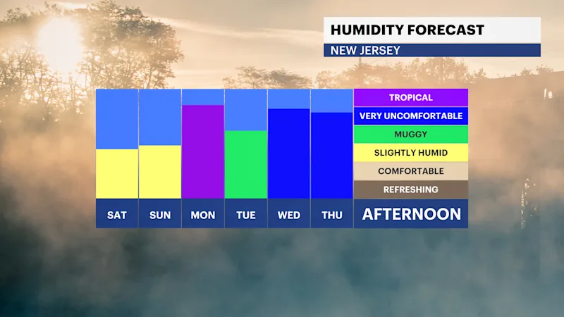
A fair weekend is expected with calm conditions ahead of high humidity that induces storminess throughout next week.
More Stories


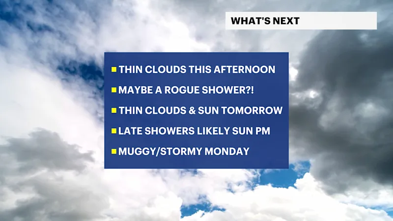
Today's weather is lovely. Temperatures will be in the mid to upper 80s under a mostly sunny sky that gives way to afternoon and evening thin clouds. There will be diluted sunshine today as a result, but it should otherwise be fair. Cloudiness lingering overnight with lows that drop in the lower 70s, and maybe in the upper 60s in elevated areas. There could also be a rogue, unplanned, surprise sprinkle at times today in some spots, but the chance for this is very low and isolated.
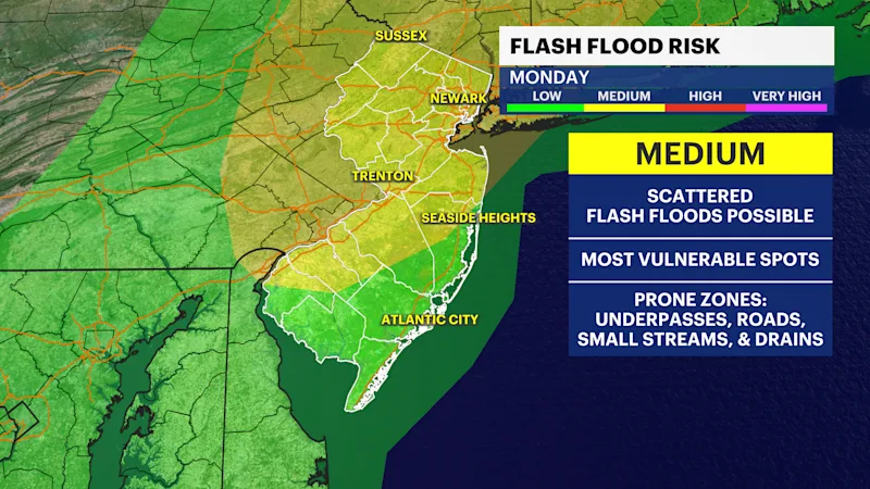
Sunday is a fair day with sun and clouds. The clouds thicken by the evening to an overcast that eventually ushers rain in for the late night. Rain showers move in for Monday where it will be stormy throughout the midday. Flash flooding is becoming likely and a problematic risk for Monday's weather.
Next week's humidity level is high and this will create afternoon and evening storms for Tuesday, Wednesday, and maybe Thursday.