STORM WATCH: Coastal Storm moves in with downpours and gusty winds
The Storm Watch Team is tracking the coastal storm that brings the threat of heavy rain and wind.
More Stories


The Storm Watch Team is tracking the coastal storm that is expected to pound New Jersey overnight with heavy rain and wind.
NATIONAL WEATHER SERVICE ALERTS:
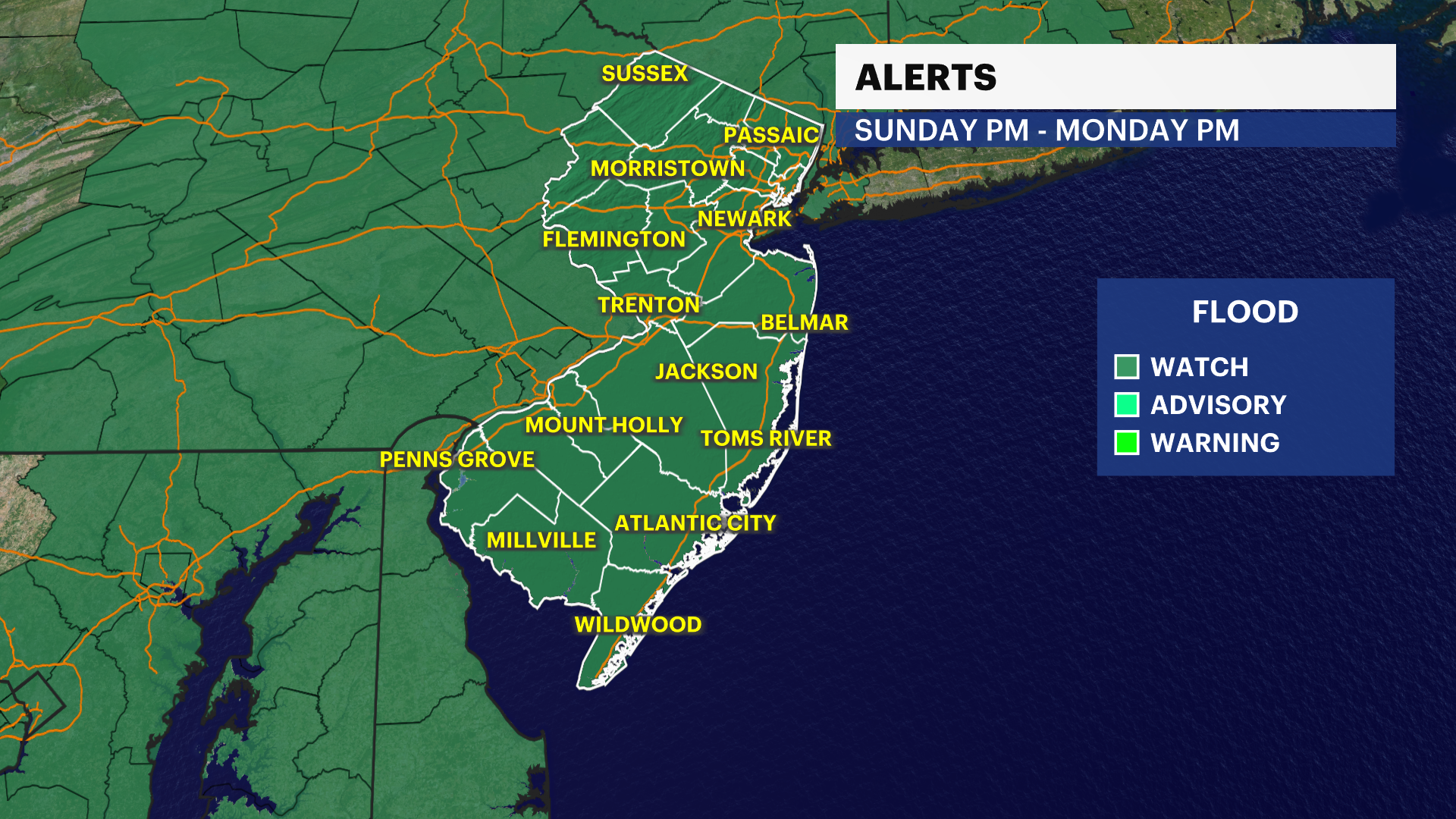
Flood Watch | All of NJ | Sunday evening to Monday evening
This highlights the potential of road, stream and creek flooding during this time.
Coastal Flood Warning | Cumberland County | Through Monday 6 a.m.
Property threatening flooding will be likely along the Maurice River and Delaware Bayshore with both the Sunday night and Monday morning high tide.
Coastal Flood Advisory | Monmouth, Ocean, Atlantic and Cape May counties | Through 4 p.m. Sunday
This is to highlight the risk of minor stage coastal flooding. Up to 4" of salt water likely occurred on susceptible bayside roads during the high tide earlier today. More coastal flood advisories will be likely for the high tide tonight (11AM-2PM) and then again Monday afternoon (12PM-3PM). Tidal flooding will be highest in the northern Barnegat Bay and then on the bayside of the barrier islands for Monday afternoon.
Wind Advisory | Monmouth, Ocean, eastern Burlington, Atlantic and Cape May Counties | Sunday evening to 7 a.m. Monday
This highlights the risk of spotty power outages and wind damage to large tree branches and tree limbs.
NEW: Rain becomes heavier and steadier. Winds will continue to pick up into the evening. The worst of the storm will be from roughly midnight to 8 a.m. Monday. A driving, wind-swept rain will create some issues on the roads. Streams and creeks can rise above their banks. Fortunately, last week's storm had minimal issues with 2-5 inches of rain. Despite nearly the same rain this time, I expect more issues, as the ground is already saturated. Coastal flooding will occur, likely closing down some roads. Expect power outages and wind damage.
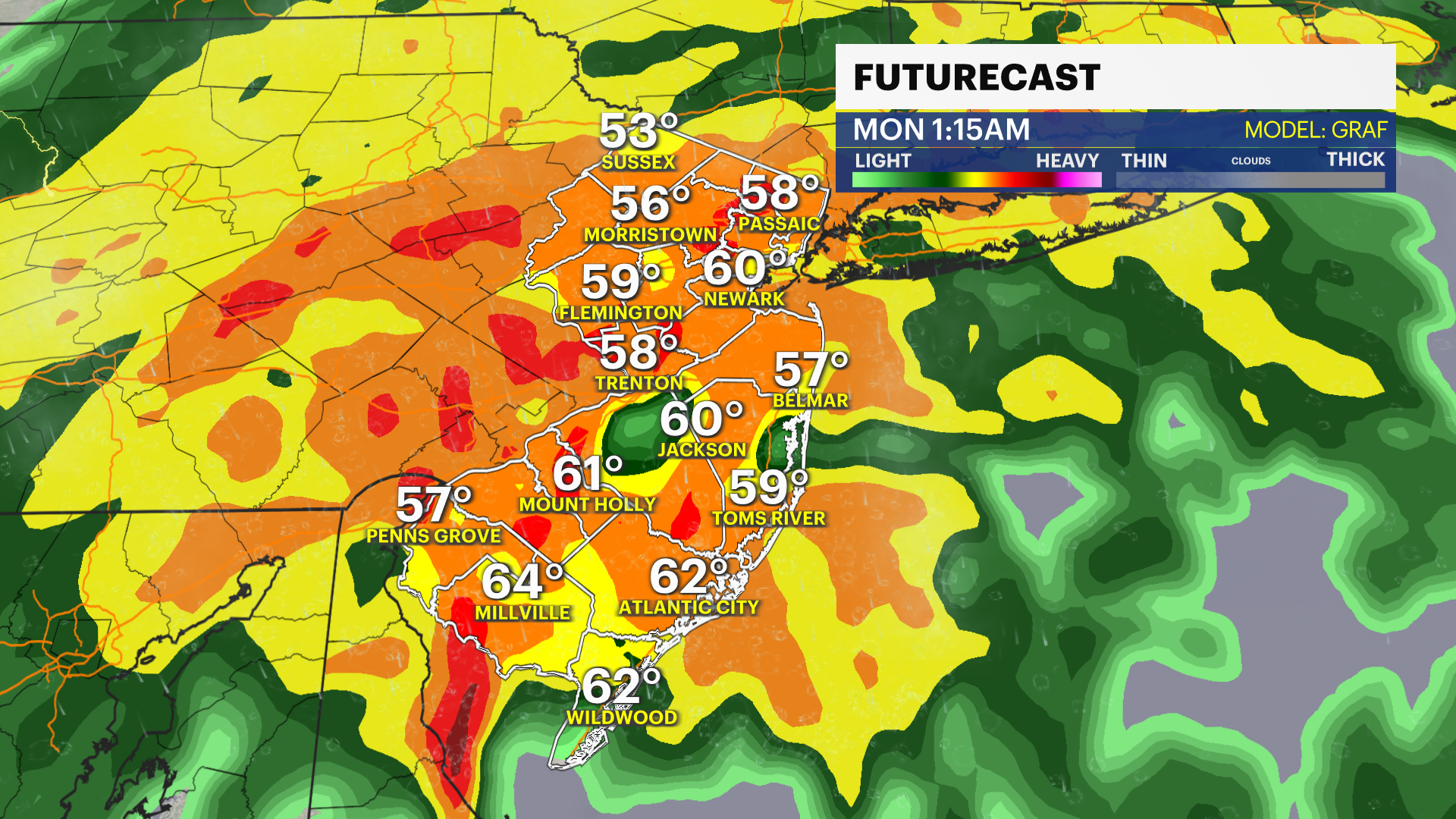
After 8 a.m., expect a break. However, another 2-3 hours of rain will pass between 10 a.m. and 4 p.m. Winds will remain gusty, though not enough for any serious wind issues. One more round of coastal flooding will occur when it rains, too.
Sunday Night: Wind swept rain. Rain and tidal flooding will threaten. Damaging winds will not be ruled out. Temperatures rise through the 50s.
Monday: Heavy rain and strong winds until roughly 8 a.m. Then, gusty winds continue with a break in the rain until late morning. Another round of rain will be present through late afternoon. Temperatures fall into the 50s and 40s.
Monday Night: Clear to start with a cold wind. Mixed rain/snow showers will be possible toward dawn. Lows in the upper 20s to around 32.
Tuesday: A rain/snow shower possible north of I-195 until 10 a.m. Otherwise, intervals of sun and cold. Breezy. Highs in the low 40s, with wind chills below 32.
Wednesday-Friday: Plenty of sunshine. Morning lows in the 20s (inland) and 30s (coast). Highs will be in the 40s.