More Stories
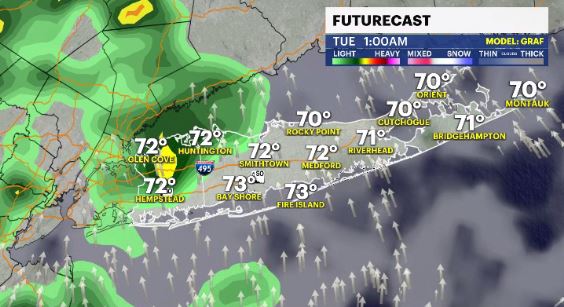
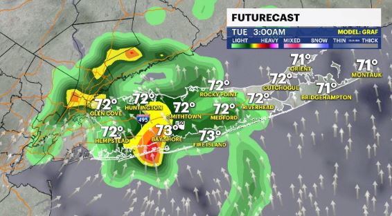
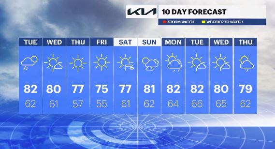
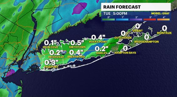
WHAT'S NEW: Unsettled weather lingers through straight into Tuesday morning with a threat of scattered showers and isolated thunderstorms.
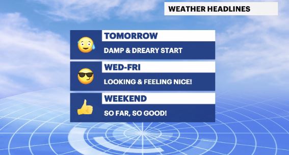
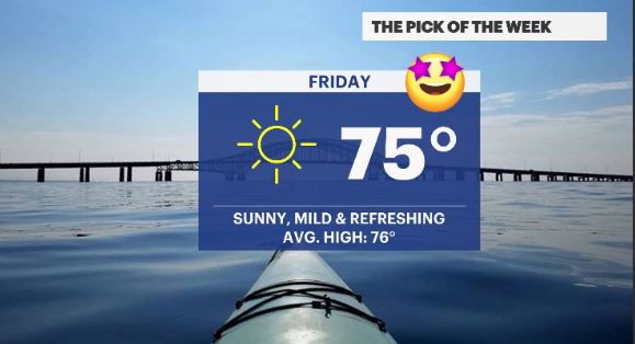
WHAT'S NEXT: Drier & more comfortable air moves in Wednesday through the weekend with Friday being amazing.
News 12 Storm Watch Team meteorologist Addison Green says chances for spotty showers and storms remain into Tuesday morning with better weather to come.
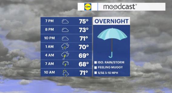
OVERNIGHT: Remaining muggy with isolated to scattered shower and thunderstorm chances moving through. Lows: low 70s.
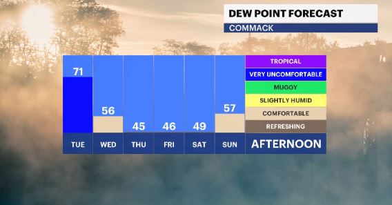
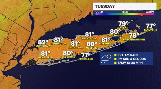
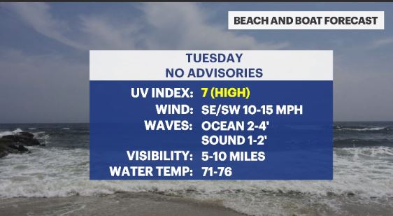
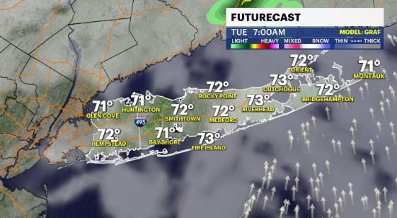
TUESDAY: A few batches of showers and storms will be around for the morning rush with diminishing chances heading into the afternoon. Highs: low 80s. Lows: low 60s.
WEDNESDAY: Mostly sunny, warm and breezy with a northwest wind, bringing in less humid air. Highs: low 80s. Lows: low 60s-Upper 50s.
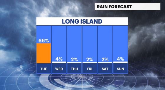
THURSDAY: Drier & comfortable with a breezy northwest wind and mostly sunny skies. Highs: mid 70s. Lows: upper 50s.
FRIDAY: *Pick of the week* - Sunny, mild, pleasant with very low humidity and a more relaxed breeze. Highs: mid 70s. Lows: mid 50s.
WEEKEND: Mostly sunny with some more clouds rolling in from Saturday to Sunday. Humidity will remain on low levels for Saturday but increasing for Sunday through the day. Rain chances are low to none. Highs: Upper 70s to low 80s. Lows: low 60s.
More from News 12
2:03

Proposed bill aims to align spring break schedules across school districts
2:03

Storms tonight bring blustery colder conditions tomorrow to New Jersey

Nutley teacher charged with child neglect after allegedly using narcotics on duty

Toms River man charged with arson and antisemitic vandalism at Manchester Township home

Driver killed in single-vehicle crash on I-80 in Roxbury
2:51
