Warmer and mild on Saturday; tracking Tuesday storm
Storm Watch Team Meteorologist
Share:
More Stories
1:42
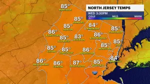
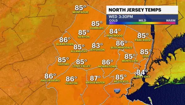
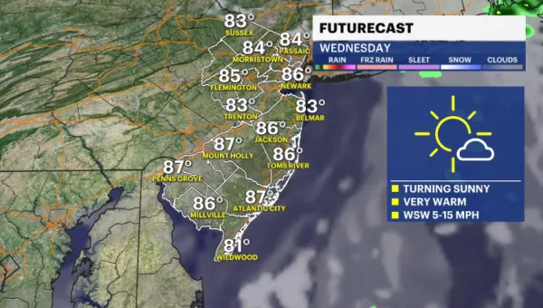
Afternoon welcomes sunshine and temps in the mid-80s in New Jersey
1h ago1:00

LIVE BLOG: News 12 weather updates
8h ago1:42
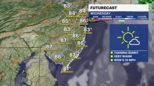
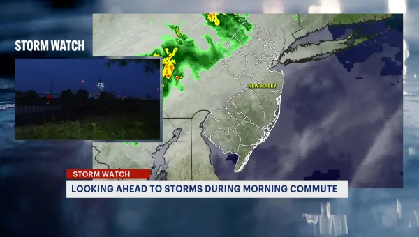
STORM WATCH: Early morning storms expected to impact Wednesday commute
17h ago1:42
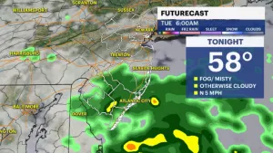
Early storms Tuesday followed by partial sun; temps warm to upper-70s
yesterday1:42

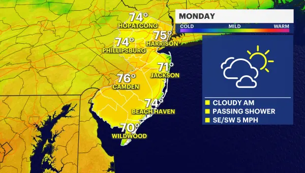
Cloudy with passing showers for Monday in New Jersey
2ds ago1:42
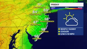
Mostly sunny Friday ahead with cooler temperatures; tracking weekend rain
5ds ago1:42
Afternoon welcomes sunshine and temps in the mid-80s in New Jersey
1h ago1:00
LIVE BLOG: News 12 weather updates
8h ago1:42
STORM WATCH: Early morning storms expected to impact Wednesday commute
17h ago1:42
Early storms Tuesday followed by partial sun; temps warm to upper-70s
yesterday1:42
Cloudy with passing showers for Monday in New Jersey
2ds ago1:42
Mostly sunny Friday ahead with cooler temperatures; tracking weekend rain
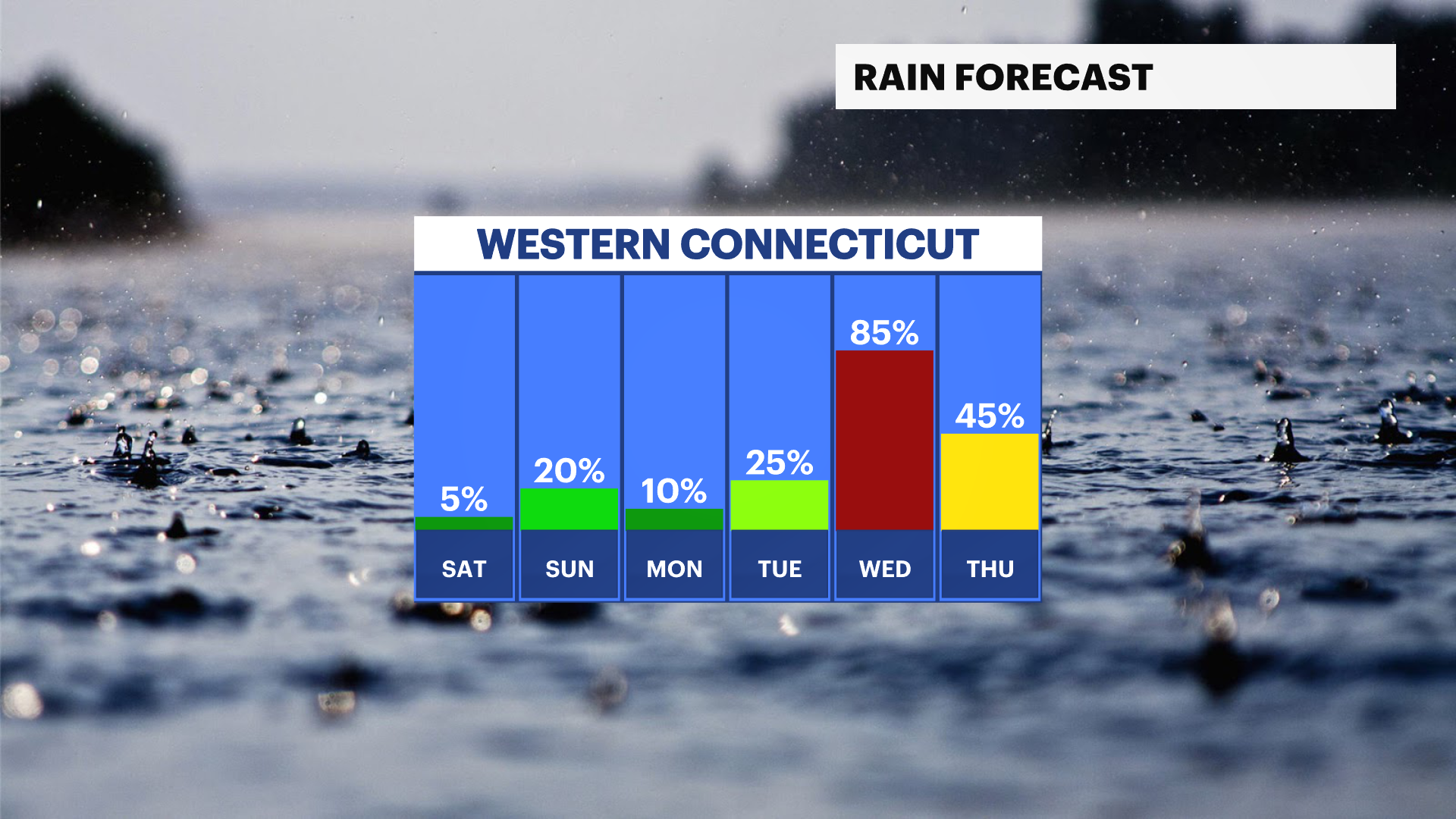
5ds agoNOW & NEW: Storm Watch Team Meteorologist Michele Powers says milder temperatures will be returning to Western Connecticut starting tomorrow. Expect to see more clouds than sun over the next few days, but it will feel warmer.

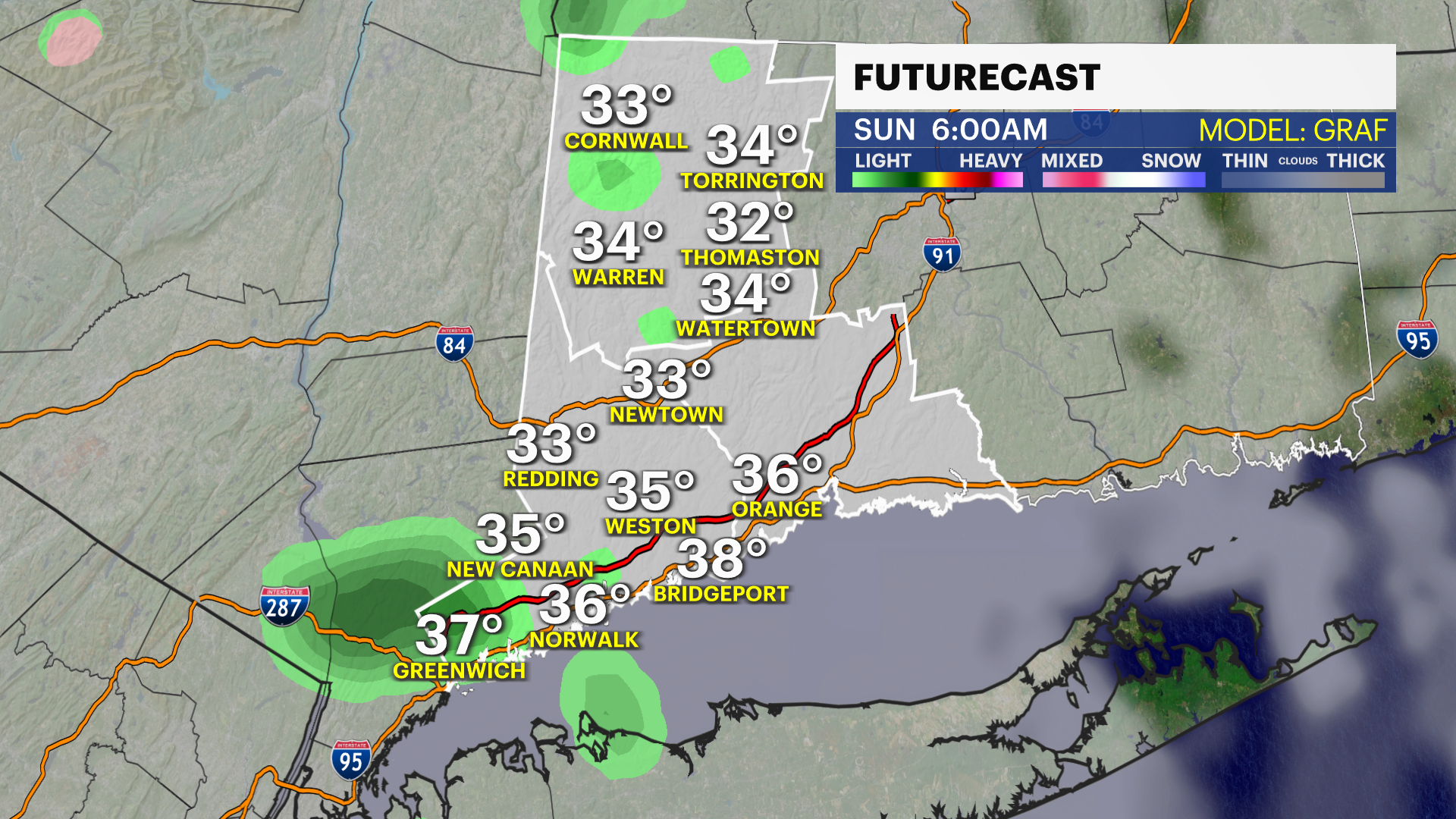
A partly sunny to mostly cloudy weekend is on the way with a risk of a few showers later Saturday and into Sunday. They won't amount to much, but as temperatures drop Saturday night into the middle 30s, there could be some light wintry mix falling from the sky at times. Most locations will stay dry until the day after Christmas.
NEXT: Another storm is on the way for Tuesday through Wednesday. Some forecast models show rain into Thursday. A coastal low will develop and bring more rain to the area. The thing is we had so much rain this past Sunday that it's easier to see flooding and with gusty winds, trees are also more likely to fall.
I'm not saying this will happen but there is a chance of about 1-2 inches of rain with winds 30-40 mph at this point. This could be a bit disruptive to holiday travel next week. Temperatures will reach the 50s, for a few days but then cool back down after the rain clears.
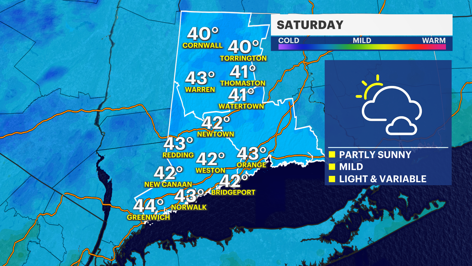
SATURDAY: Mostly cloudy, late sprinkles or rogue showers. High of 43.
SUNDAY: Mostly cloudy with isolated showers or sprinkles. High of 47.
MONDAY: Partly sunny. High of 50.

TUESDAY: Mostly cloudy, afternoon showers. High 50.