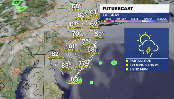
STORM WATCH: Warm Tuesday ahead; tracking potential for stormy Wednesday
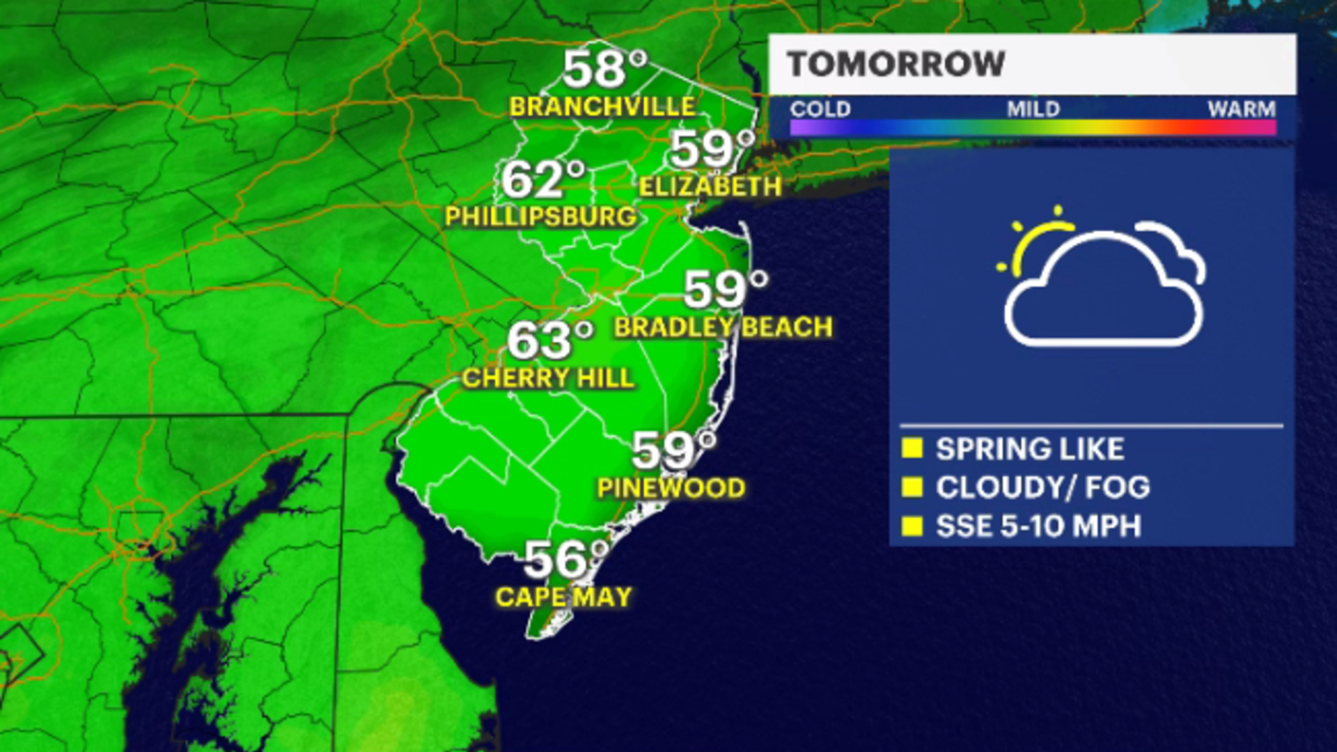
Tuesday is expected to see high temperatures near 60 degrees.
Share:
More Stories
2:19
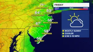
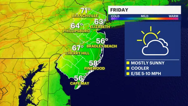
Mostly sunny Friday ahead with cooler temperatures; tracking weekend rain
48m ago1:26

Look up! Annual Eta Aquarid meteor shower peaks early Sunday morning
2h ago1:06

LIVE BLOG: News 12 weather updates
18h ago2:19
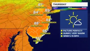
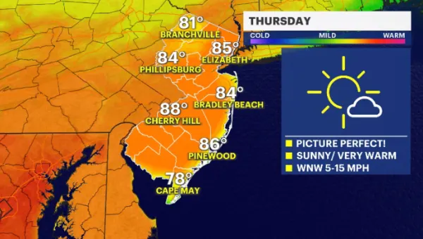
Beautiful Thursday weather ahead; clouds and rain develop by the weekend
yesterday2:19
STORM WATCH: Tracking evening thunderstorms expected to impact New Jersey
2ds ago1:51

New Jersey sees more than 150 aftershocks since April 5 4.8 magnitude earthquake
3ds ago2:19
Mostly sunny Friday ahead with cooler temperatures; tracking weekend rain
48m ago1:26
Look up! Annual Eta Aquarid meteor shower peaks early Sunday morning
2h ago1:06
LIVE BLOG: News 12 weather updates
18h ago2:19
Beautiful Thursday weather ahead; clouds and rain develop by the weekend
yesterday2:19
STORM WATCH: Tracking evening thunderstorms expected to impact New Jersey
2ds ago1:51
New Jersey sees more than 150 aftershocks since April 5 4.8 magnitude earthquake
3ds agoA wonderful warm-up is in store for New Jersey as temperatures soar to late April feels. Of course, it's springtime, so the weather isn't going to be exactly perfect. As a result, fog, mist and drizzle will also be on the menu.
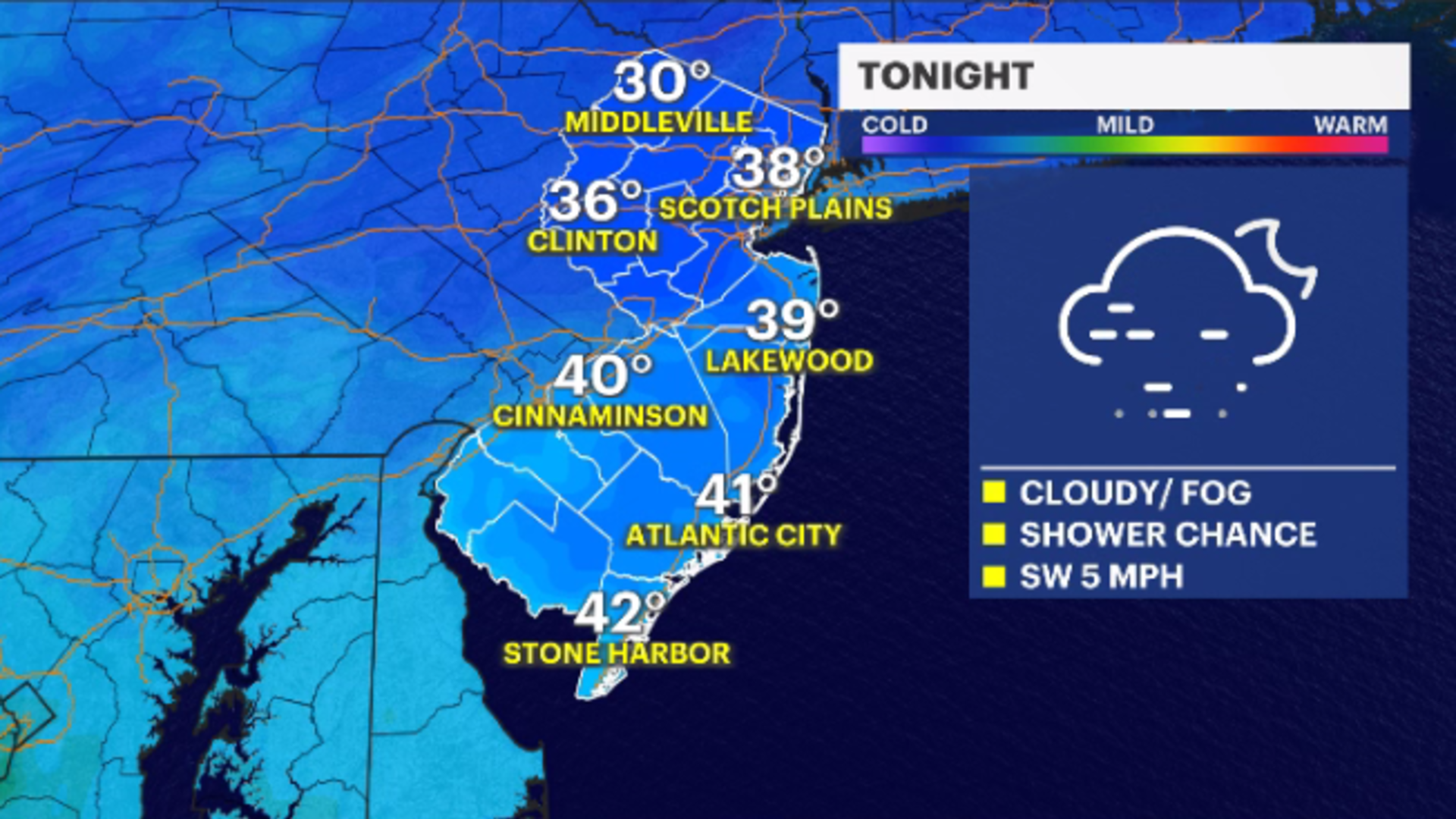
TONIGHT: Cloudy with areas of fog/mist/drizzle developing through the overnight. Temperatures will be above average in the upper-30s.
TUESDAY: Even warmer than Monday was, but it will also be cloudier with moments of fog and showers. High near 60 degrees.

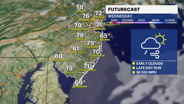
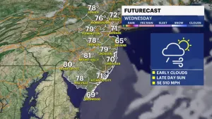
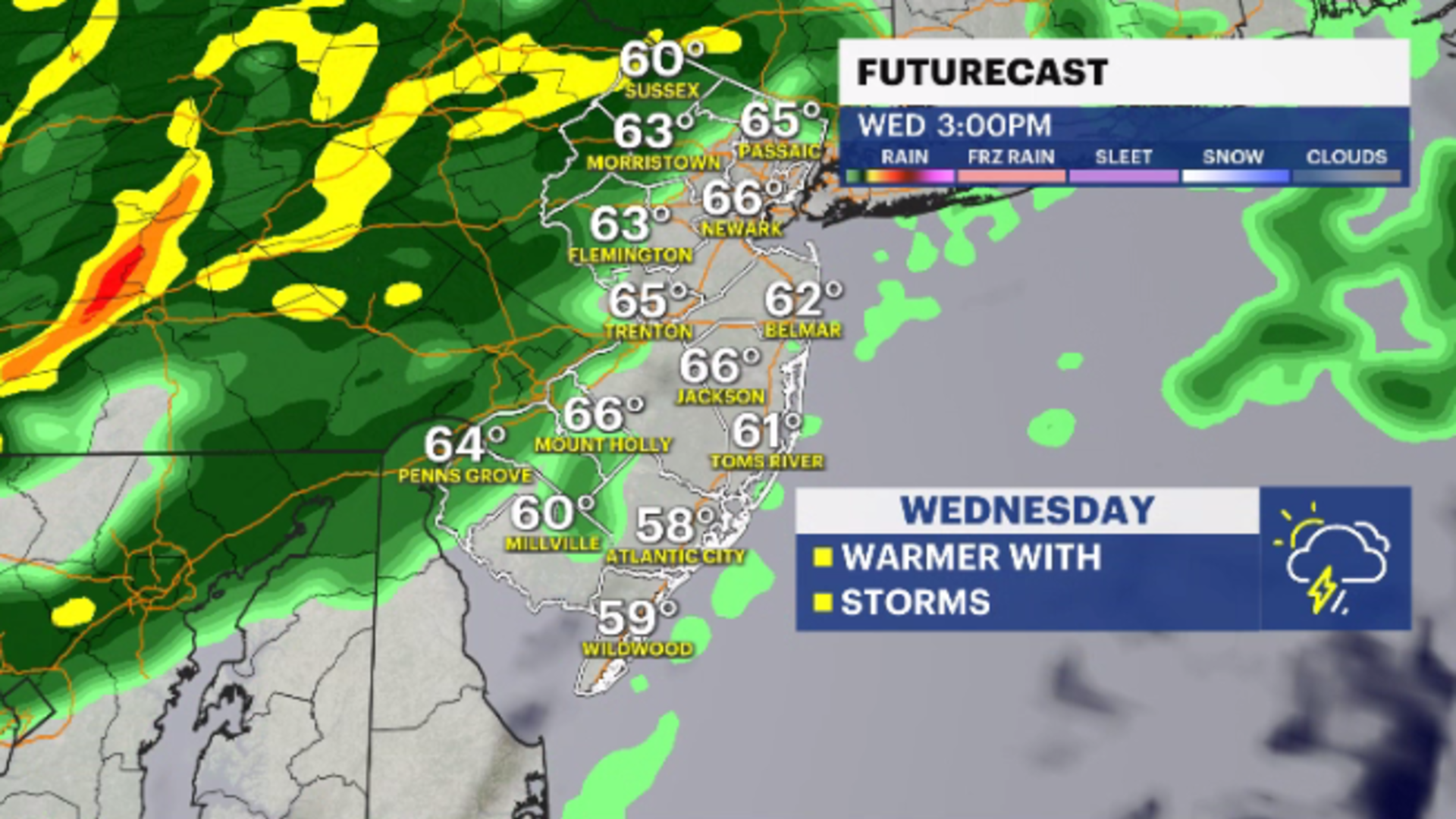
WEDNESDAY: A transitional day. Temperatures soar to the low- and mid-60s. Not record-breaking, but warm enough. A storm system will move into this warm/humid, unsettled airmass, and more organized rain, and maybe even a few thunderstorms will develop. Highs in the low- to mid-60s.
COMING UP: Behind the storms comes windier and colder weather. Only briefly though and even though it's cooler on Thursday and Friday. Expecting daytime highs in the upper-40s. That is still warmer than the seasonable average. A warm comeback for the weekend and beyond.
While I am not ready to call winter over, the opera singer is warming up.