More Stories
New Jersey residents should prepare for a wet start to the weekend.
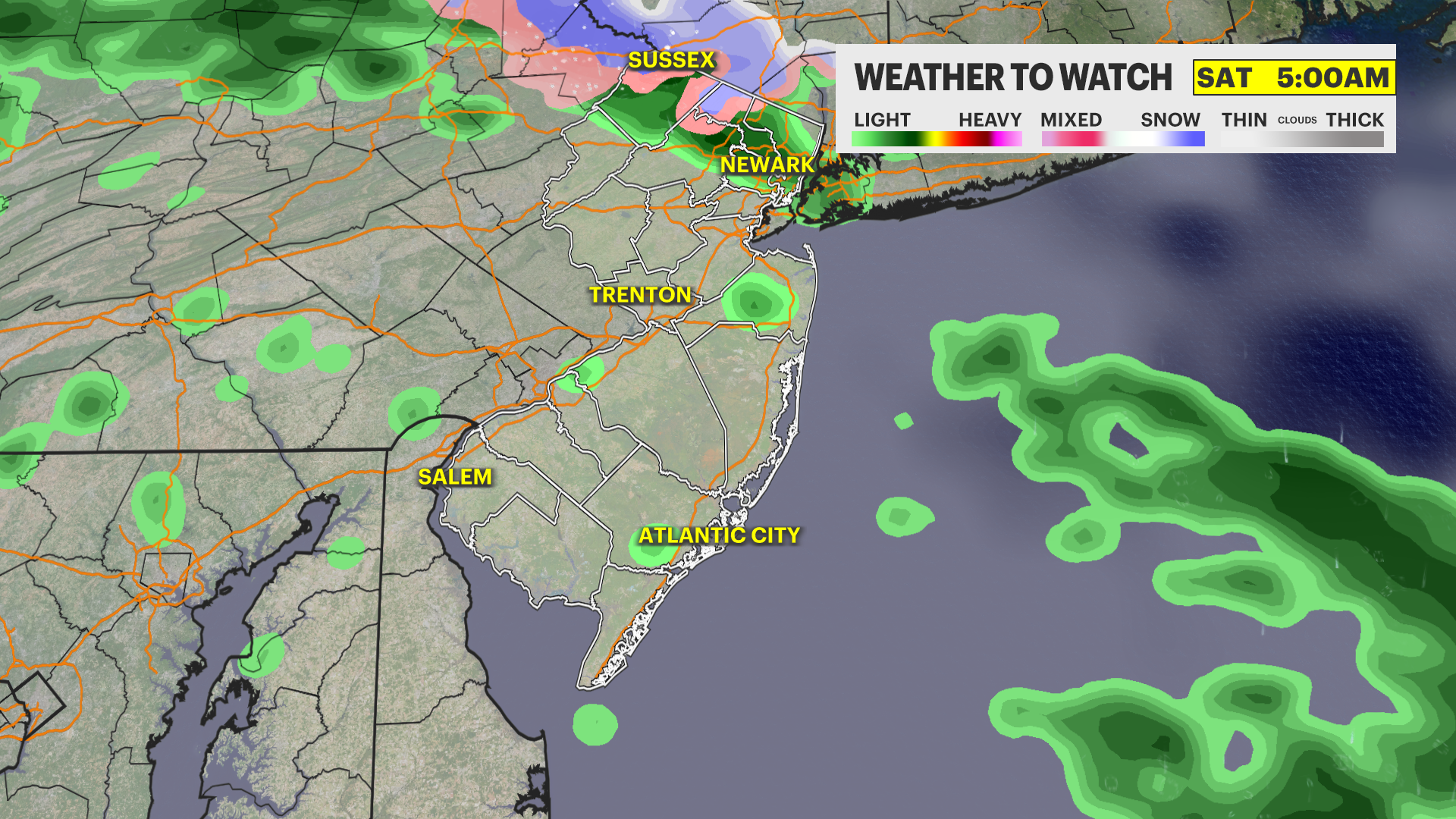
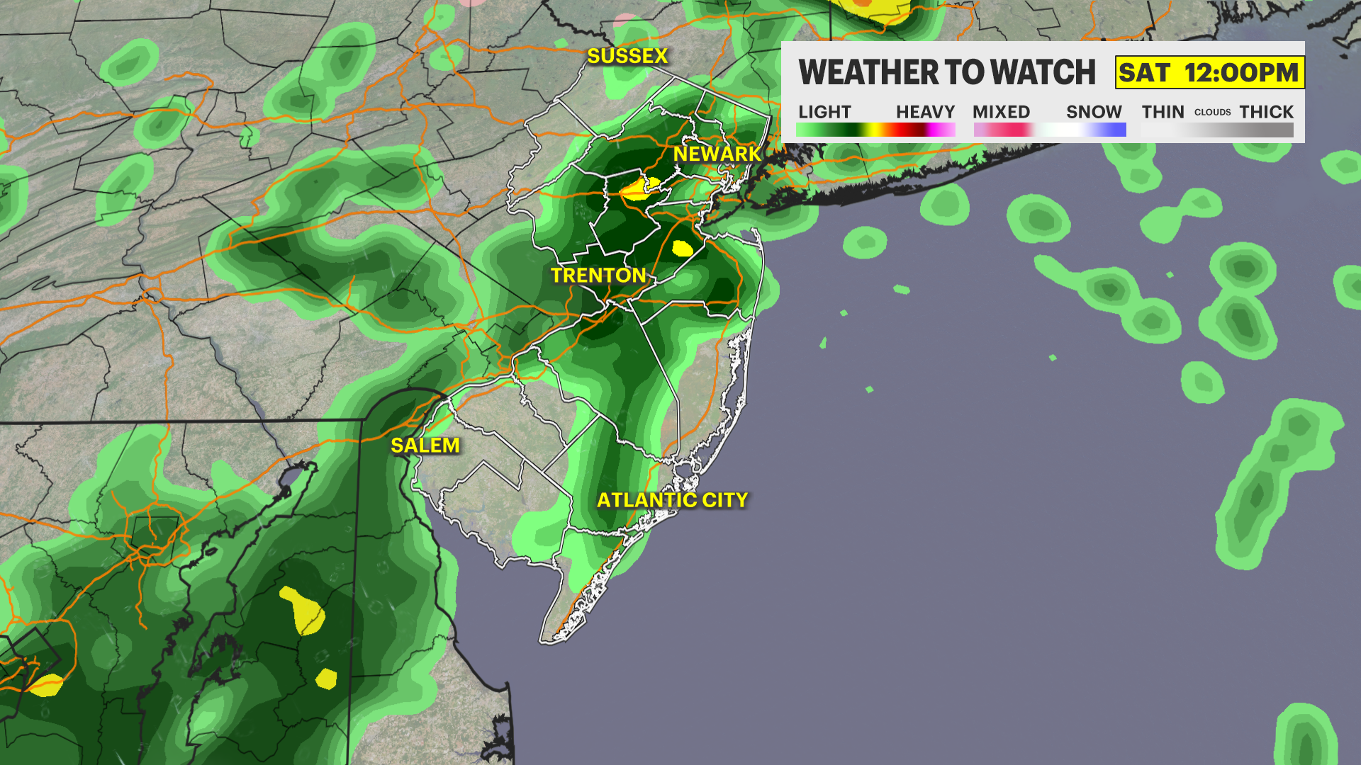
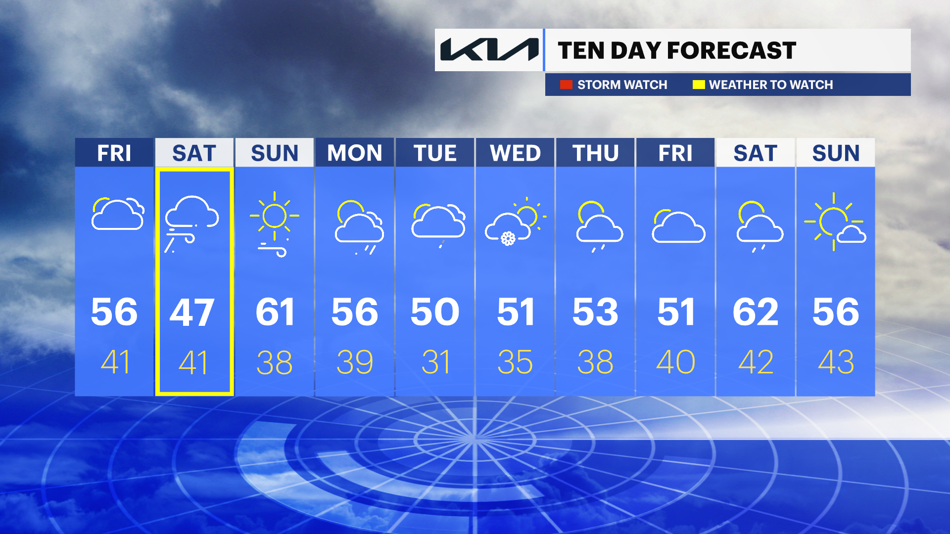
News 12 Storm Watch Team Meteorologist Michele Powers says that Saturday will start off with lighter rain Saturday morning that will develop into heavier showers by the afternoon.
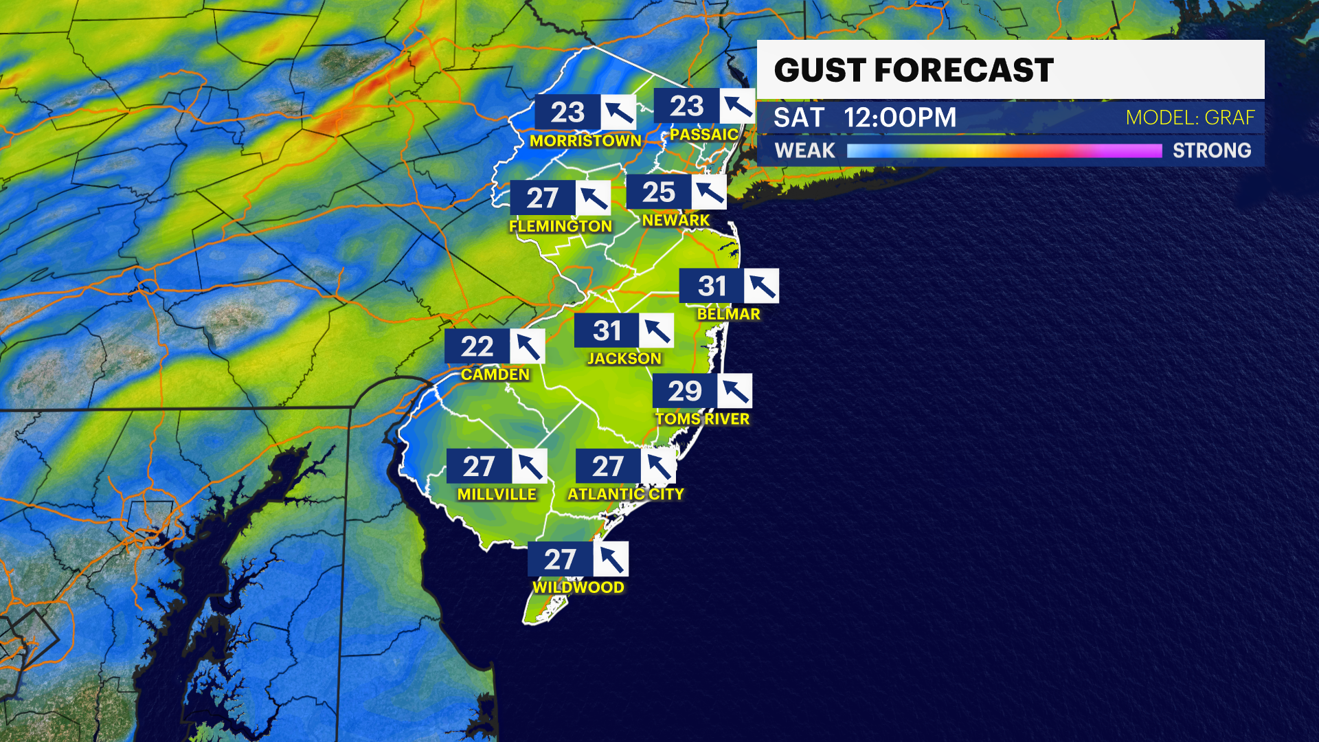
WHAT’S NEXT: Heavy rain across the state with breezy conditions on Saturday. There is the possibility for minor coastal flooding due to the rain. Isolated thunderstorms Saturday evening into midnight. Improved weather for Sunday.
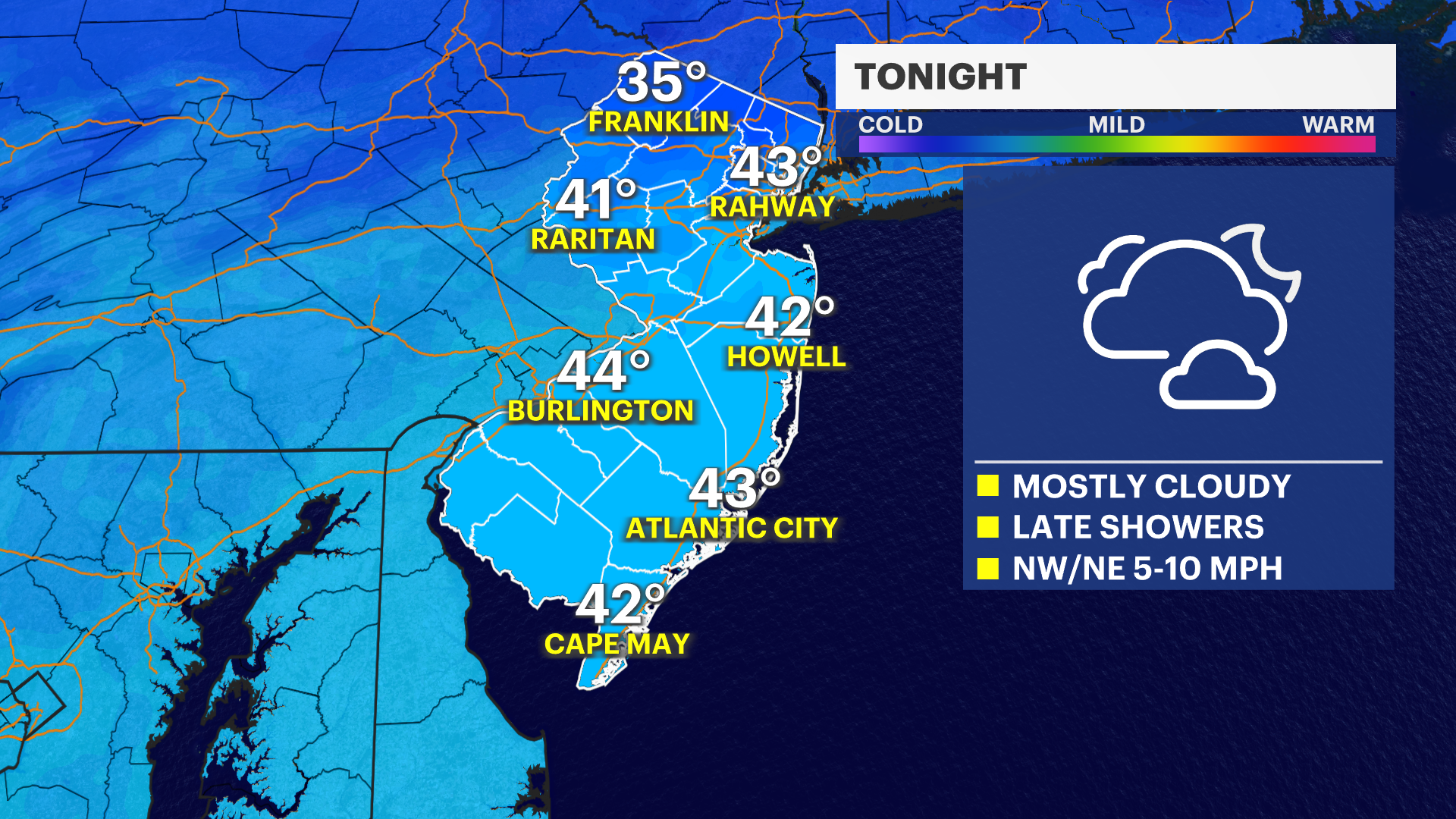
OVERNIGHT: Cloudy skies with temperatures in the low-40s. Rain begins to develop by the morning.
SATURDAY: Rain in the morning, followed by heavier showers Saturday afternoon. Coastal flooding could be an issue. Breezy conditions. Daytime highs cooler in the upper-40s. Overnight lows around 41.
SUNDAY: Rain clears out. Mostly sunny skies. Daytime highs warmer in the low-60s. Overnight lows chill to 38 degrees.
MONDAY: Mix of sun and clouds with the possibility of some more rain. Daytime highs around 56. Overnight lows around 39.
COMING UP: Mix of sun and clouds for the upcoming week. Temperatures in the 50s. Possibility for some snow flurries Wednesday.
More from News 12
1:56

Popcorn Park Animal Refuge seeks help in repairing blizzard damage
4:29

LIVE UPDATES: NJ Transit to resume bus & rail services Tuesday morning
1:37

Warmer temps finally on the way after brutal stretch

Back-to-back storms? There’s weather to watch this weekend in the tri-state
2:11

Gov. Sherrill announces public transit suspensions amid ‘dangerous storm’
1:17
