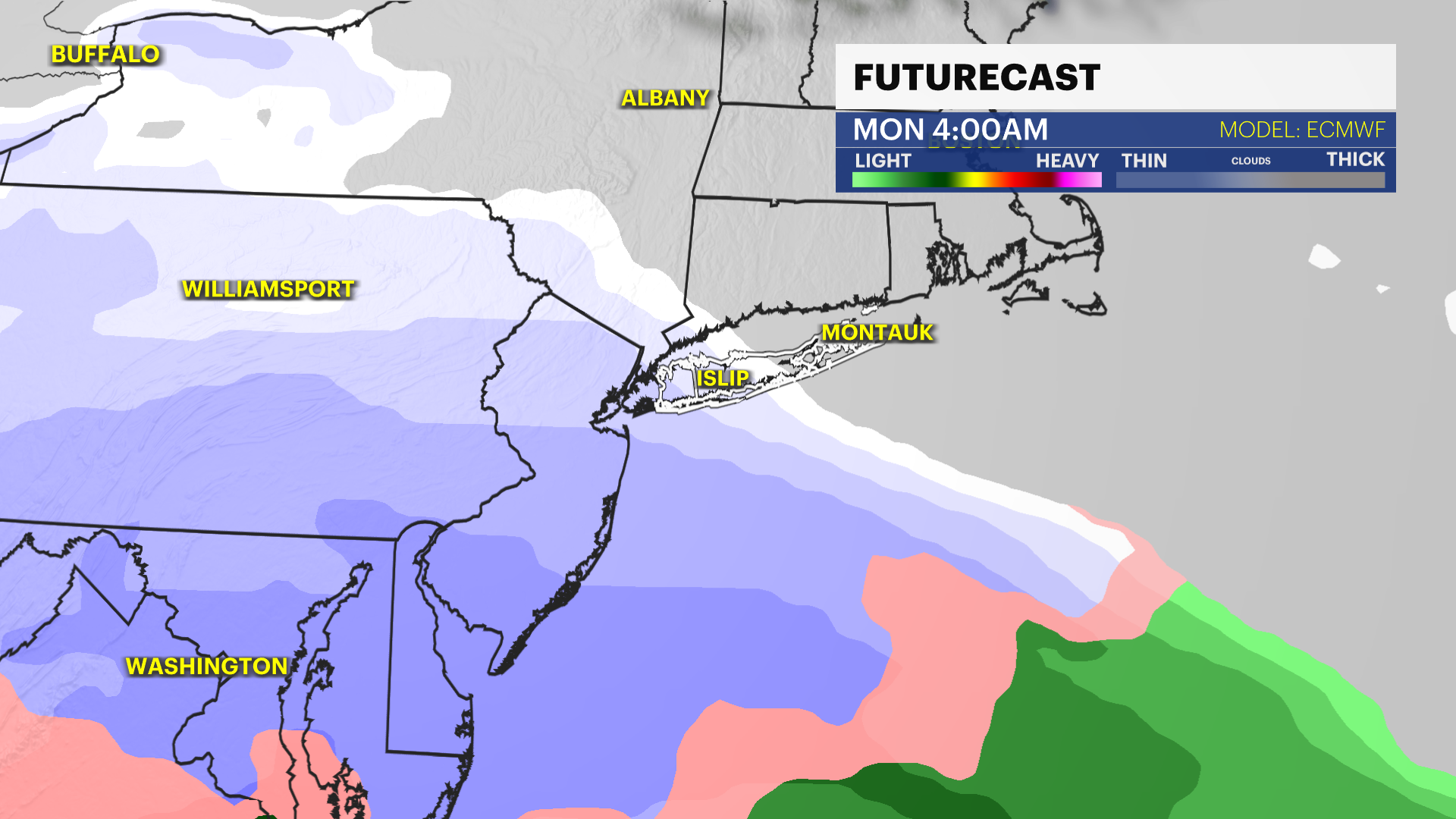
Tracking Monday snow chances for Long Island
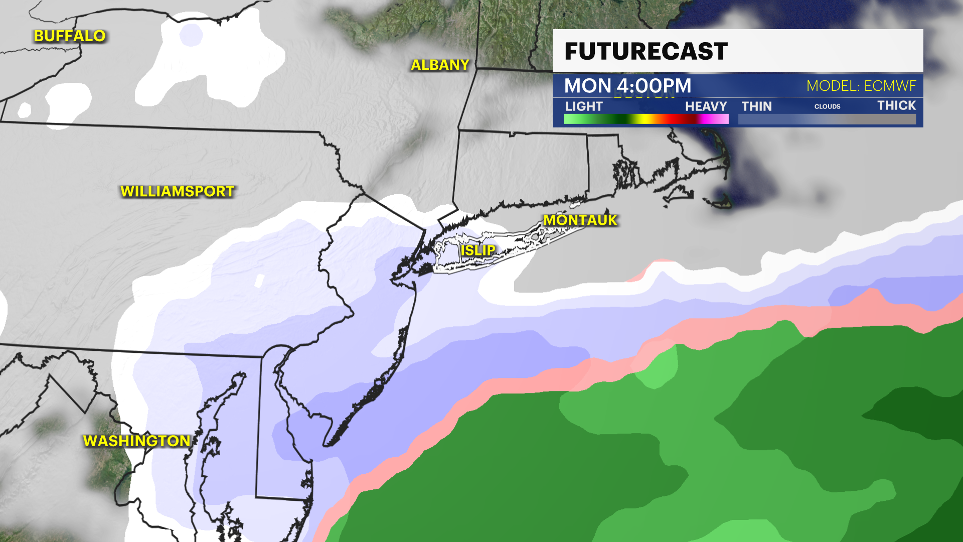
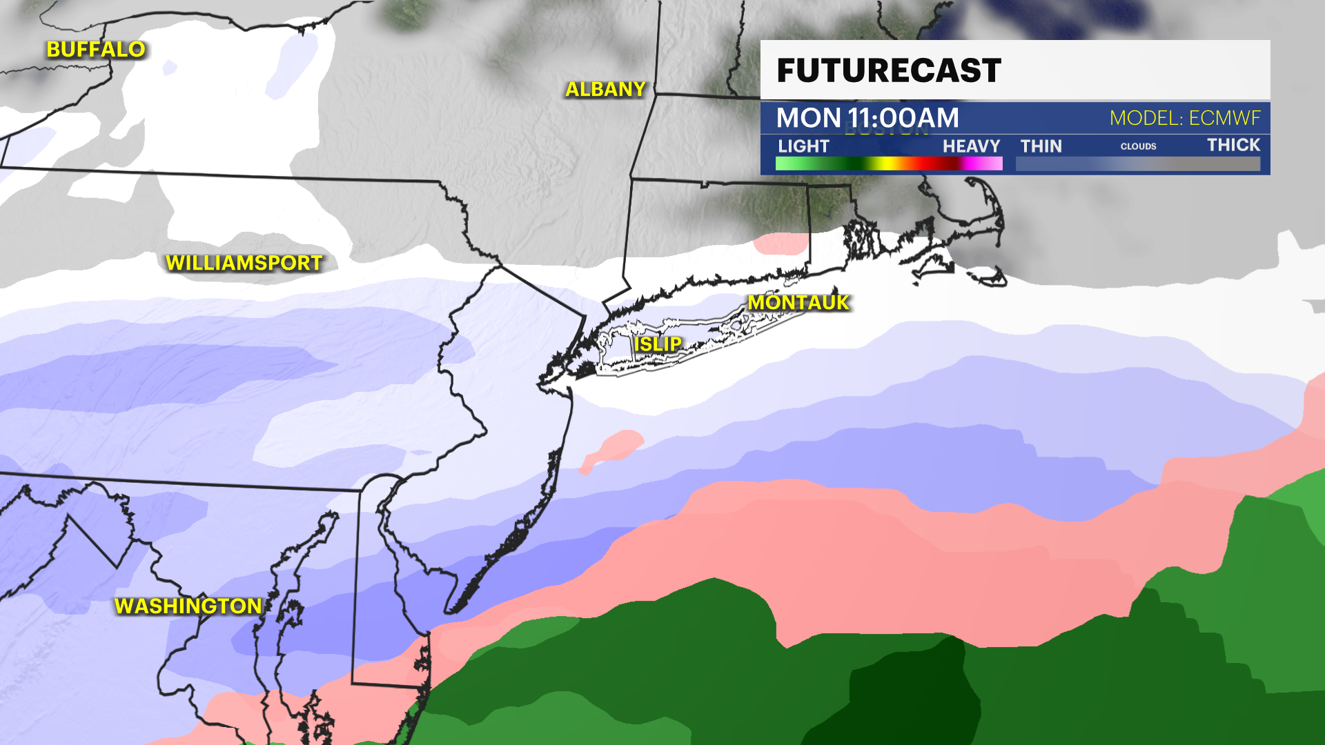
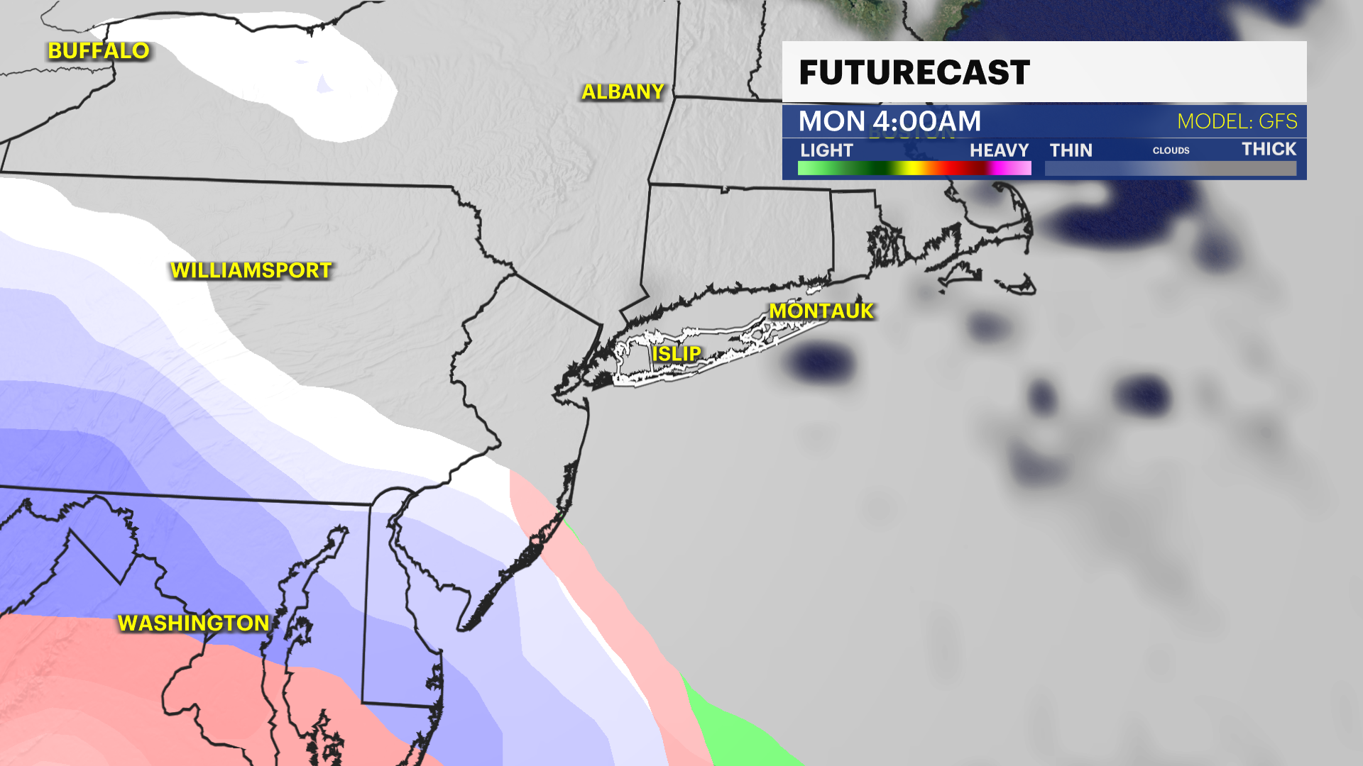
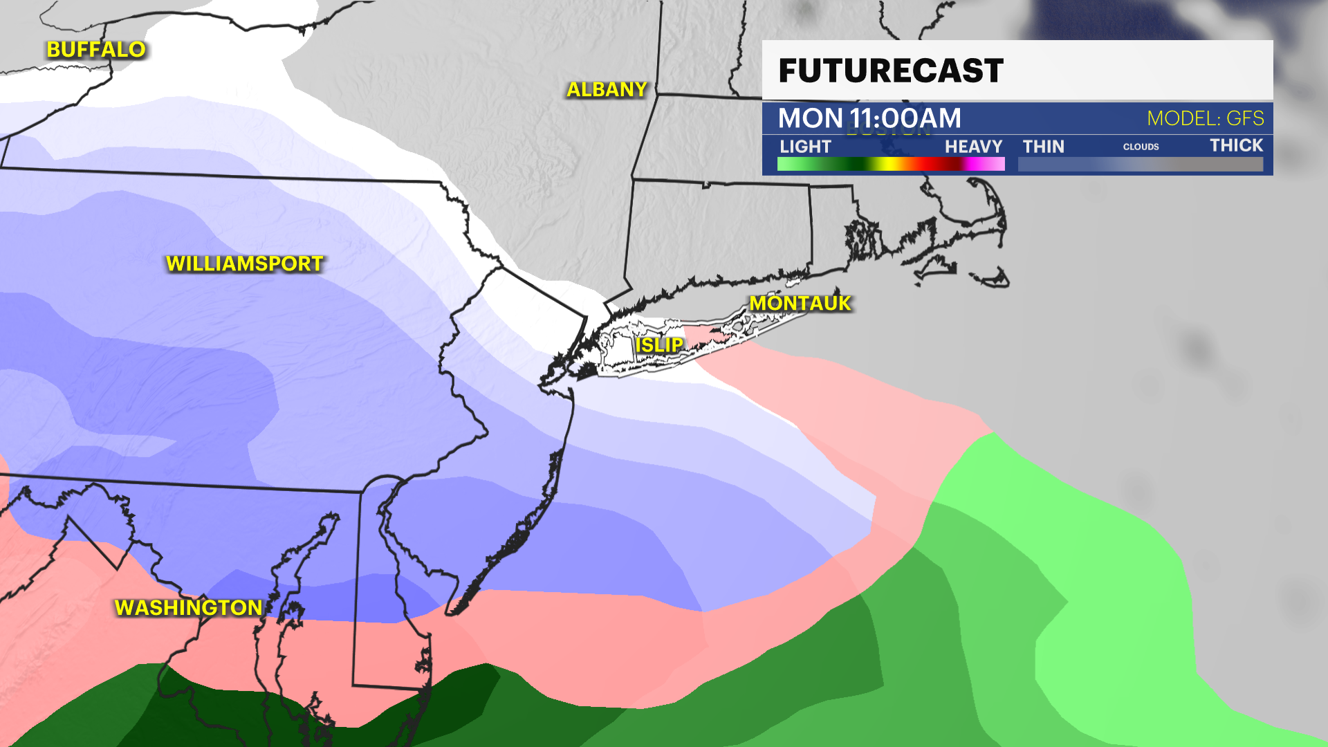
As of now, there are two computer models ( ECMWF - EUROPEAN / GFS - AMERICAN ) suggesting a storm will make its close approach to our area on Monday.
More Stories


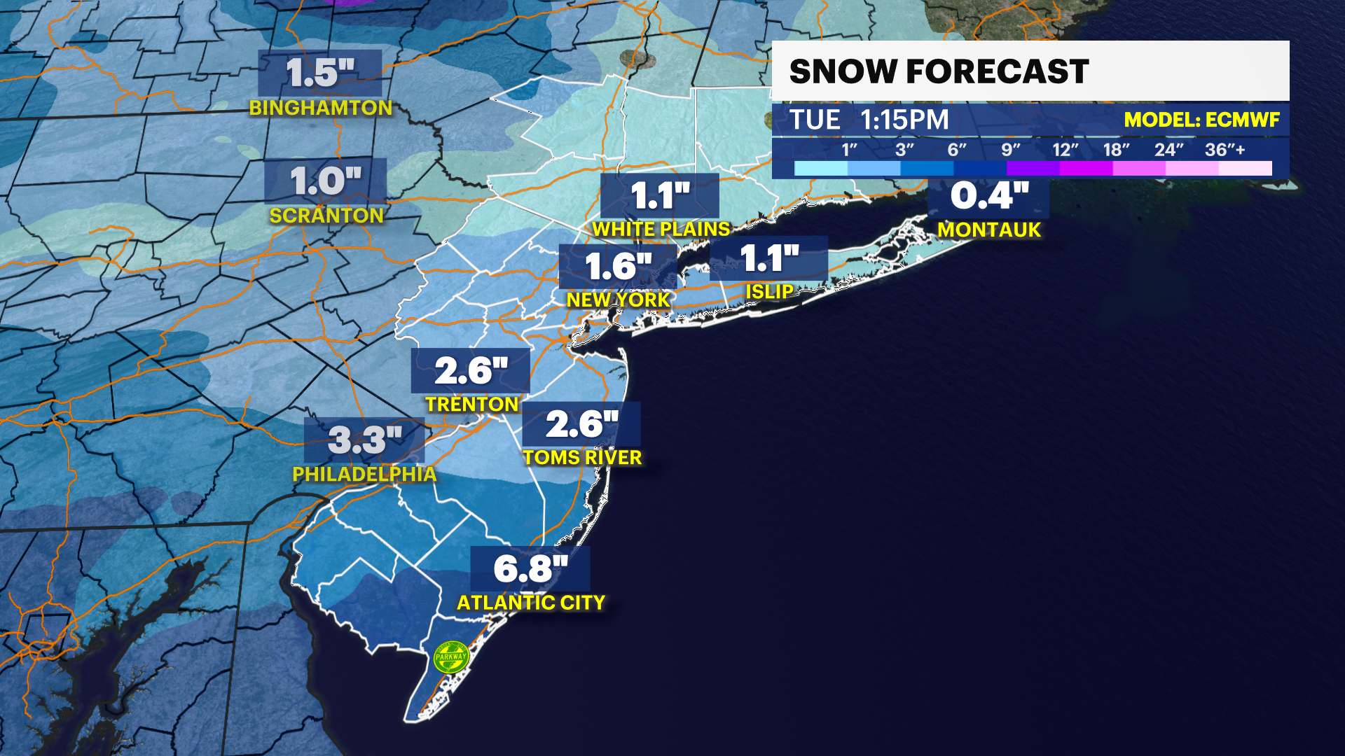
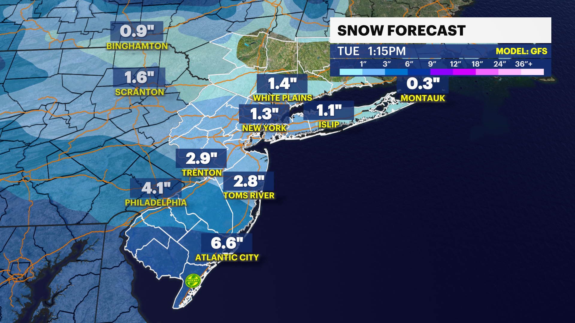
We’re less than a week away from our next potential snow storm. However, there are still several factors that still need to be aligned for the storm to happen. We need enough cold air to meet with some moisture to produce snow or even a wintry mix.
Temperatures are cold this weekend into next week to the 30s. As of now, there are two computer models ( ECMWF - EUROPEAN / GFS - AMERICAN ) suggesting a storm will make its close approach to our area on Monday. In terms of how much snow, how long it’ll last and the exact track is still to be determined. There are two scenarios that we’re looking at to see if we get snow or not.
SCENARIO #1
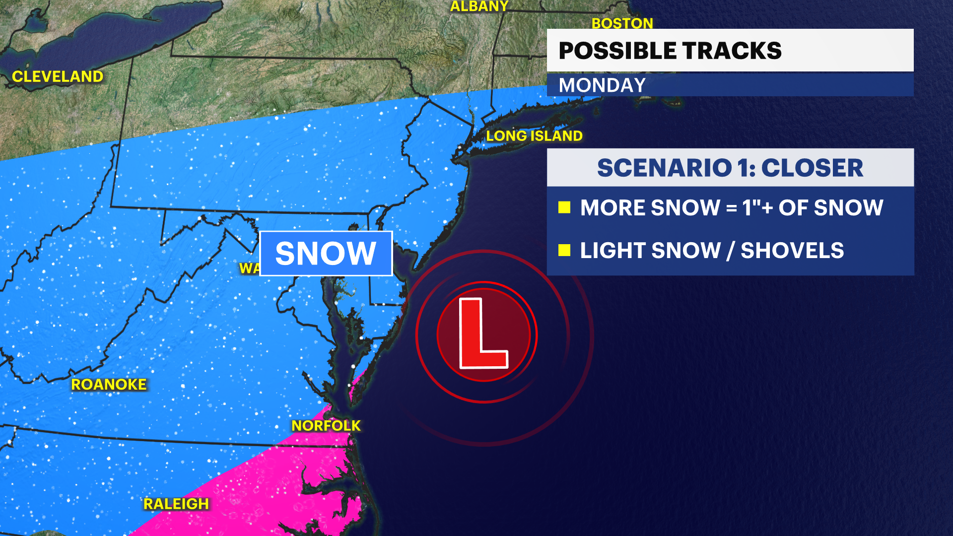
Closer storm = more snow (1”+ of snow)
SCENARIO #2
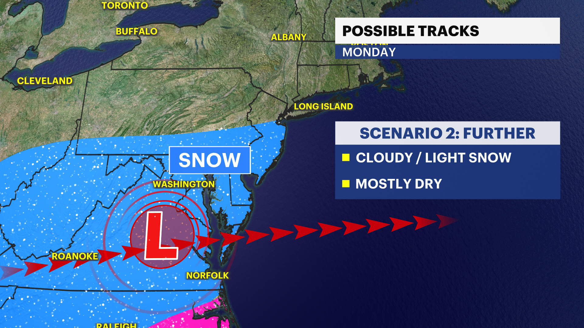
Further storm = less snow (cloudy /light snow)
If any snow falls, it will likely be a light fluffy snow that will stick to the ground. We’re currently not looking at a significant storm, but stick with your News 12 team of meteorologists for the latest updates with this storm.