STORM WATCH: Heavy rain continues today; windy weather expected
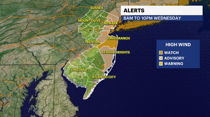
Parts of New Jersey could see winds of up to 65 mph on Wednesday. There is a slight possibility for snow on Thursday.
More Stories


Strong winds are expected to impact New Jersey, with gusts of up to 65 mph expected.
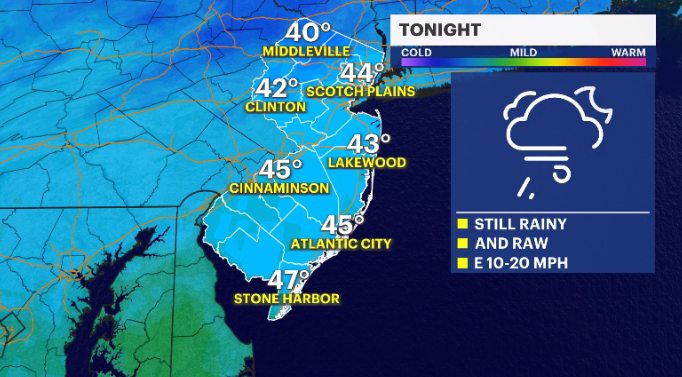
Rain continues tonight in an on-again, off-again fashion. It's possible an additional inch of rain could collect, keeping streets and low-lying areas filled with puddles.
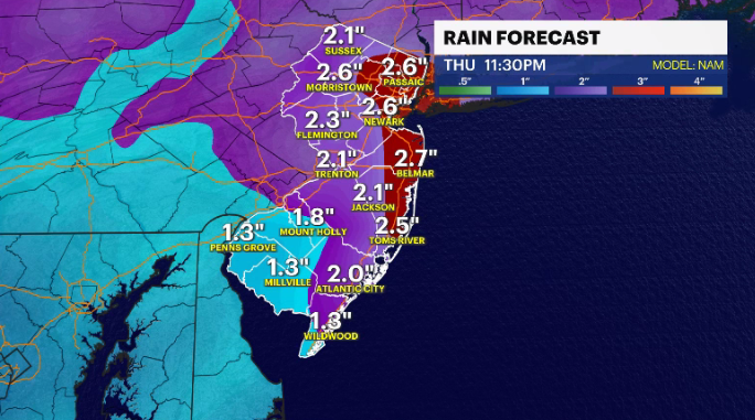
The storm transitions to a coastal system starting tomorrow. This is when the winds start becoming an issue. Wind-driven rain is expected throughout the day tomorrow. On top of that, as the storm begins its energy transfer to this coastal entity, it's possible a few thunderstorms could develop throughout the day.
MORE: News 12 New Jersey Weather Center
Our coastal storm develops just off the Monmouth County beaches. The positioning alone doesn't really bode well for a wintry development, however, the timing of it all, in the wee hours of Thursday morning could have just enough cold air to help see a wintry mix form in elevated communities along and north of Interstate 80. Worst case scenario is 1-2 inches of snow. I highly doubt that happens, but I do think a few neighborhoods might wake up with a coating on the colder surfaces.
The weekend starts cloudy but will finish with sunny skies on Sunday. Temperatures start warming up next week. A few towns may flirt with 70 degrees by the middle of next week with sunshine.
COASTAL STORM
A coastal storm will continue to impact the tri-state through Thursday morning. Rounds of heavy rain and high winds will likely create unfavorable or hazardous conditions during daytime hours, along with flooding concerns across the region. Storm Watch Team Meteorologist Julian Seawright gives a quick breakdown on the latest storm.