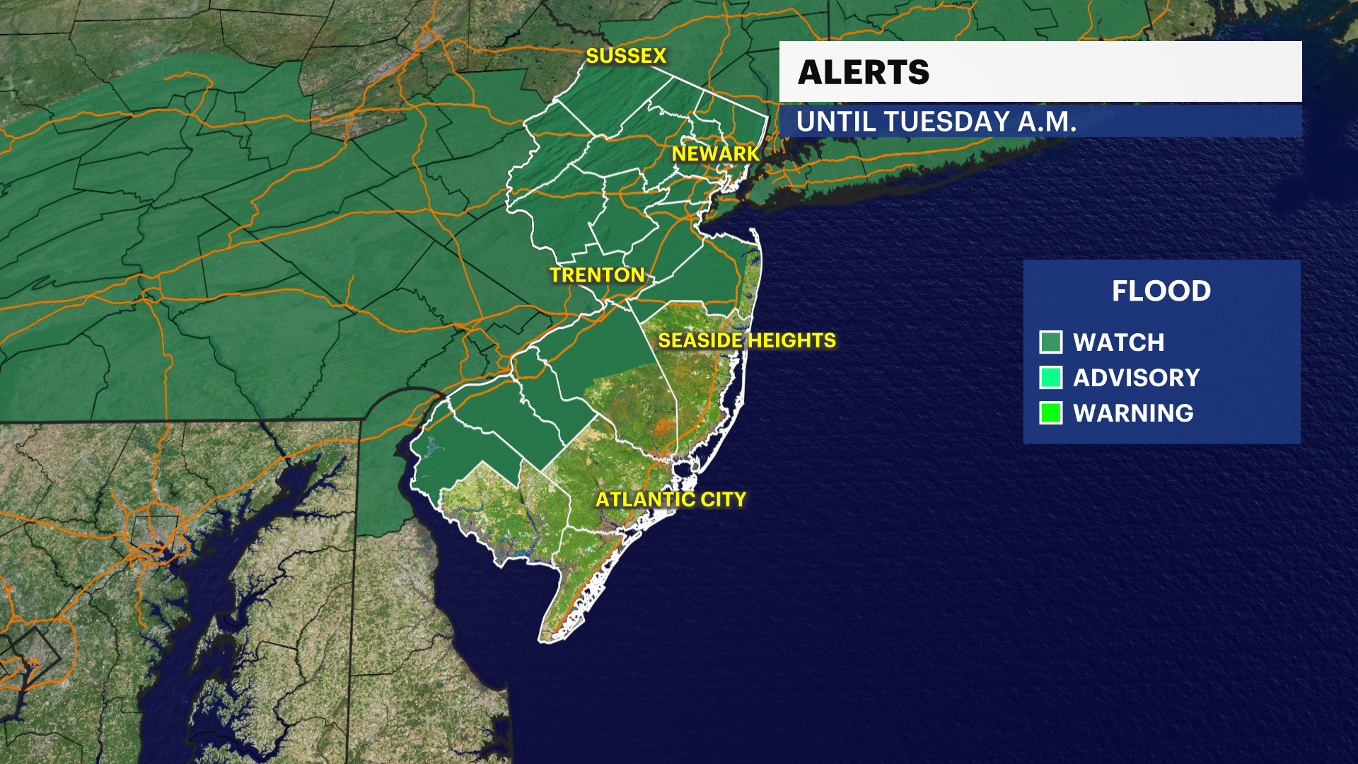
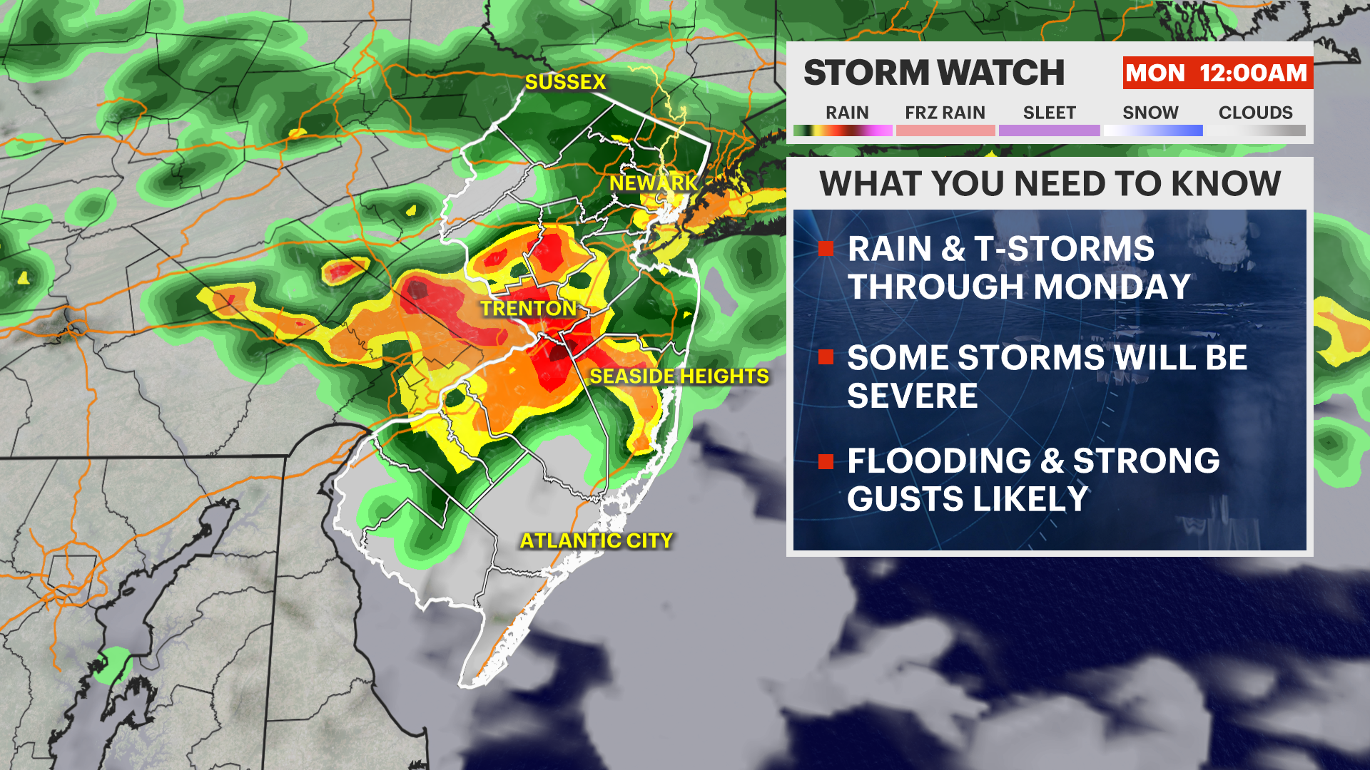
STORM WATCH: Thunderstorms to bring a flash flood threat to the state into Monday
Rounds of heavy storms will dump several inches of rain locally over the next 24-36 hours.
More Stories


FORECAST:
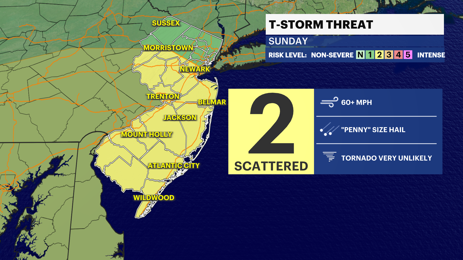
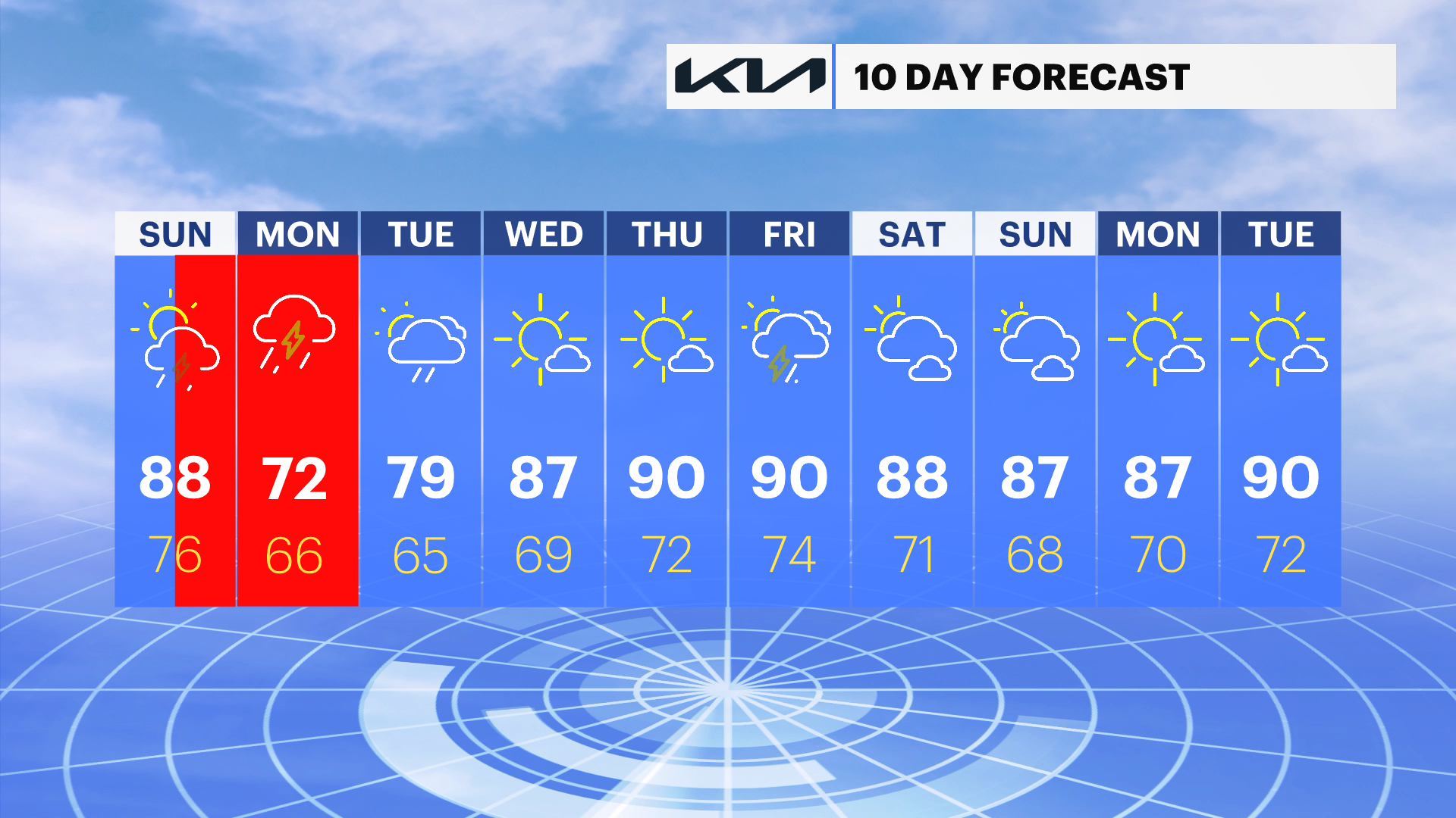
After a several days of extreme heat, the attention turns to heavy rain and thunderstorms. 80s for highs today will feel relatively better than the triple digit heat of the past, but it still will be border line hot. While we already had our fair share over the last couple of days, another round of widespread storms will cause flooding concerns.
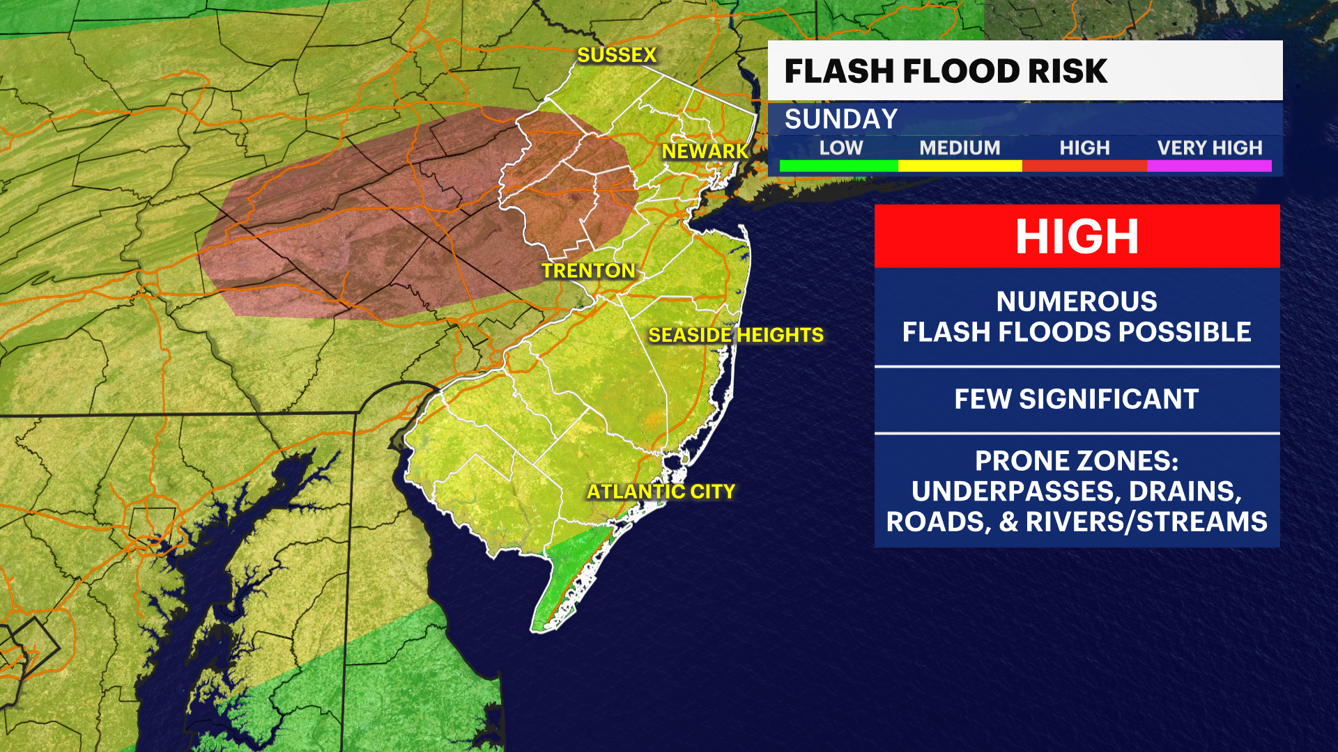
The first-round rolls in late afternoon today into this evening with gusty to damaging winds in the strongest of storms. Monday will feature numerous storms with heavy rain, leave some extra time for both commutes. All this leads to the threat of flash flooding with storms moving over the same area for hours, dumping inches of rain in a short period of time. Turn around, don't drown!
Do not drive through flooded roadways, that is dangerous and can lead to deadly consequences.
In total, 1-3" is rain is likely with locally higher amounts. We do need the rain, but this might be too much of a good thing at once. Either way, make sure you have our News12 app downloaded for the latest warnings and radar updates.
RELATED: PSE&G Power Outage Map
RELATED: JCP&L Power Outage Map