More Stories
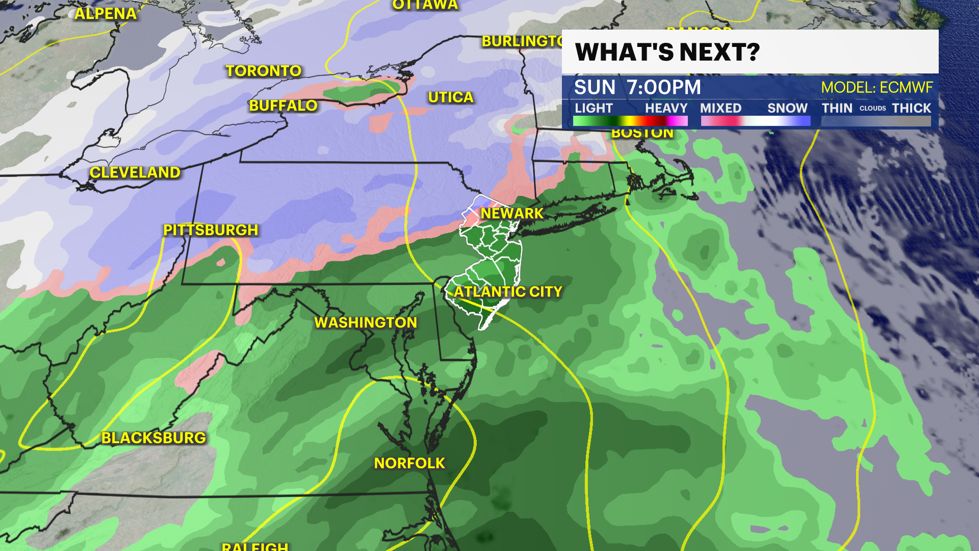
Storm Watch Team Meteorologist Joe Martucci says Sunday will be a
mostly dry day. Rain doesn't move in until sunset. Residents northwest of I-287
will see a bit of snow to start with little to no accumulation.
NATIONAL WEATHER SERVICE ALERTS: Coastal flood advisory for Cape
May County from 7 a.m. until 1 p.m. Sunday. Coastal flood statement for Hudson,
Eastern Union and Eastern Essex from 6 a.m. until 10 a.m.
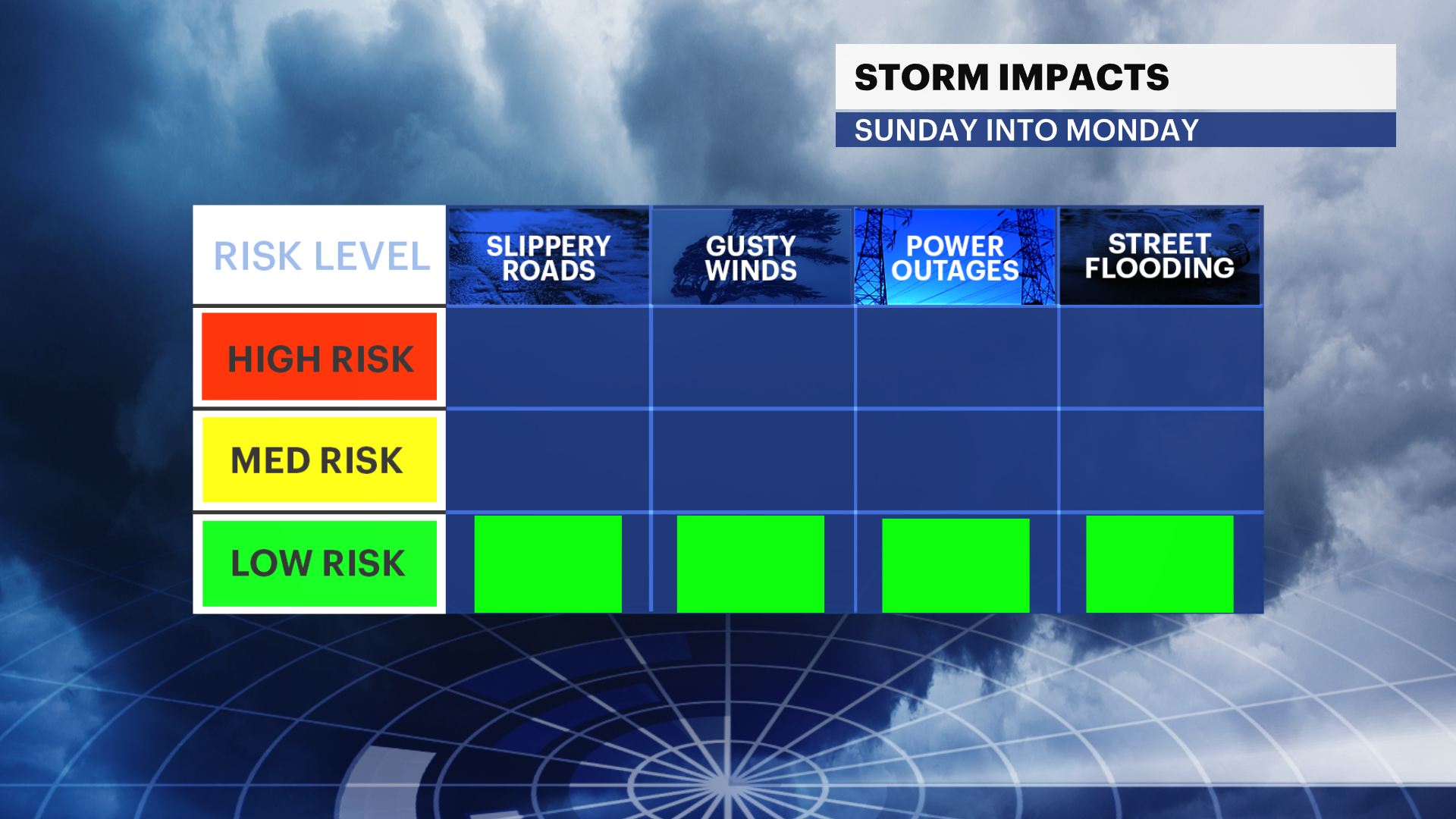
NEW: Coastal flooding does look to be a bit of an issue Sunday
morning. Up to 3" of salt water on vulnerable roadways near the bays will
be around.
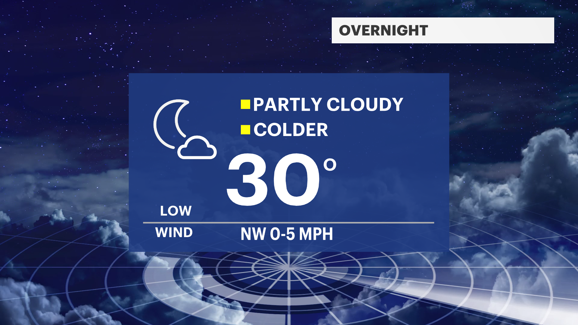
OVERNIGHT: Partly cloudy and chilly. Lows around 30 with a light northwest breeze.
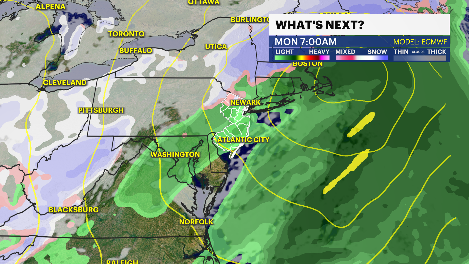
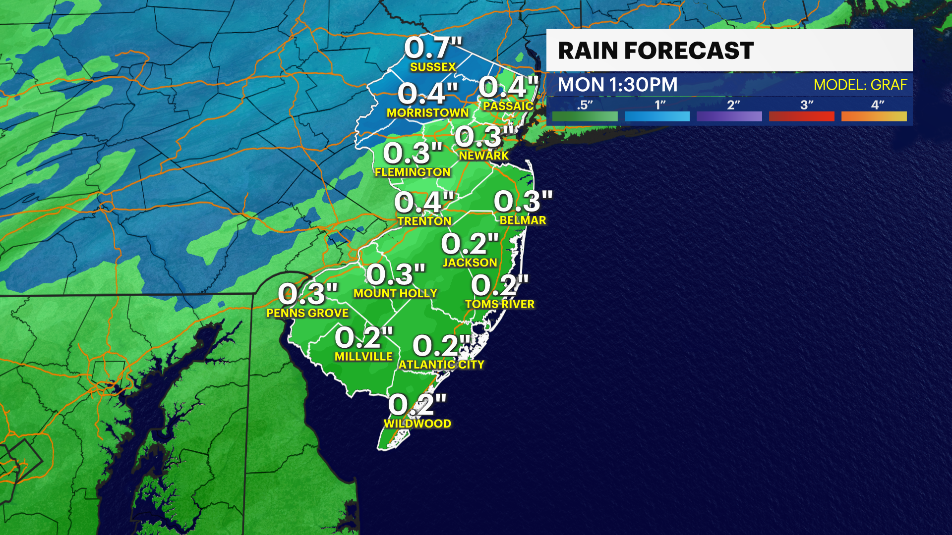
SUNDAY: Becoming cloudy with rain moving in after lunch. A few flakes are possible in northwest NJ overnight with the rain through the Monday morning commute. Highs in the 40s and lows in the 30s. Light and variable wind.
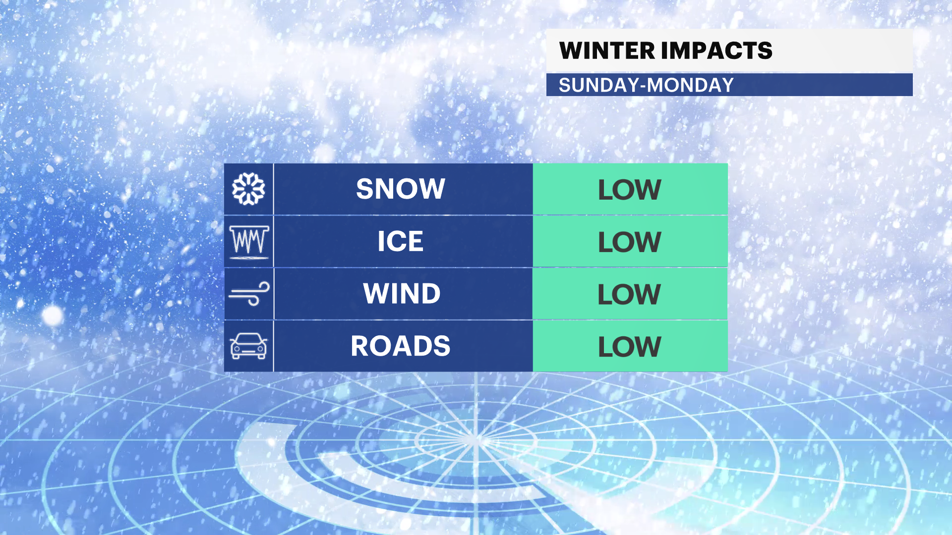
MONDAY: Rain early, turning mostly to partly cloudy. Gusty winds up to 25 mph.
TUESDAY: Mostly sunny. Highs in the 40s and lows around freezing.
WEDNESDAY & THURSDAY: A chance for snow and rain moves into the region. Highs in the 40s and lows in the 30s Wednesday. Highs in the 40s and lows in the 20s Thursday.
More from News 12
0:52

Person injured as fire tears through homes in Fairview
1:29

Big warmup on the way across the state this week
2:06

Rising gas prices hit New Jersey landscapers ahead of busy spring season
0:58

56-year-old Newark man killed in 2-car crash
2:00

Suspicious package forces last-minute cancellation of Keansburg’s 20th St. Patrick’s Day Parade
2:27
