More Stories
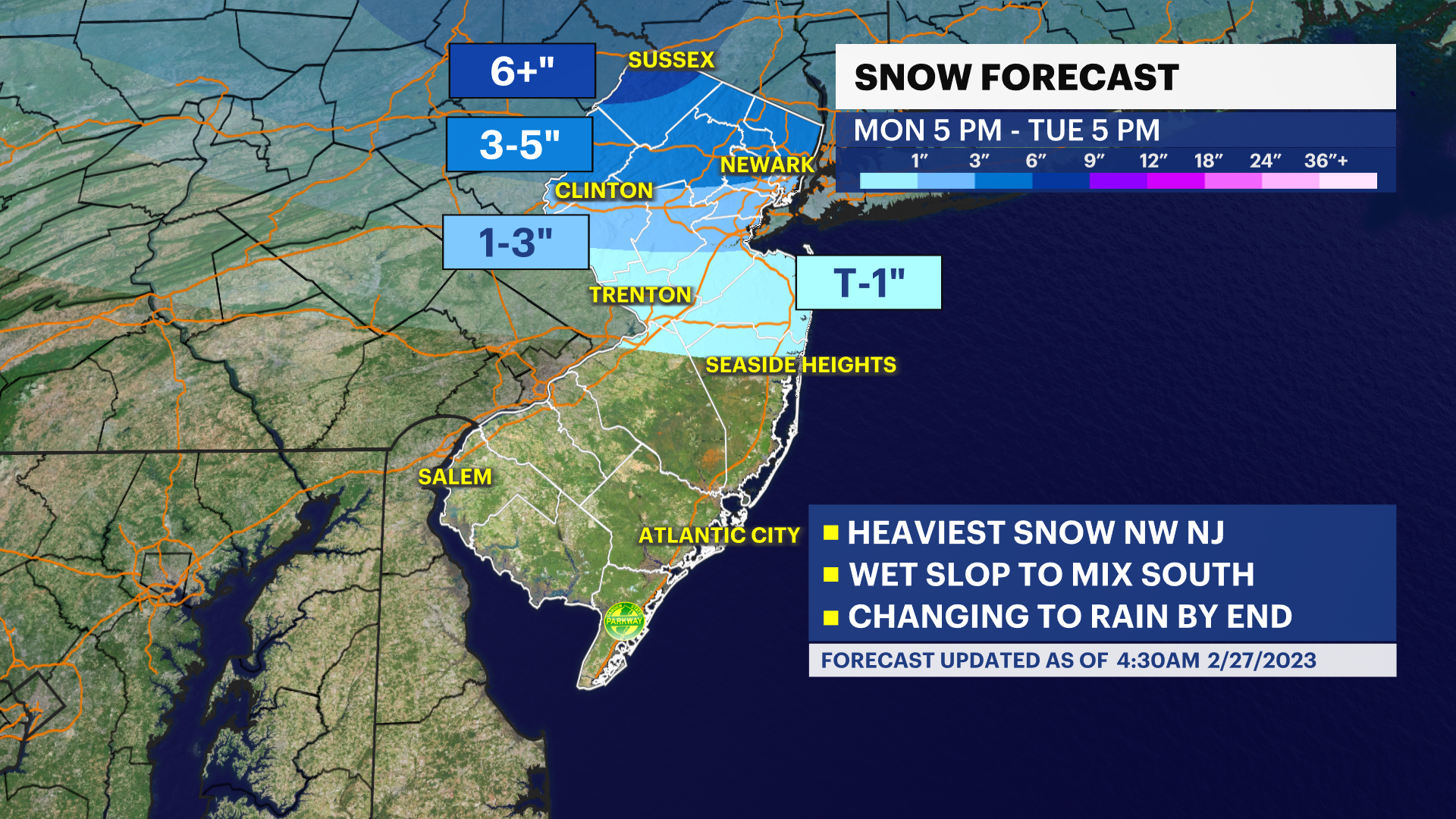
A winter storm warning is in effect for parts of northern New Jersey.
News 12 Storm Watch Team Meteorologist Dave Curren says the winter storm will cause a wet, wintry headache with plowable snow accumulations Monday evening into Tuesday.
TIPS TO STAY SAFE: Winter Weather Ready Guide
WHAT’S NEXT: A mixed bag of precipitation, especially south of the Driscoll Bridge, will create some sloppy commuting conditions this evening. Northern New Jersey (north of Interstate 80 especially) will see snow with as much as 4 inches in northern Sussex County.
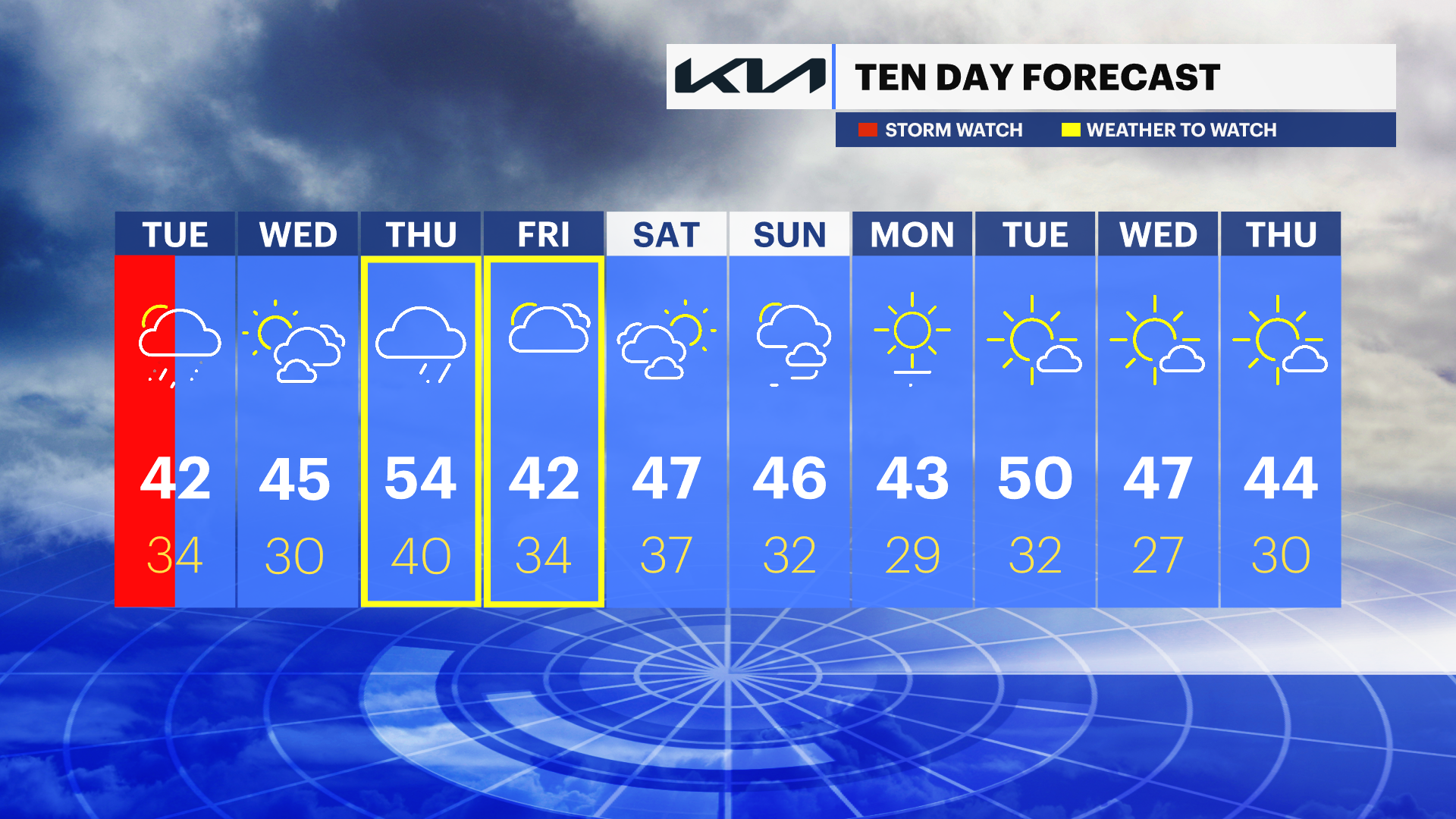
TUESDAY: Overnight rain and mix ends by or very close to the afternoon commute. South to north storm exit. Clouds give way to sunshine. Highs near 42. Lows near 28.
WEDNESDAY: Mostly sunny and a decent break in wet weather. Highs near 47. Lows near 41.
THURSDAY: Sun followed by increasing clouds, rain showers later in the day. Highs near 55. Lows near 35.
FRIDAY: Rain and wintry mix likely. Tracking this system. Highs near 44. Lows near 27.
More from News 12
1:56

Popcorn Park Animal Refuge seeks help in repairing blizzard damage
4:29

LIVE UPDATES: NJ Transit to resume bus & rail services Tuesday morning
1:37

Warmer temps finally on the way after brutal stretch

Back-to-back storms? There’s weather to watch this weekend in the tri-state
2:11

Gov. Sherrill announces public transit suspensions amid ‘dangerous storm’
1:17
