More snow possible after record-breaking blizzard: eyes on 2 storms late this week
After a historic blizzard buried the tri-state in nearly 30" of snow in spots, we are watching for messy weather Friday and a more impactful storm Friday.


More Snow Possible After Record-Breaking Blizzard
As soon as we finish digging out from the record-breaking Blizzard of 2026, we have to prepare for more winter weather later this week which could complicate cleanup efforts and extend delays. Long-range forecast models suggest a weaker system arriving midweek, followed by a more organized storm toward the end of the week. Confidence is still evolving, but the signal for continued winter weather is clear.
Weak System Possible Wednesday
The first system is expected to move through on Wednesday, bringing the potential for light snowfall north and west of the city in the Hudson Valley and Connecticut. Fortunately, if snow accumulates, it wont be in the hardest hit areas.
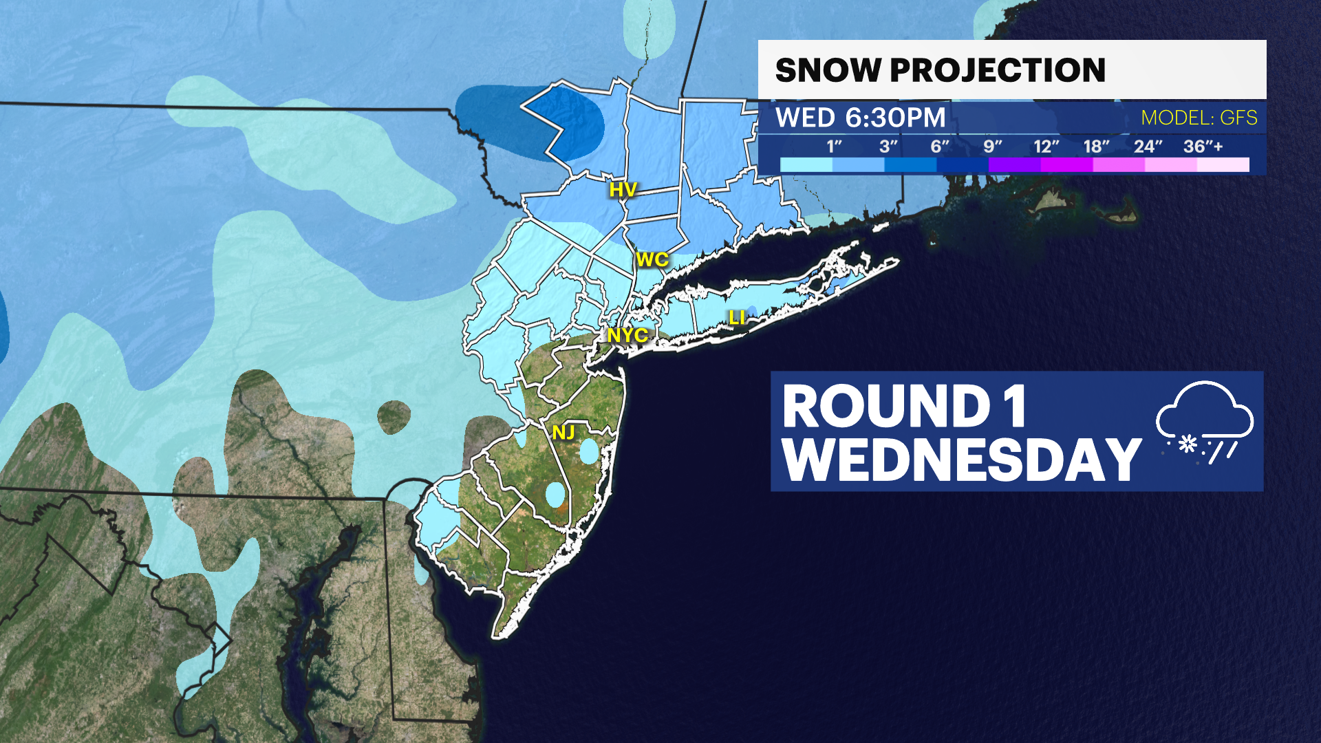
This is an Alberta Clipper, which typically only produces nuisance precipitation and are fast moving, their fast-moving nature makes them trickier to forecast, and they have lower had lower forecast confidence.
Even small amounts of snow could create hazardous travel conditions and impact cleanup efforts.
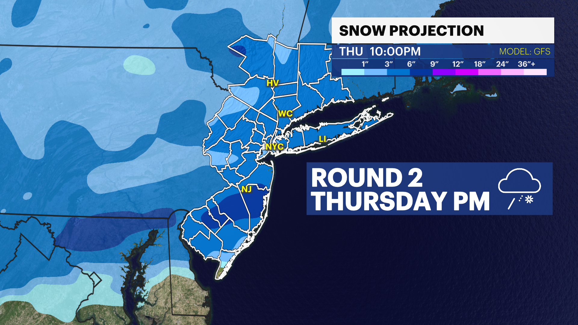
More impactful Storm on Thursday
Model guidance shows another storm moving through the tri-state on Thursday afternoon into Friday morning and it does look more sizable with winter weather impacts.
GFS Model: A snowstorm for most of the tri-state
This was the model that projected the Blizzard of 2026 best. It has widespread 3"+ snowstorm with plowable snow returning. The guidance indicates some areas would see more than 6"
Wintry mix and icy conditions projected for New Jersey
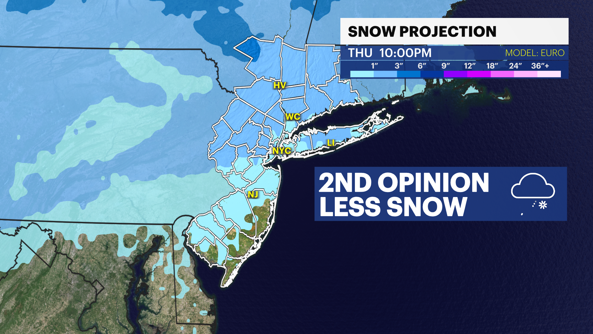
European Model (ECMWF): Less snow, more icy
Snow totals are lower, but a major ice storm is possible over central New Jersey into the city and perhaps Long Island.
NOTE: Mixed precipitation events are notoriously difficult to forecast so expect changes to occur.
Winter Weather Threat into March
The overall weather pattern remains cold and active, allowing multiple storm systems to move through the region into the first week of March.
This means:
Snowpack from the blizzard will remain in place
Additional snow will be possible
Travel conditions may stay challenging
Plow operations may continue for days
Residents are encouraged to stay updated on the forecast as details become clearer over the next several days.