More Stories
New Jersey will see mostly quiet and cooler weather over the next few days.
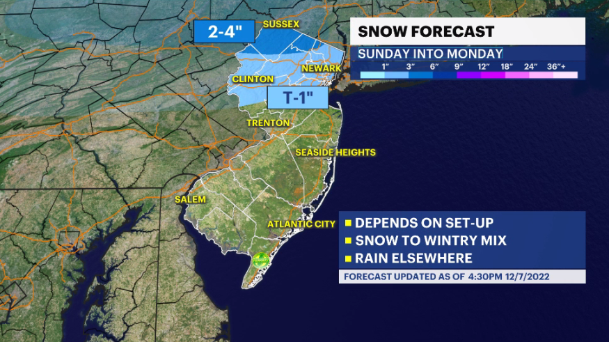
Storm Watch Team Meteorologist Dave Curren says that he is tracking the possibility for some snow in northwestern New Jersey Sunday into Monday.

WHAT’S NEXT: There is the potential for some snow in parts of New Jersey Sunday night into Monday. The snow would mostly impact parts of northwestern New Jersey – areas of higher elevation. There is the potential for up to 4 inches of snow in some areas.
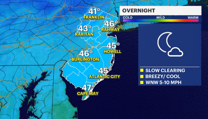
OVERNIGHT: Skies begin to clear. Overnight lows in the upper-40s.
RELATED: News 12 New Jersey Weather Center
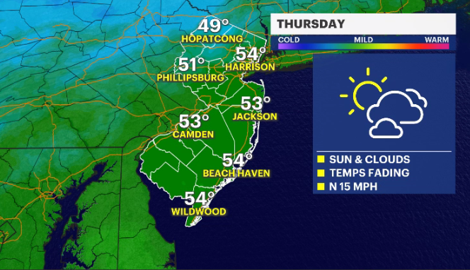
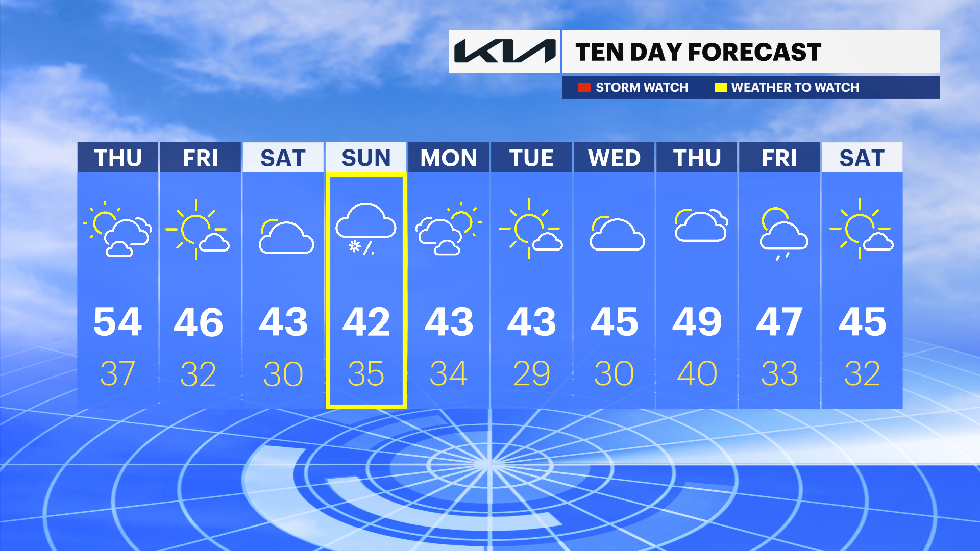
THURSDAY: Mix of sun and clouds. Daytime highs mild and around 54 degrees. Overnight lows around 37.
FRIDAY: Mostly sunny with some clouds. Daytime highs around 46. Overnight lows around 32.
SATURDAY: Mostly cloudy with cooler temperatures. Daytime highs around 43 degrees with overnight lows around 30.
SUNDAY: Cloudy skies, with the potential for some snow by the evening. Daytime highs around 42. Overnight lows around 35.
MONDAY: Mix of sun and clouds. Daytime highs around 43. Overnight lows around 34.
More from News 12
2:07

Clouds slowly lift from south to north across New Jersey causing temperatures to spike with afternoon sun
1:56

Toll of Commuting: Pothole repairs can be costly for New Jersey drivers
2:04

New Jersey ready to welcome spring after frigid, snowy winter
1:33

60-foot tree rips through roof of home while family of four sleeps inside

LIVE RADAR: Tornado Watch in effect for NJ
1:35
