Dangerous heat builds through the rest of the week
Along with the heat, we also have passing storms Wednesday through Monday.
More Stories


The heat will get center billing on the weather marquee, for now. There will be a batch of nasty storms we will have to keep our eyes on by Thursday evening.
Fair weather, which brought such beautiful conditions to New Jersey and the tri-state area, is now nudging offshore. This will allow the winds to capture that humid Carolina air and start pumping it in our direction. The forecast is about to get really sweaty, unfortunately.
Skies are clear tonight and the air is seasonably warm. You will notice just a smidgeon of mugginess creeping in, but it will still be quite comfortable.
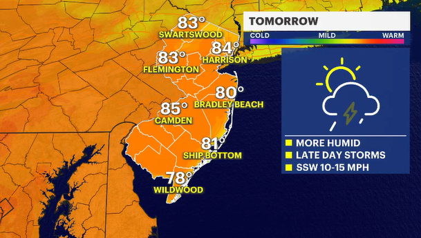
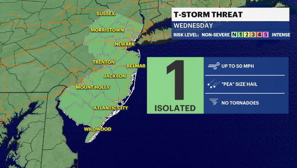
Wednesday is warmer and throughout the day, the air will get stuffier and sultrier. Daily highs will only be a few degrees warmer than the seasonal average of 80 degrees, but with the building humidity, it will feel warmer. Passing showers are possible after 4 p.m., especially in the southern areas of the state.
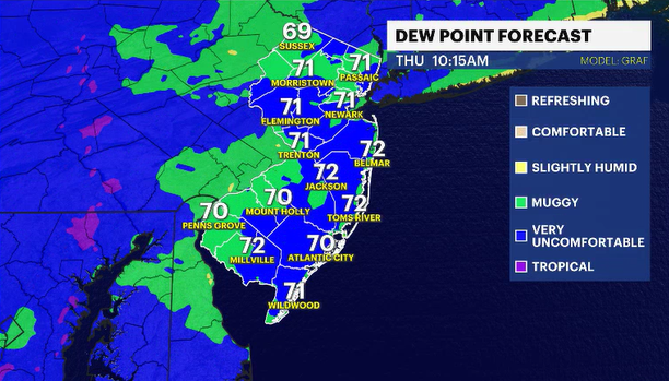
The weather turns very summery on Thursday. Ninety-six degrees set back in 2000 is the record we will be eyeing to either tie or break. The air will also be sodden with moisture, so temperatures in the mid-90s will feel more like 100 degrees plus!
Please be safe and smart in the heat. It will be the first time we've had to deal with both the dangerous heat and the humidity together this year. Also, in this wickedly hot atmosphere, some very nasty thunderstorms will arrive around dinner time. The primary weather concern would be downpours capable of quick flooding and damaging winds.