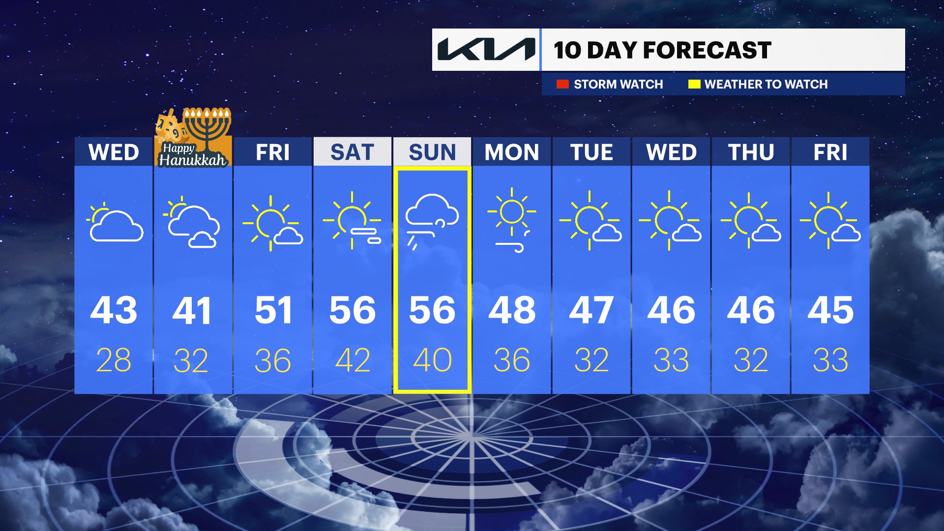
Temperatures cool overnight into Wednesday; tracking potential Sunday storms
Temperatures for Tuesday night will dip into the mid-30s.
More Stories


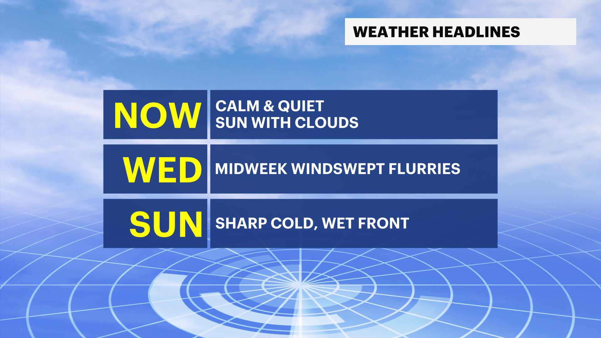
NOW: Clouds drifted in this afternoon but we will stay rain-free. Tomorrow into Thursday, colder temps settle in with cold mornings. Temperatures 26-32 degrees.
NEXT: Stronger signal for stormy and soggy Sunday. We are keeping an eye on this and narrowing down details as we get closer to the weekend. As of now, looks like gusty winds near 55 mph and rain. Coastal flooding is likely.
TONIGHT: Clouds linger this evening and colder. Overnight lows near 35.
MORE: News 12 New Jersey Weather Center
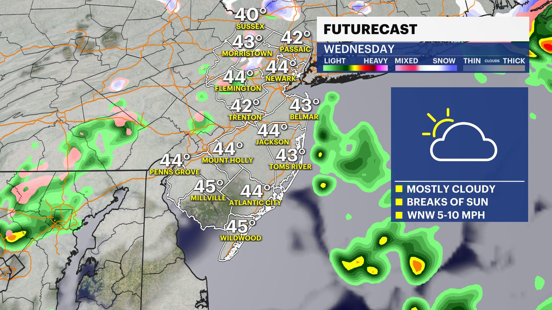
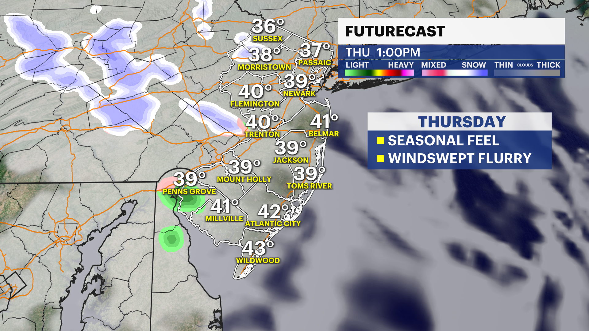
WEDNESDAY: Mostly cloudy with unsettled system nearby, north/west. A flurry or two could be windswept but not looking at anything major. No accumulations are expected. Highs near 43. Overnight lows are cold near 28.
THURSDAY: Colder morning! Feels like more layers, with 25-28 degrees. Partial sunshine with clouds passing in the afternoon. Another flurry potential! Highs near 41. Overnight lows near 32.
FRIDAY: Nice, mostly sunny day with temps rebounding near 51. Overnight lows near 36.