More Stories
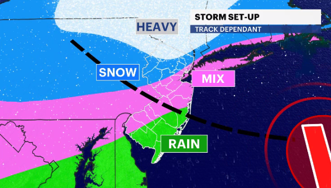
A winter storm could bring several inches of snow to parts of New Jersey Friday night into Saturday.
News 12 Storm Watch Team meteorologists say that the snow will mostly be confined to northern areas of the state.
WHAT’S NEXT: A light but consistent snowfall is expected along and north of Interstate 80, a wintry mix near Interstate 78 and rain and wind for the rest of the state. Snow accumulations are expected but should remain only on colder services.
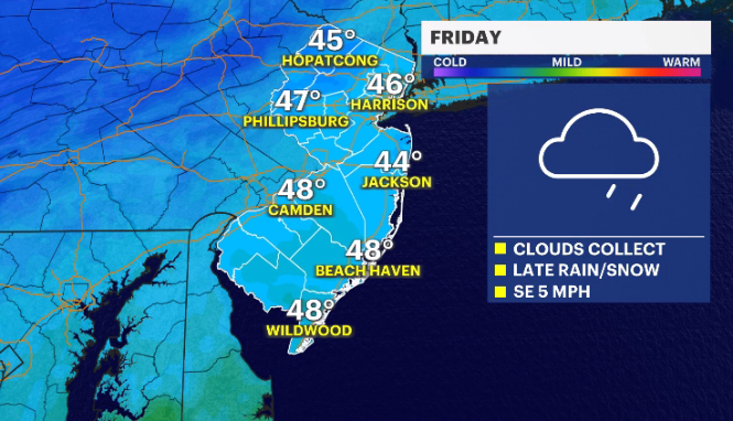
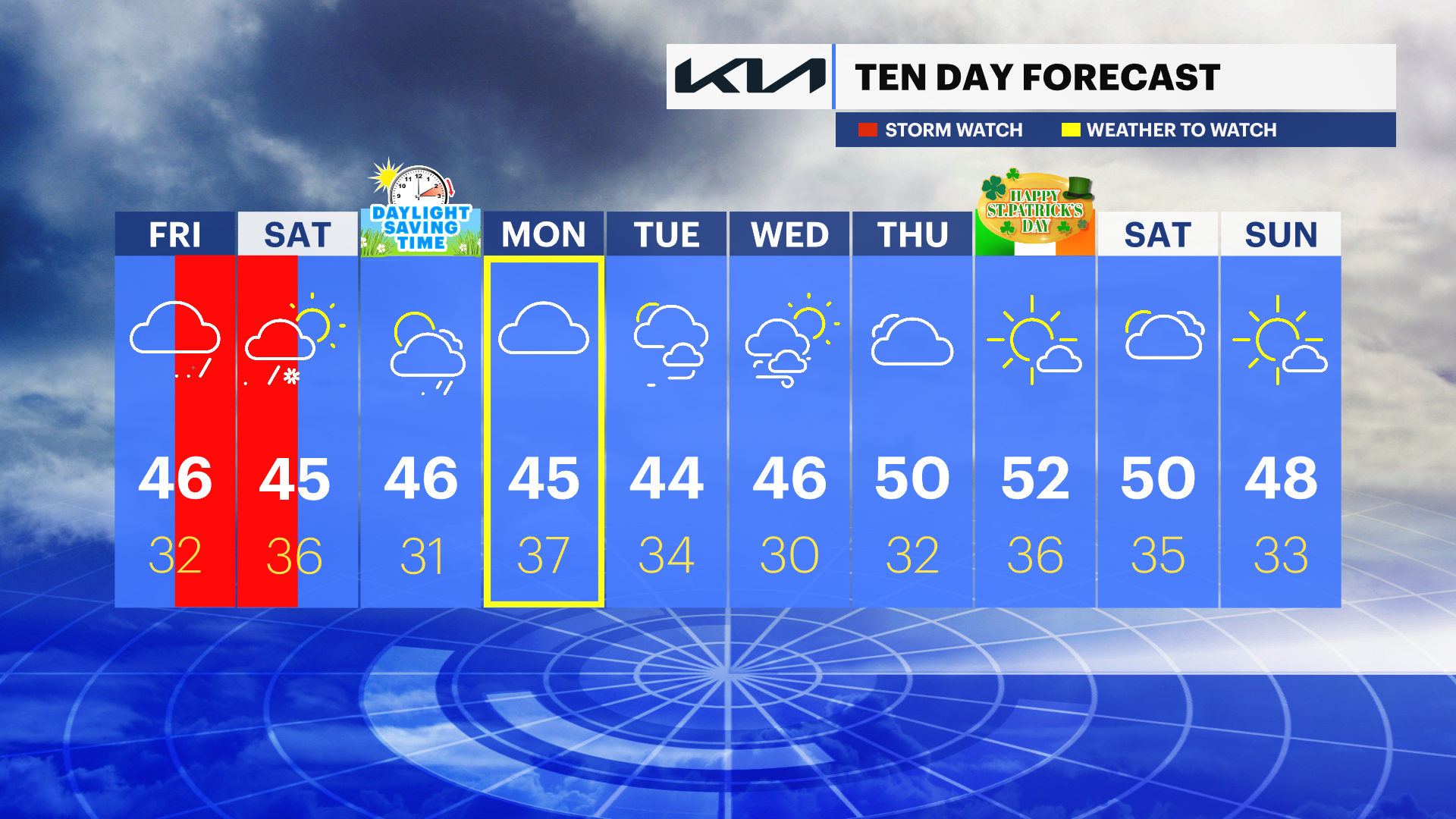
TODAY: Cloudy conditions to start off the day. Rain and snow begin by the afternoon. The precipitation is expected to continue Friday night into early Saturday morning. Daytime highs of around 46 degrees with overnight lows around 32.
SATURDAY: Snow and rain expected to end around 8 a.m. Then windy and colder temperatures. Daytime highs around 45 degrees. Overnight lows around 36.
SUNDAY: Daylight saving time begins. Clocks should be set forward one hour at 2 a.m. Mostly cloudy with the chance of some rain. Daytime highs around 46 and overnight lows around 31.
COMING UP: Mostly cloudy weather ahead for the upcoming week. Temperatures in the mid-40s and low-50s.
More from News 12
1:47

Celestial sights you don’t want to miss this April
1:56

Popcorn Park Animal Refuge seeks help in repairing blizzard damage
4:29

LIVE UPDATES: NJ Transit to resume bus & rail services Tuesday morning
1:37

Warmer temps finally on the way after brutal stretch

Back-to-back storms? There’s weather to watch this weekend in the tri-state
2:11
