More Stories
The News 12 New Jersey Storm Watch Team is tracking a system that will bring heavy rain, strong winds and freezing temperatures to the Garden State.
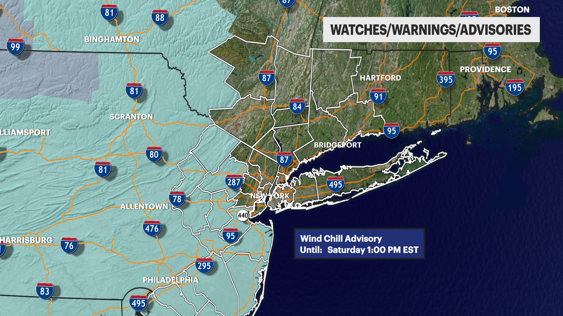
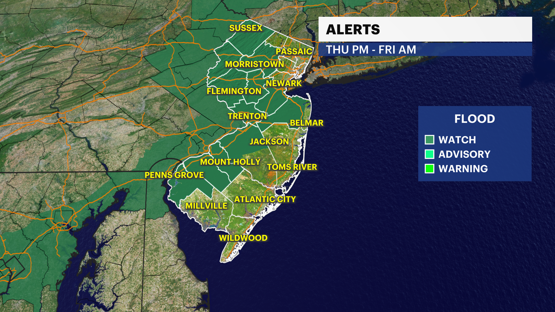
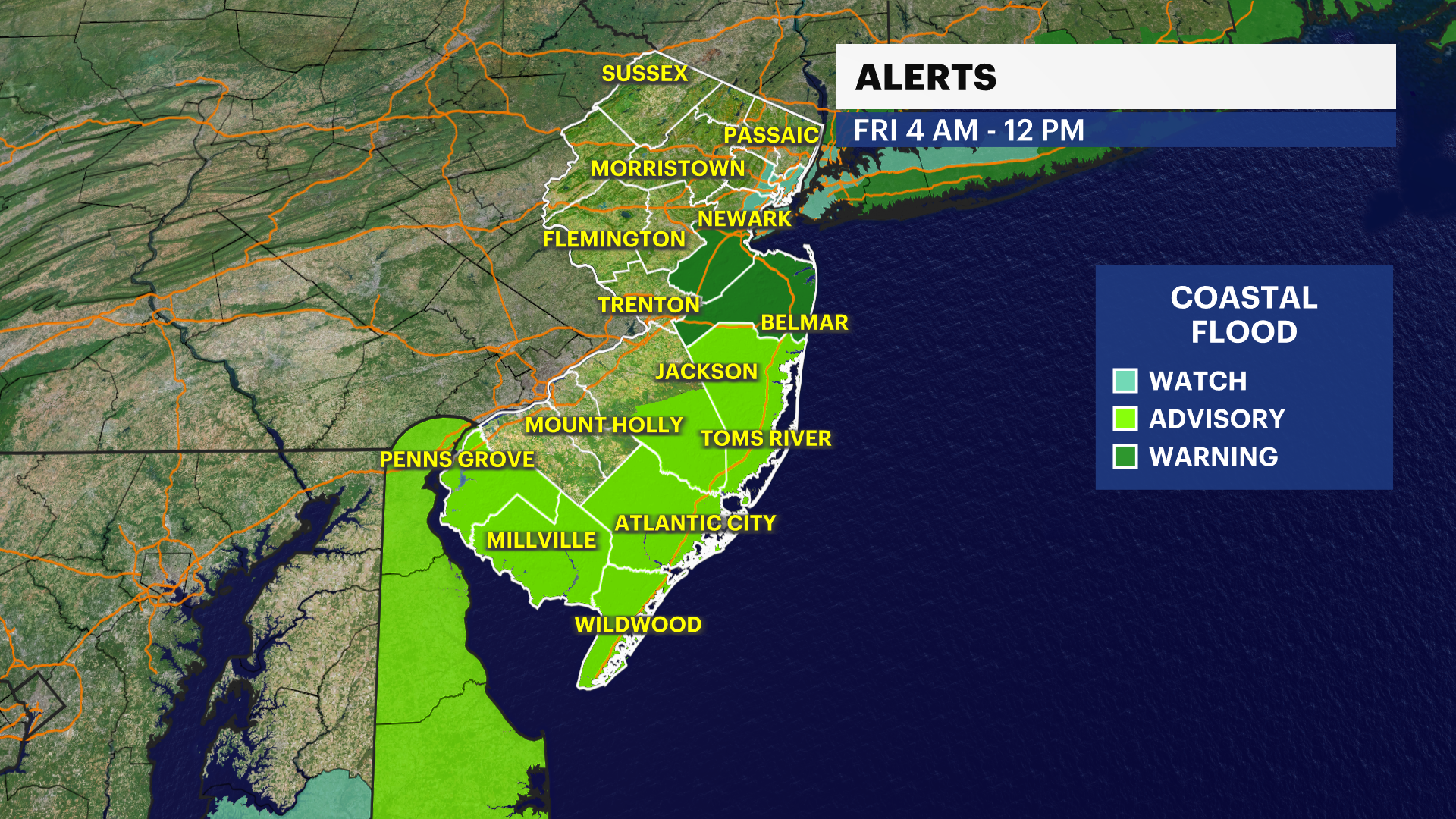
NEW: Wind chill advisory issued for much of New Jersey into Saturday. We have a complex, two-part storm that will bring significant impact to the tri-state area. The first half is all about rain, wind and flooding - minor urban and coastal. Then it's all about the bitter blast, winds, flash freezing and extremely low wind-chills Friday.
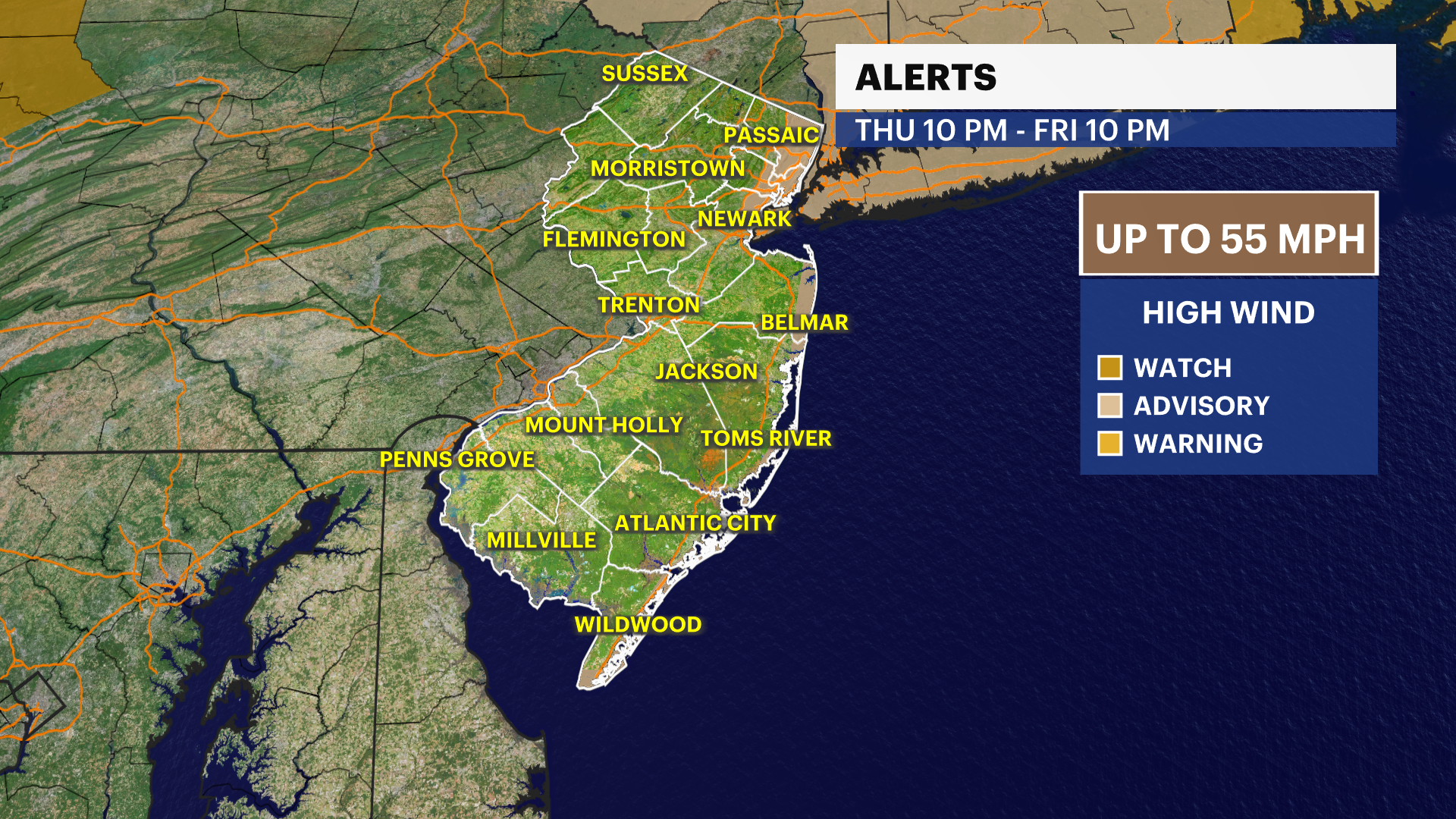
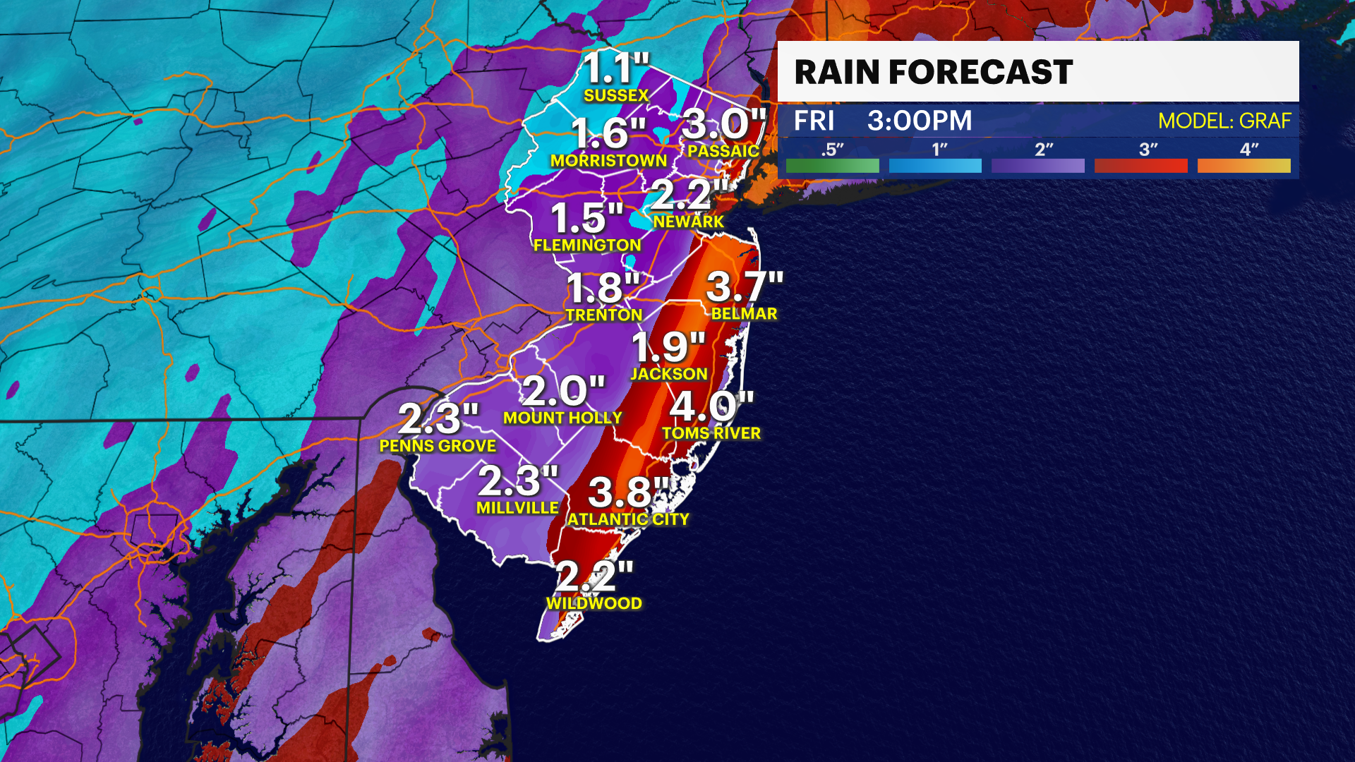
NEXT: Tracking light rain showers by late Friday morning through about noon, then picking up as we go through the rest of the day. Winds will also start to increase by afternoon and evening. Wind advisories go up for some counties at 10 p.m. We will see sustained winds 20-30 mph with gusts 45-55 mph.
Storm Watch Team Meteorologist Dave Curren says to expect another day of mild temps on Thursday before the cruel chill arrives with this weekend's storm.
THURSDAY: Mostly cloudy skies. Daytime highs around 48 degrees. Overnight lows dip to around 29 degrees.
FRIDAY: Rain for most of the day, with strong winds. Daytime highs around 57 degrees. Overnight lows around 45.
CHRISTMAS EVE: Temperatures drop to around 29 degrees under mostly cloudy skies. Overnight lows around 19.
CHRISTMAS DAY: Mostly cloudy skies with some sun. Daytime highs around 28. Overnight lows around 16 degrees. Dangerously cold through Sunday, then below-normal temperatures through the first half of next week.
More from News 12
1:47

Celestial sights you don’t want to miss this April
1:56

Popcorn Park Animal Refuge seeks help in repairing blizzard damage
4:29

LIVE UPDATES: NJ Transit to resume bus & rail services Tuesday morning
1:37

Warmer temps finally on the way after brutal stretch

Back-to-back storms? There’s weather to watch this weekend in the tri-state
2:11
