Dave’s Forecast: Seasonable chill continues through the week; tracking stormy Sunday weather
Thursday and Friday will see a mix of sun and clouds with temperatures in the 40s.
More Stories


A seasonable chill continues for the rest of the week. Will the holiday decorations survive a possible rainy and windy weekend?

NOW: Some instability showers developed today with flurries and raindrops. There was even a quick coating in the lower Hudson Valley where they had a better angle on that lake-enhanced squall. More of that tomorrow morning.

NEXT: Timing some of these mini squalls would be between 9 a.m. and 1 p.m. Best location would be in Warren, Sussex and western Morris counties. Not very impactful for the most part, but worst-case scenario, a sugar coating happens on colder surfaces.
MORE: News 12 New Jersey Weather Center
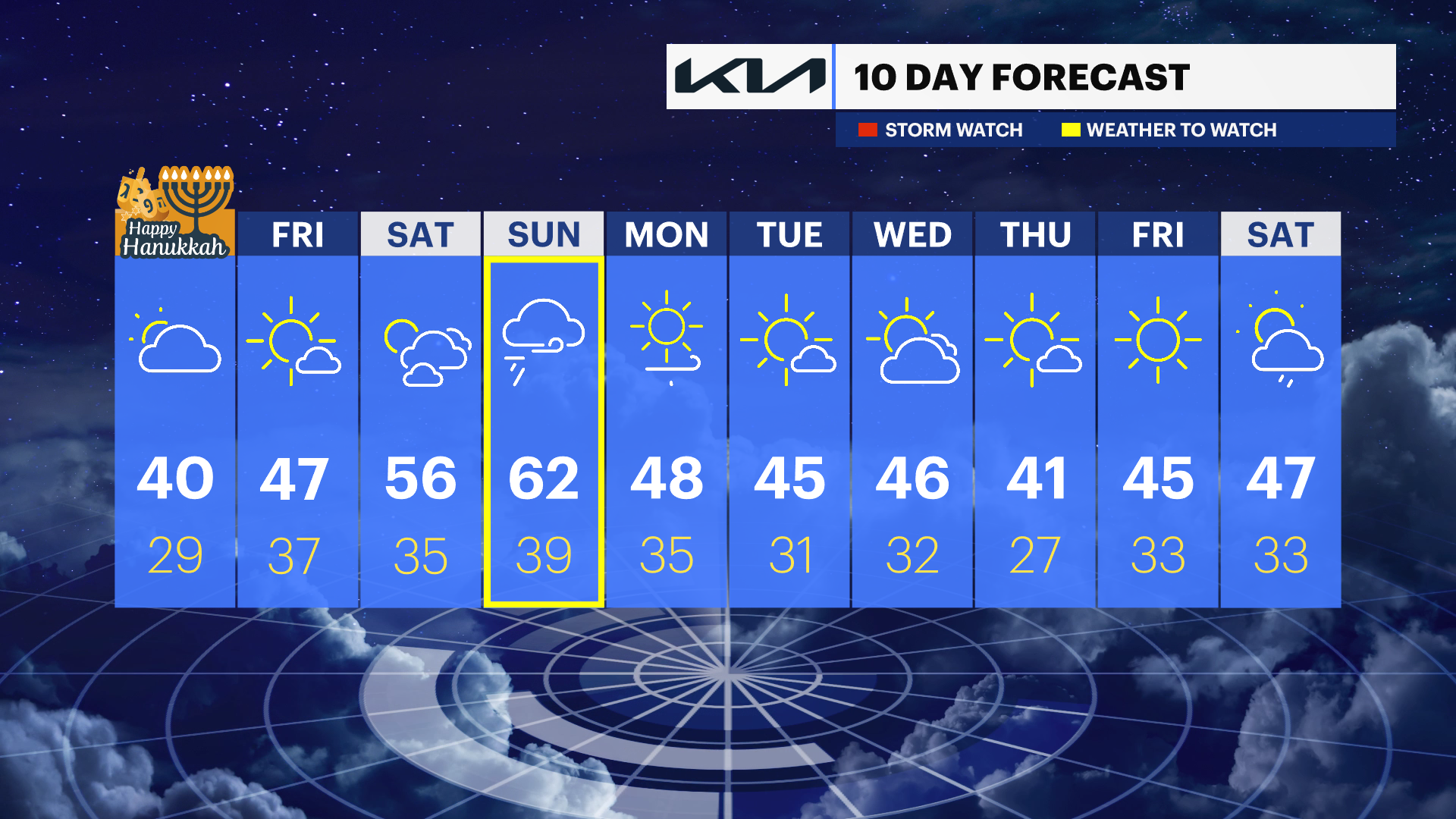
THURSDAY: Thursday is overcast with minimal hints of sun. Because of the wind and lack of sunshine, temperatures will once again be below the seasonable average. 48 is normal. We struggle just to get to 40. Thursday night the clouds slowly part ways with the area. Lows will be within the normal range. Low: 32.

FRIDAY: Saving the best weather for the end of the week. Mainly sunny and milder on Friday. High closer to 50.
SATURDAY: Saturday is looking pretty good with sun mixing with late afternoon clouds. Highs around 56 degrees.
SUNDAY: Sunday falls out of the ugly tree and hits every branch on the way down. Rain and wind could wreak havoc with decorations. We’ll watch to see how the pattern evolves. Daytime highs around 62.