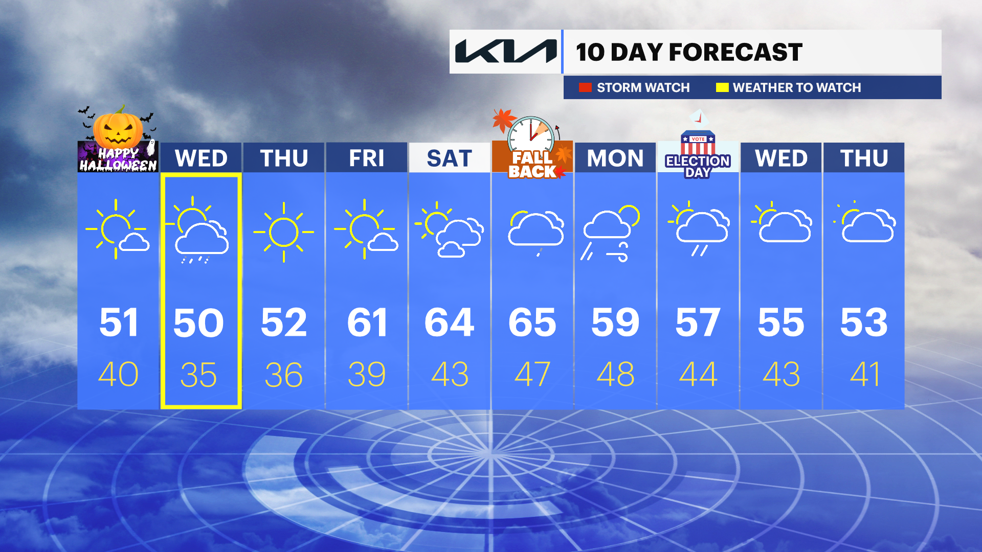
Dave’s Forecast: Blustery Halloween ahead with temps around 50
Halloween will see windy and cooler weather. Rain is possibly late Halloween night.
More Stories


Crazy day weather today, temperature-wise. Conditions were in the 40s and 50s, with overcast skies and foggy conditions in the northern end of the state. While the coast and southern towns saw temperatures in the 70s and 80s, Atlantic City Airport broke a record with 81 today. The record was 80 set back in 2016.
The weather is about to change and in a big way. The cold is already on the move, and it is going to have that record-breaking warmth retreating back to the Carolinas and even further south starting tonight.
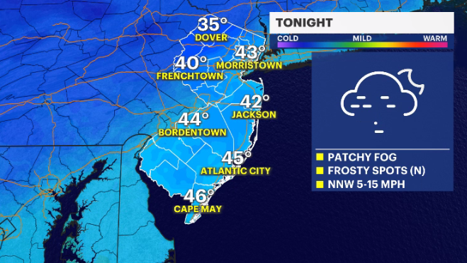
TONIGHT: Areas of patchy fog stick around. Patchy frost develops in the northwestern corner of the state. A frost advisory is officially in effect for Warren and Sussex counties. I wouldn't be surprised if Hunterdon, Morris and western Passaic counties see some frost Tuesday morning as well.
MORE: News 12 New Jersey Weather Center
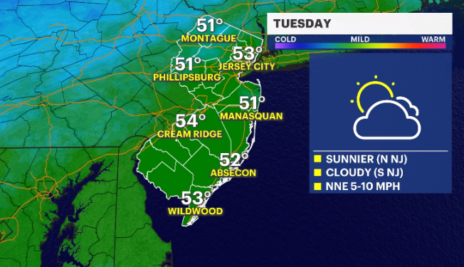
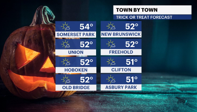
HALLOWEEN: Blustery and chilly. Not the coldest Halloween but the little ones may need an extra layer under their costumes. High temperatures around 51 degrees. After the sun sets the temperatures will fade quickly to the upper- to mid-40s.
HALLOWEEN NIGHT: Partly to mostly cloudy with a few showers up along the immediate shoreline. Lows in the mid- to upper-30s.
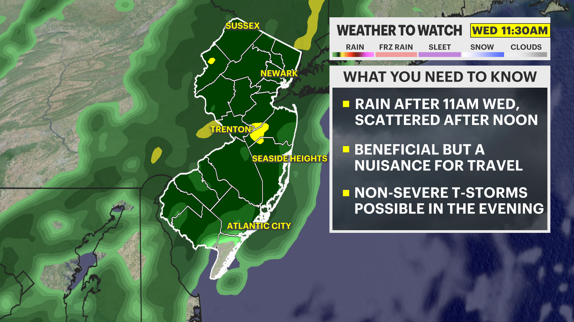
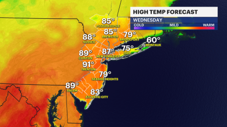
WEDNESDAY: Mainly sunny and much colder. Highs in the upper-40s to around 50. Early sunshine will give way to a few ominous-looking clouds and a few instability showers. Don't be surprised if a sprinkle or a wet snowflake.
THURSDAY-SATURDAY: Wall-to-wall sunshine. Temperatures rebound a bit to the low- and mid-60s.
SUNDAY: Possibly rain showers. I know, I know, but we have a few days to watch and see how it all evolves.