More Stories
Rainy and foggy weather is expected to continue in parts of New Jersey for the next few days.
Storm Watch Team Meteorologist Scott Sincoff is also tracking the potential for some snow Sunday night into Monday.
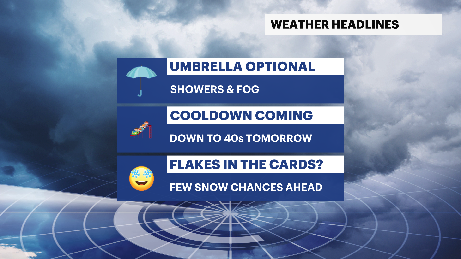
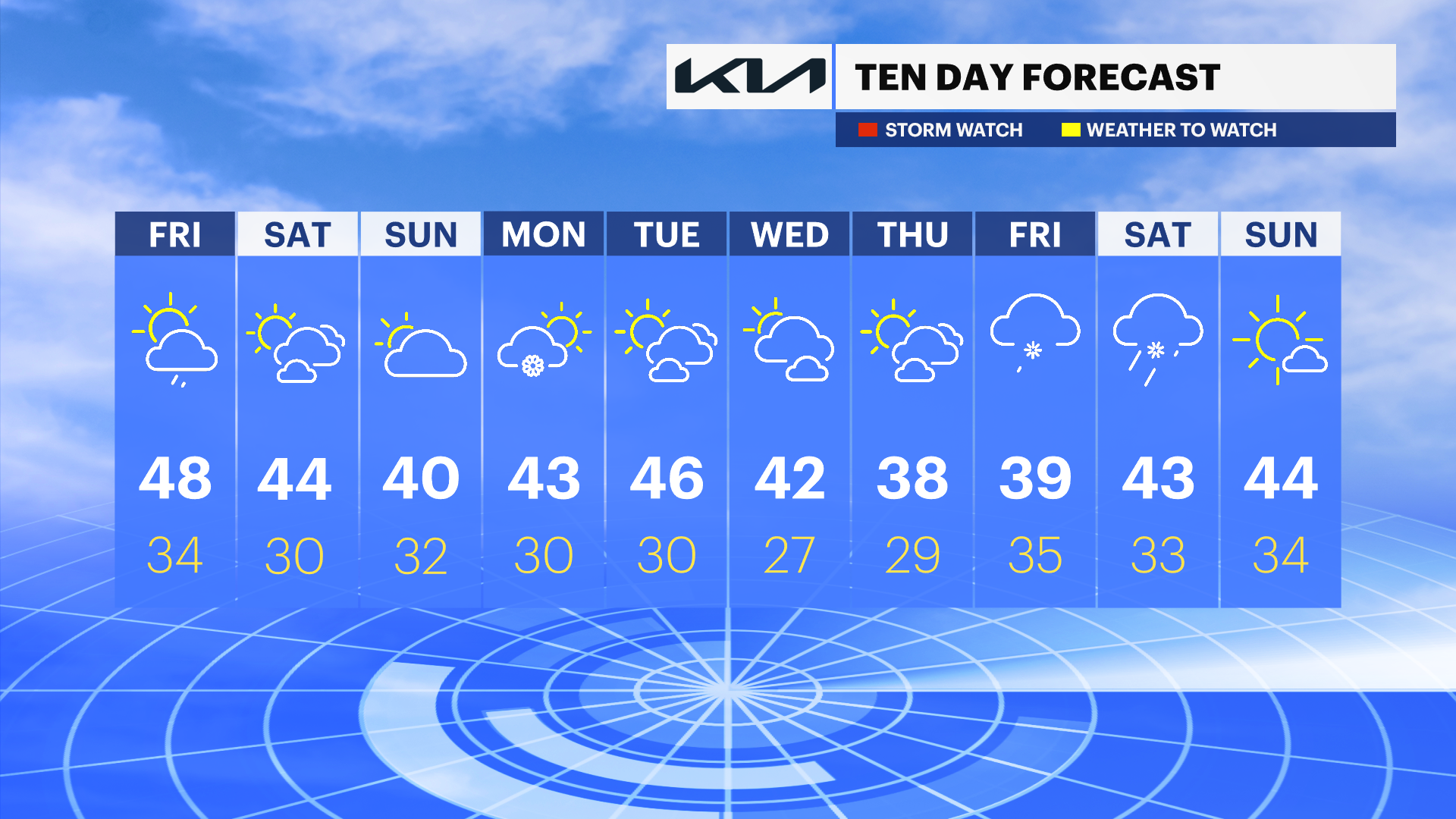
WHAT’S NEXT: Starting this weekend, temperatures are back to where they should be for this time of year. Highs are expected to be in the 30s and low-40s.
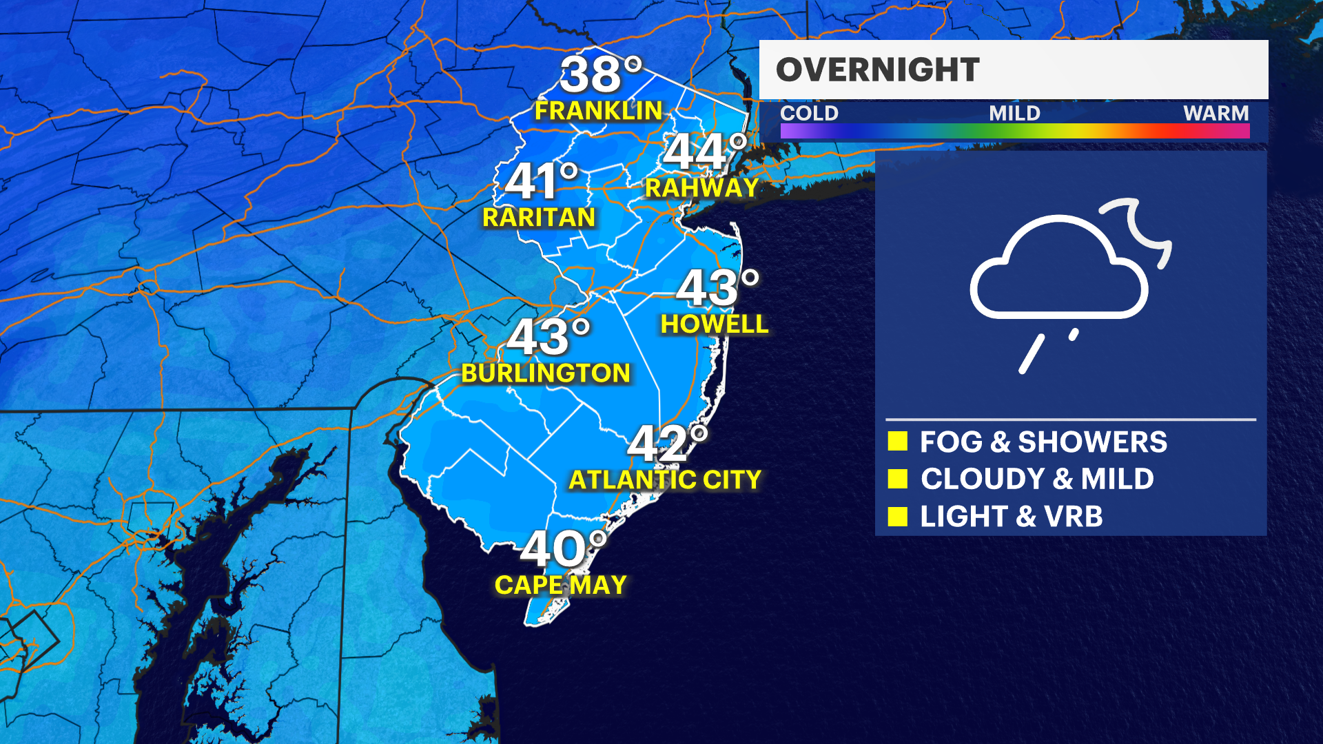
OVERNIGHT: Clouds, fog, and showers. Lows in the low-40s and upper-30s. Light and variable wind.
FRIDAY: Clearing sky with lingering showers and areas of fog. Highs around 50. Light west wind.

SATURDAY: A mix of sun and clouds. Highs in the 40s and lows around 30.
SUNDAY: Increasing clouds with snow possible overnight, with more of a mix in southern parts of the state. Highs around 40 and lows around 32.
MONDAY: Snow early on, turning partly sunny. Highs in the 40s and lows near 30.
TUESDAY: Partly cloudy. Highs in the 40s and lows near 32.
WEDNESDAY: Clouds, sunshine and a stray flurry possible. Highs around 40. Lows in the 20s.
More from News 12
1:47

Celestial sights you don’t want to miss this April
1:56

Popcorn Park Animal Refuge seeks help in repairing blizzard damage
4:29

LIVE UPDATES: NJ Transit to resume bus & rail services Tuesday morning
1:37

Warmer temps finally on the way after brutal stretch

Back-to-back storms? There’s weather to watch this weekend in the tri-state
2:11
