HEAT ALERT: Another round of record heat on tap for tomorrow
Are you sure this is better than cold and snow? Triple digit heat expected to last thru the holiday weekend
More Stories


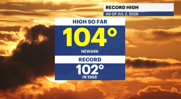
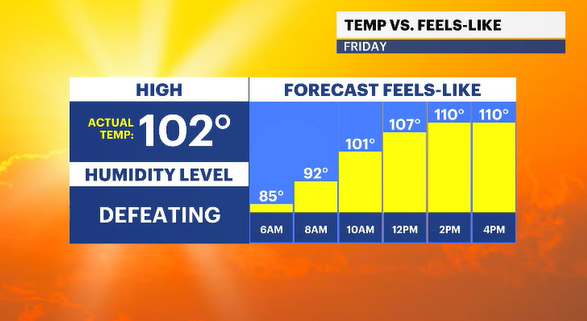
As of 3 p.m. today, Newark Liberty International Airport hit 104 degrees, thus breaking a 60-year record of 102 degrees back in 1966.
With the heat came the smothering humidity. The combination of heat and moisture in the air makes your body work harder to cool itself. Therefore, it feels hotter.
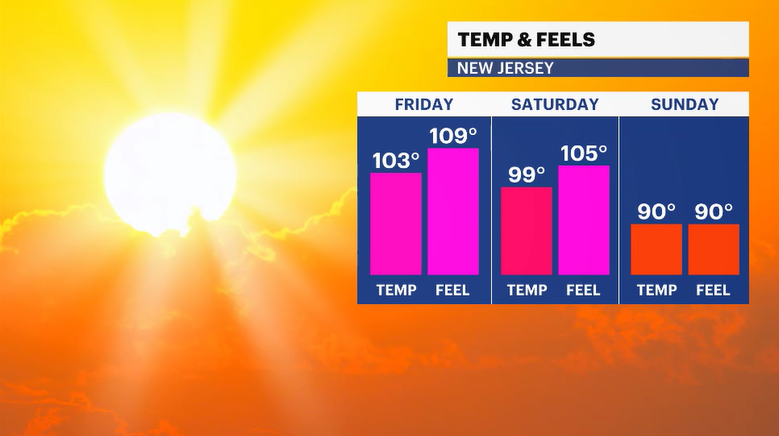
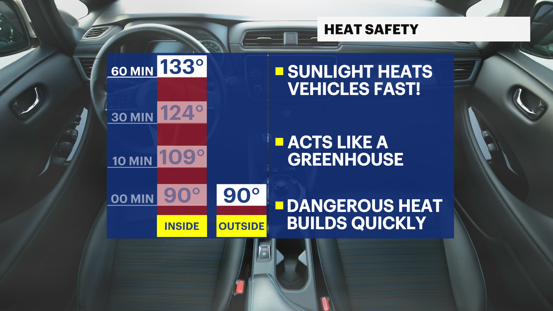
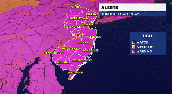
Please be extra cautious in this intense heat wave. Check on the elderly family members and neighbors. It will remain well into the 90s even after the sun has gone down for hours. The National Weather Service continues the extreme heat warning through Saturday. The conditions, at times, could be life-threatening.
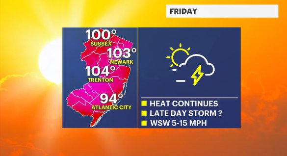
Friday is recognized as a National Holiday since July 4th falls on a Saturday this year. I am sure everyone will try to get to the beach, lake, pool and get the weekend started early. The heat has accepted your invitation to wherever you are going. It is possible tomorrow could also be a record breaker. The record in question is 105 degrees set back in 1966. Some new computer guidance is suggesting we get close.
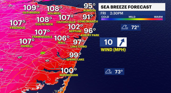
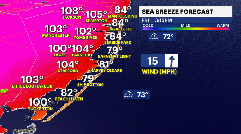
Honestly, the only place to elude the fierce heat is by staying inside in air-conditioning. But the beach is a nice alternative. Be safe and swim in front of lifeguards and make sure to continuously reapply sunscreen throughout the day. The UV Index is going to be a very high 9.


