Another dry week, but cool temperatures will heat up by Thursday in New Jersey
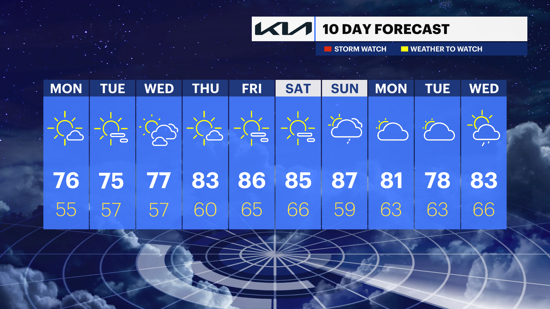
It remains cool for now with temperatures in the low 70s, but the warmth returns late this week with highs in the 80s.
Share:
More Stories


WHAT TO KNOW
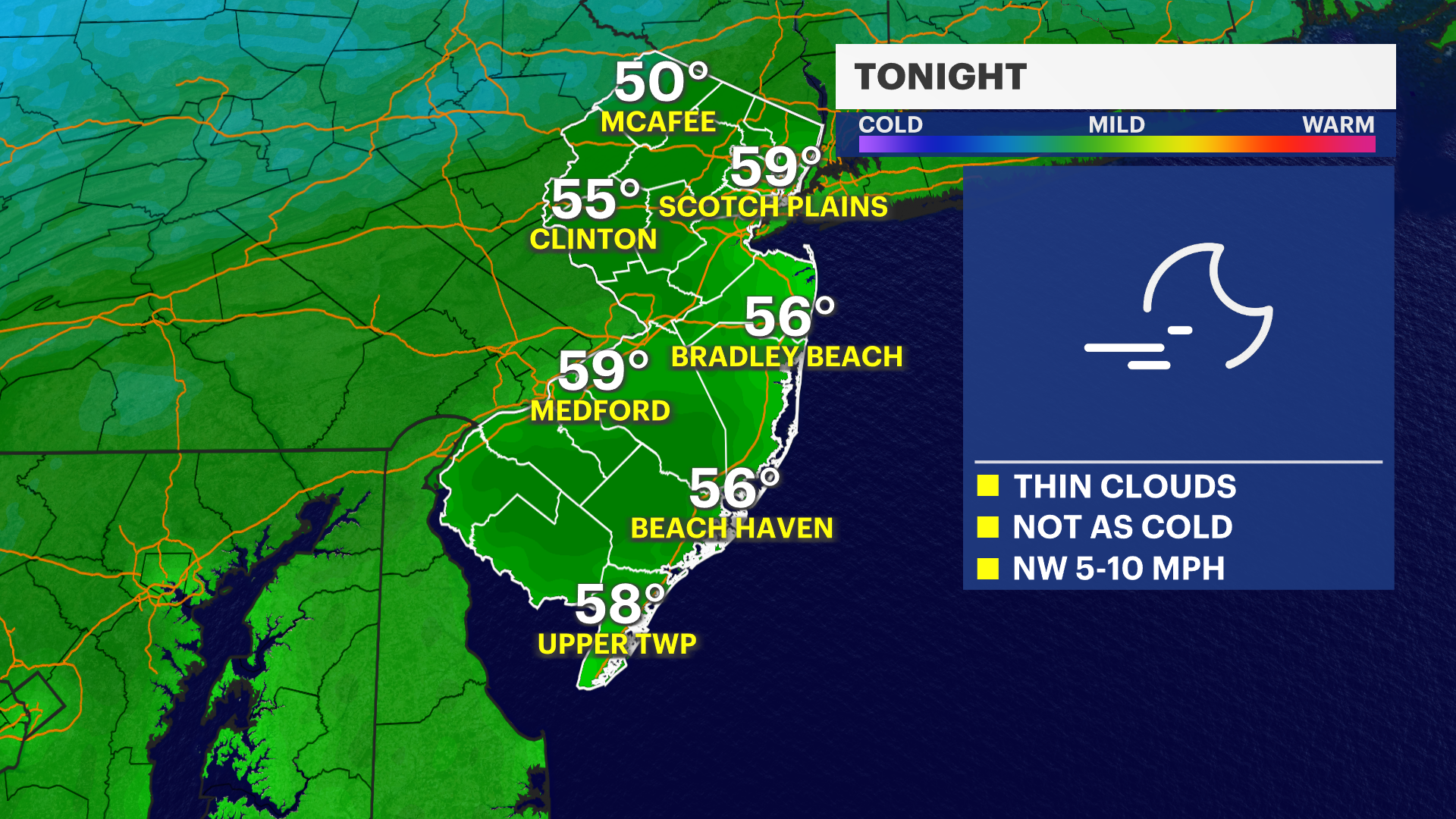
A disturbance passes just to New Jersey's east, which will spark a few rain showers overnight and into early Monday morning, primarily for the eastern parts of the state.
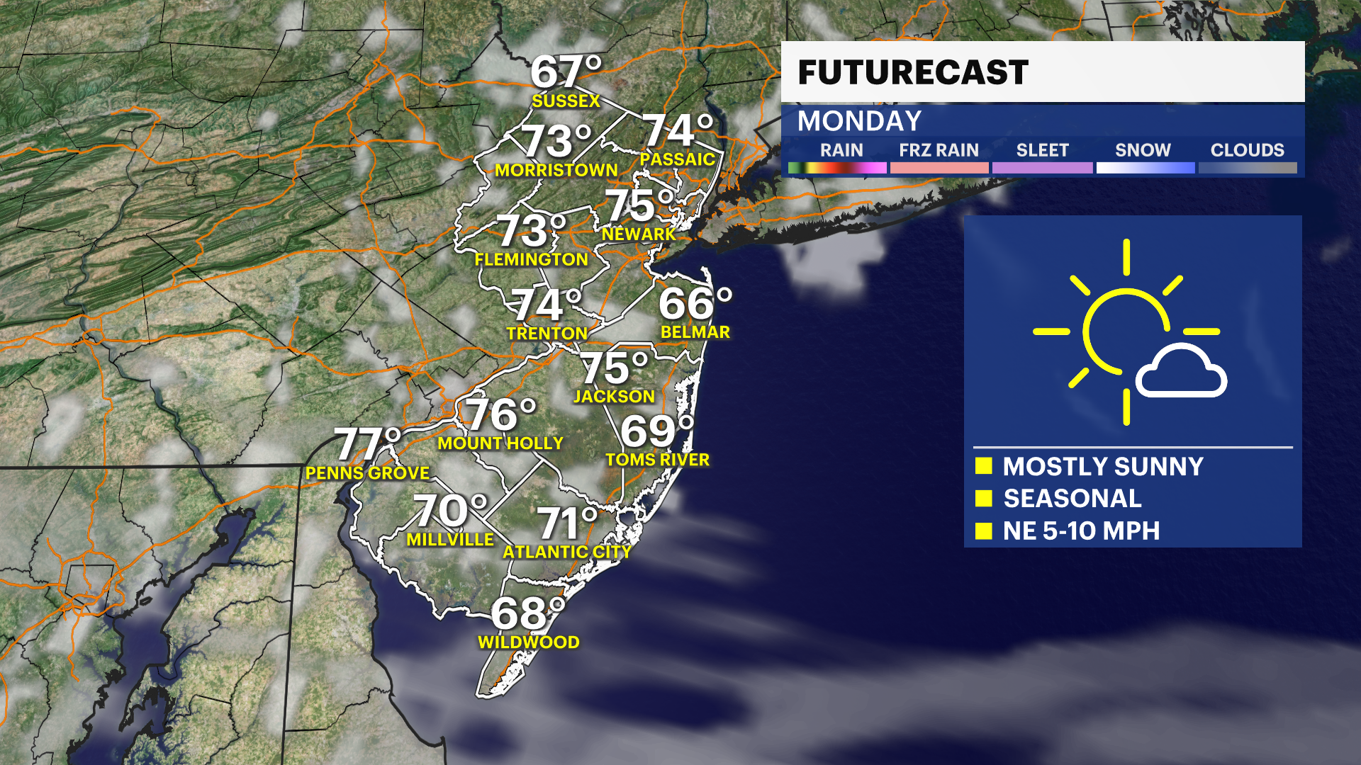
Once that clears out, Monday shapes up to be a beautiful, fair day with mostly sunny skies. Those comfortable temperatures in the lower 70s will hold, trending near or just below the seasonal normal. Looking ahead to Wednesday, the forecast is trending as of Sunday afternoon dry after initially looking a bit rainy. Then as the end of the week approaches, expect warmth and humidity to make a comeback Thursday through Saturday, with temperatures returning to the 80s.