From summery temperatures to snow? You heard that right.
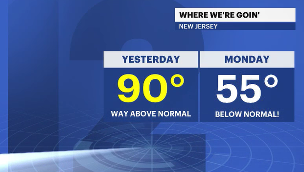
Today has been pleasant but cooler than the last few days. The temperatures will continue to fade through the weekend. Showers on Sunday will tap into even colder air and there is a chance that Monday morning there could be a few wet snowflakes for the morning drive.
More Stories


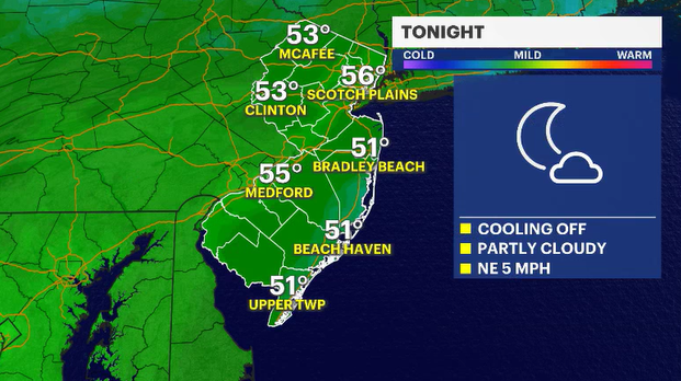
Ending the week off on a pretty nice note. A few instability showers have popped and will linger for the evening.
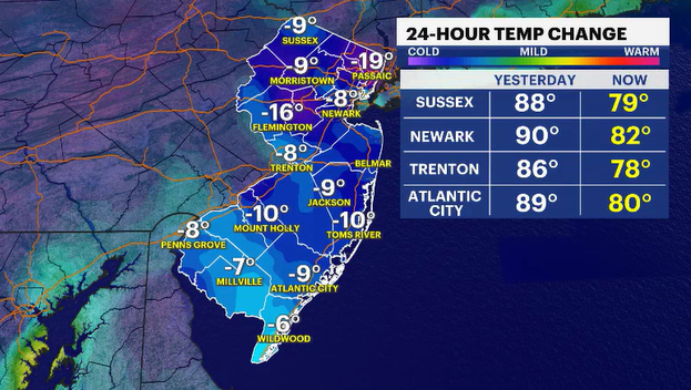
Daytime highs were in the 70s and low 80s. Still warm for this time of year, but 5 to 10 degrees cooler than yesterday. Partly cloudy skies will be the predominant sky condition and temperatures will begin to fade. Normal nighttime lows are in the mid 40s. Overnight temperatures will be in the mid-50s.
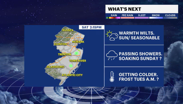
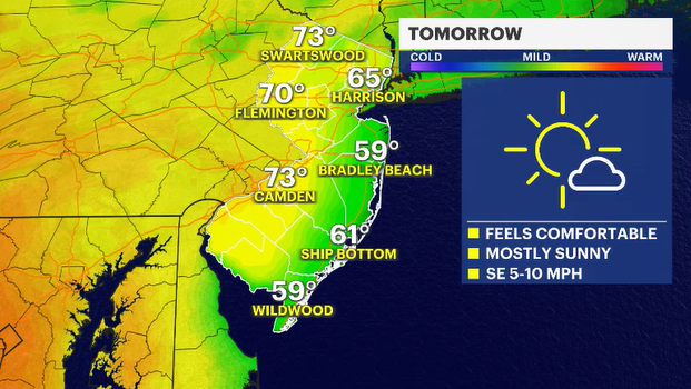
Saturday looks nice enough. The sun shares the sky with some clouds. The temperatures look to be all over the place, depending on where you live. Closer to the coast, it will be much cooler - upper 50s to near 60 degrees. Upper 60s to near 70 degrees elsewhere.
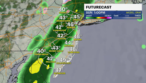
Clouds will begin to collect on Saturday night. Showers will become steadier closer to Sunday morning. The first half of Sunday looks wet and dreary. I know we don't like to see wet or stormy weather occur on a weekend, but we certainly could use a good soaking, and I think that is exactly what we can expect.
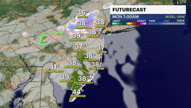
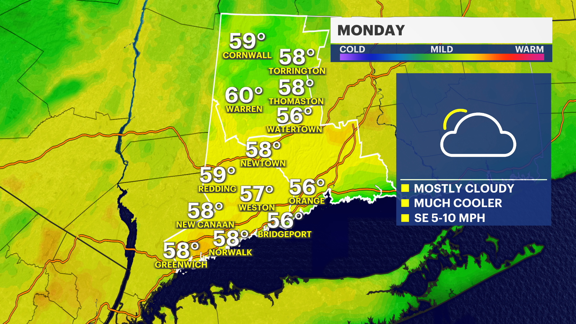
By the end of the day, the showers are passing east of the area and much, much colder air will be following. How cold, you ask? Well, for starters, morning low temperatures on Monday morning will be in the low to mid 30s, and if there is any leftover lingering moisture in the air, it could fall as wet snowflakes or ice pellets.
Yes, you read that correctly. While the chances for that to occur are very low, the chances are not zero.