More Stories
New Jersey will see a mostly dry and mild weekend, but colder temperatures are approaching.
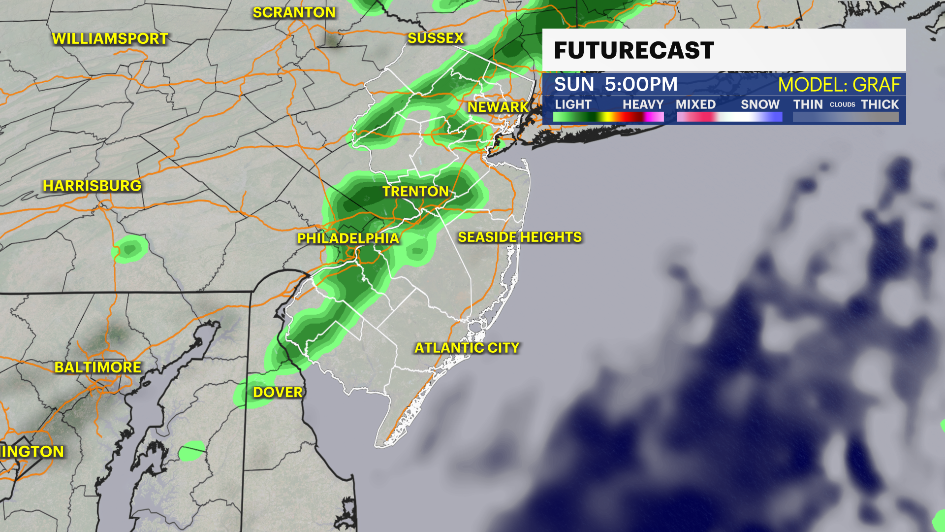
Storm Watch Team Meteorologist Michele Powers says some rain will develop by Sunday night.
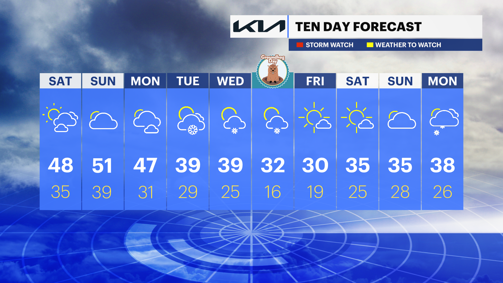
NEXT: Colder weather is coming up as temperatures go back to freezing by February, which starts Wednesday.
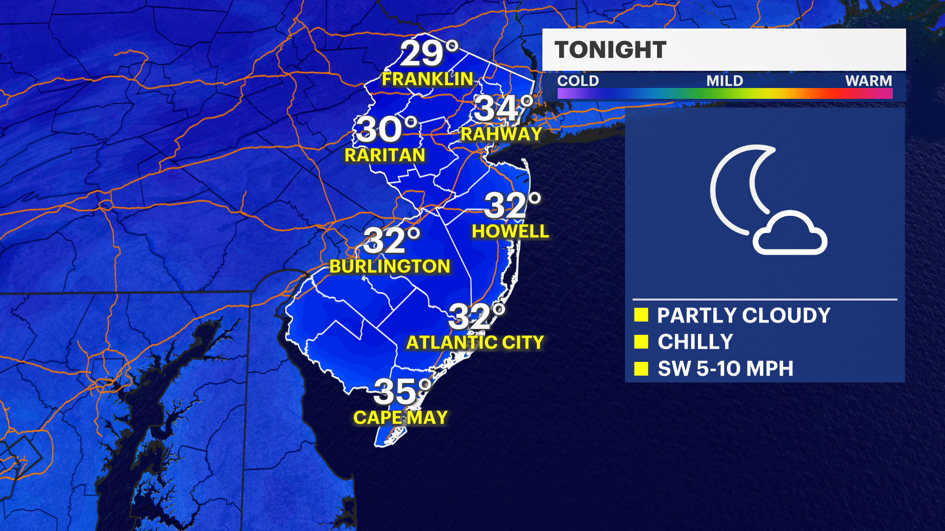
OVERNIGHT: Freezing with partly cloudy skies. Lows around 30. Wind: SW 0-10 mph.
SATURDAY: Sun and clouds. Highs in the upper-40s and lows around 35.

SUNDAY: Mostly cloudy and mild. Highs around 50. Lows in the 30s. Rain is expected to develop by the evening.
MONDAY: Mostly to partly cloudy. Highs in the upper-40s and lows around freezing.
TUESDAY: Mostly cloudy with a snow shower late. Highs in the low-30s and lows in the 20s.
WEDNESDAY: Partly cloudy with a snow shower. Highs in the 30s and lows in the 20s.
GROUNDHOG DAY: Snow showers possible and colder. Highs around freezing and lows in the teens.
More from News 12
1:47

Celestial sights you don’t want to miss this April
1:56

Popcorn Park Animal Refuge seeks help in repairing blizzard damage
4:29

LIVE UPDATES: NJ Transit to resume bus & rail services Tuesday morning
1:37

Warmer temps finally on the way after brutal stretch

Back-to-back storms? There’s weather to watch this weekend in the tri-state
2:11
