Showers this morning; Freezing cold expected on Long Island Monday night
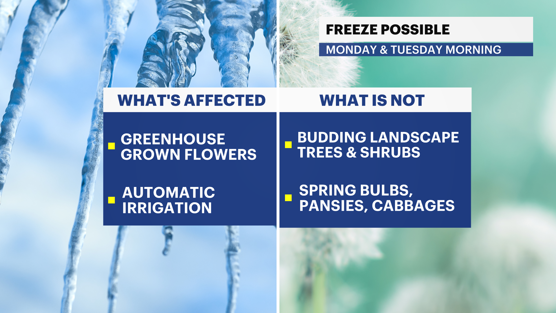
Grab the umbrella today and protect tender plants overnight. The National Weather Service has issued a Freeze Watch for our area on Monday night.
More Stories

New this morning: An unseasonable cold spell is expected early this week, bringing the possibility of frost Monday morning and freezing conditions expected on Tuesday morning. The National Weather Service has issued a Freeze Watch and will upgrade this to a Freeze Warning if the threat to tender plants continues to look likely for a freeze.
Freeze Prep Checklist:
Turn off irrigation sprinklers
Bring tender summer veggies and flowers inside or cover with very thick blankets
Know your microclimate: Although temperatures may not officially drop below 32-degrees, your garden may be colder on a calm and clear night
Rural areas may see freezing temperatures on Monday, Tuesday, and Wednesday morning
Temperatures will quickly warm up during the daytime and your sprouting landscape trees and shrubs will be unaffected
The forecast
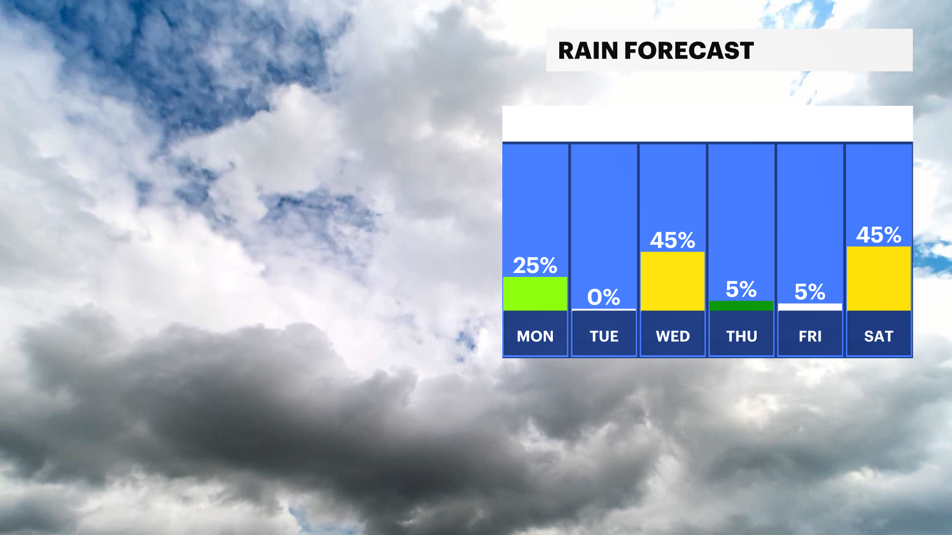
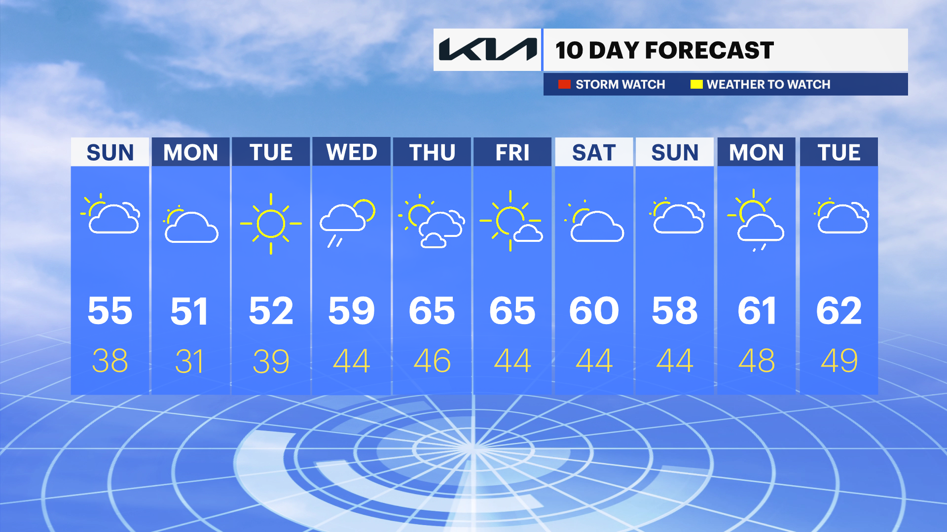
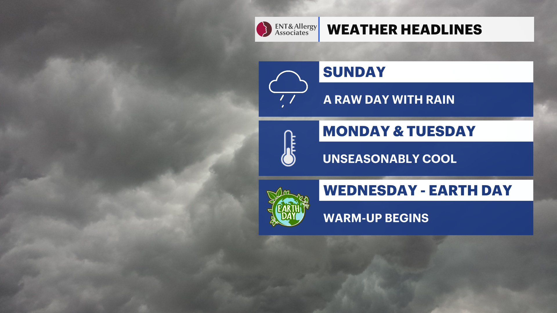
Cooler than average weather is expected for the start of the week. Temperatures will rebound on Wednesday with a stray shower in the morning. Next weekend will also be chillier than the average.
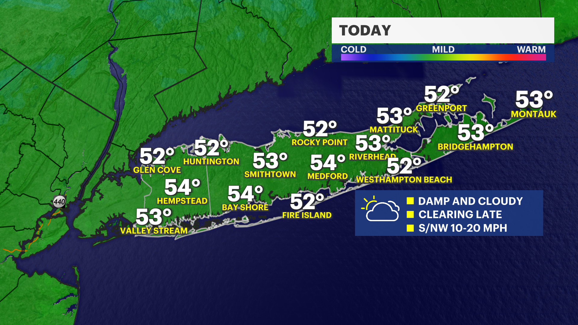
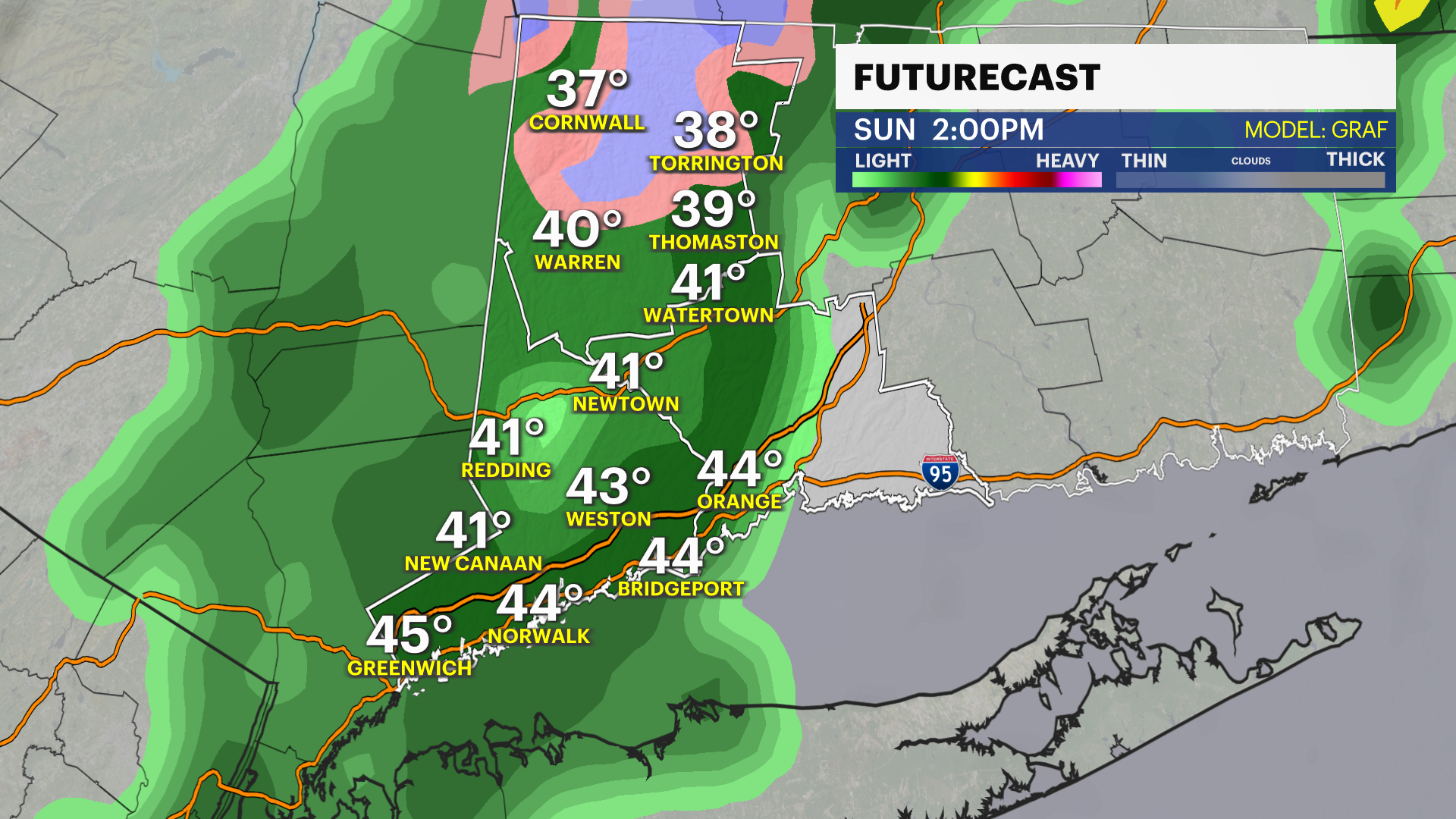
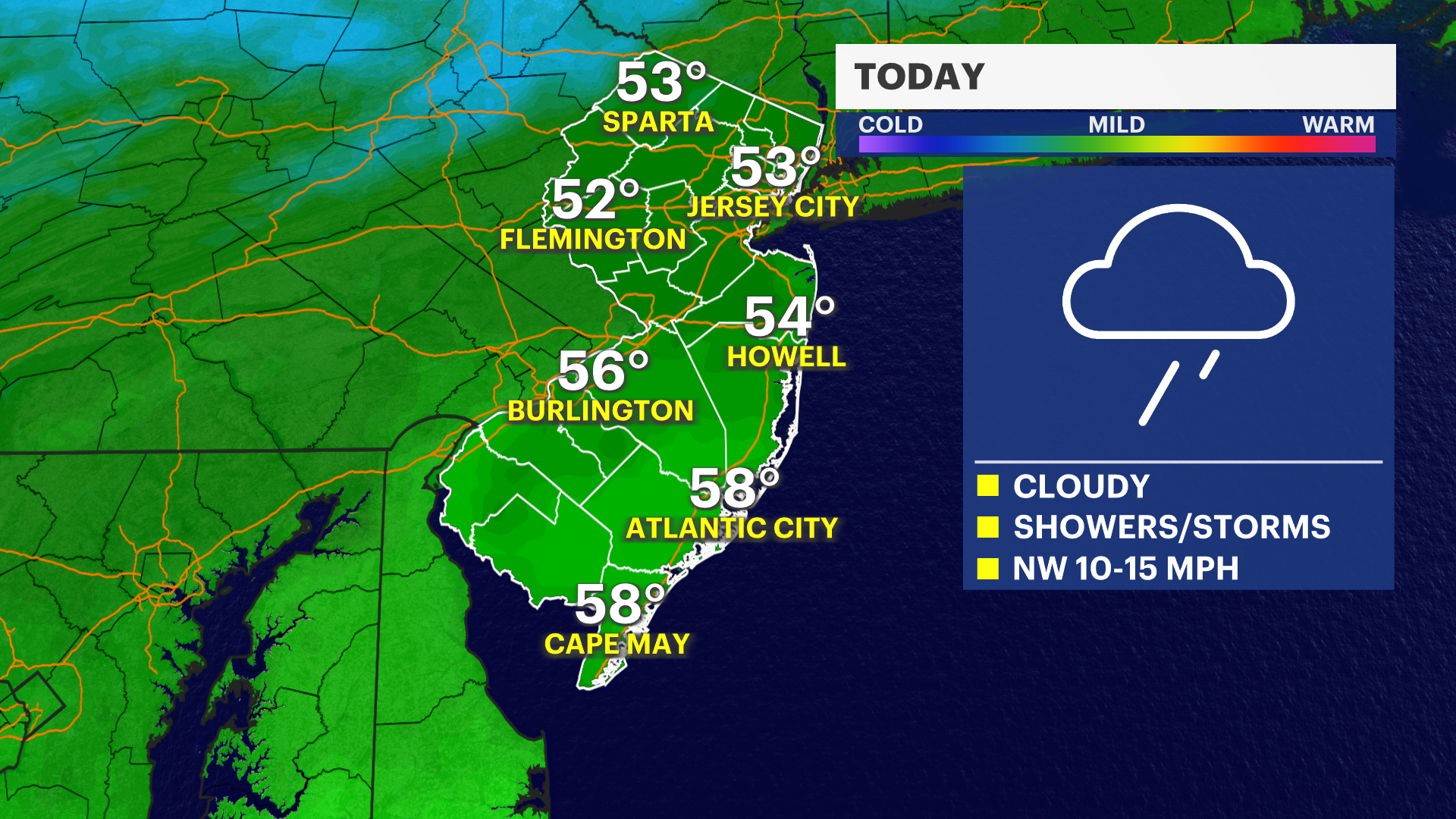
Today: Showers are expected through the early afternoon. An isolated downpour could bring a rumble of thunder. Temperatures are steady in the low 50s. Winds will shift to the northwest and increase to 20 mph in the afternoon Partial clearing is expected after 5 p.m.
Tonight: Becoming clear and cold. Calm winds will allow temperatures to drop into the upper 30s in cooler spots and near 40 elsewhere.
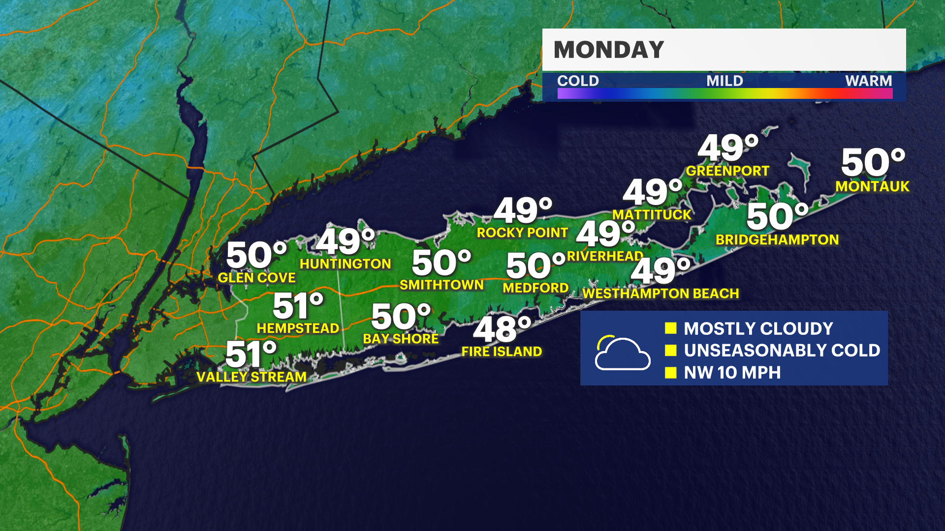
Monday: Chilly with increasing clouds. High temperatures in the low-50s. A freeze is possible in much of the area Monday overnight through 9 a.m. Tuesday morning.
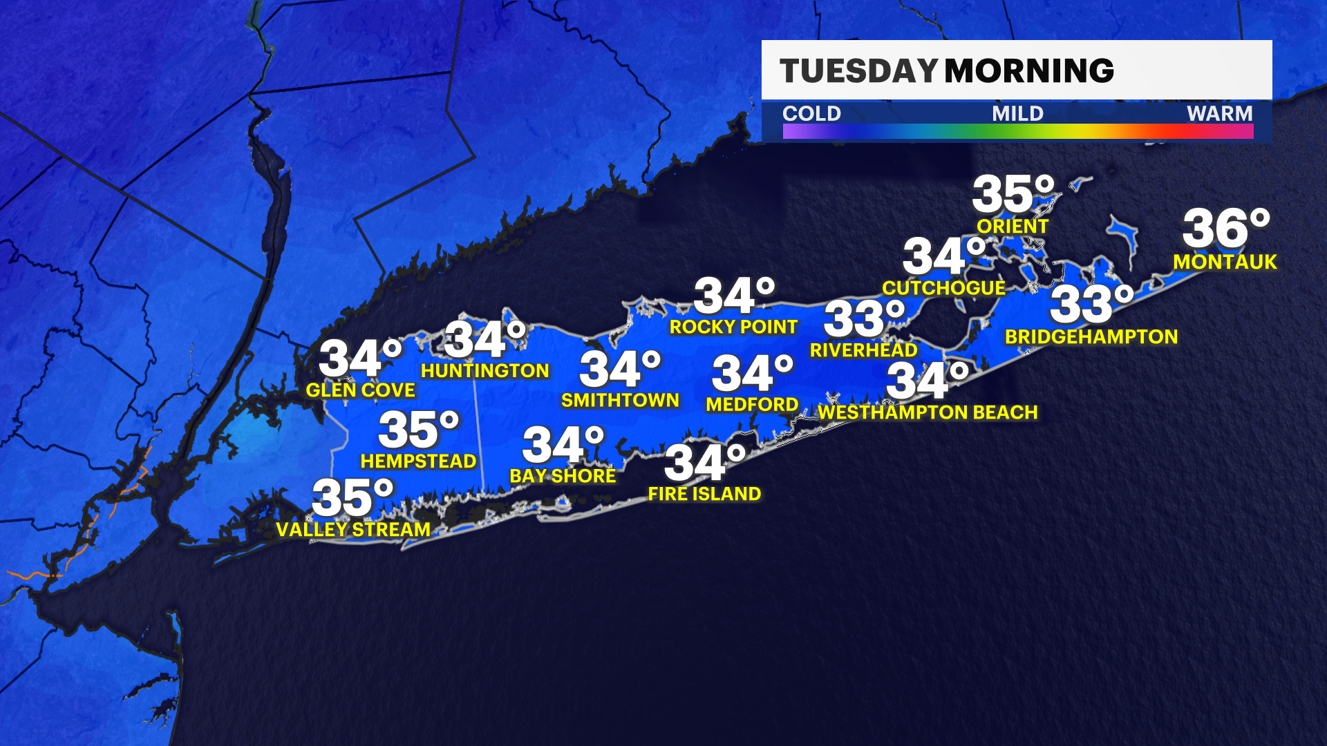
Tuesday: Very cold in the morning, remaining cooler than average in the afternoon. Expect abundant sunshine with highs in the low 50s.
Wednesday: A stray shower in the morning then a mix of clouds and sunshine in the afternoon. Highs will be in the 60s.
Thursday & Friday: Mild and dry with a mix of sun and clouds.