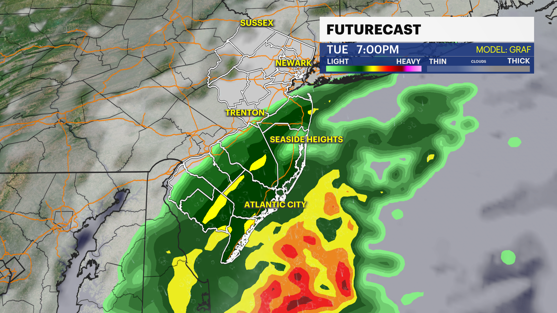
STORM WATCH: Wet snow, wintry mix for New Jersey Monday night into Tuesday

News 12 Storm Watch Team Meteorologist Hilda Estevez says the late February winter storm will cause a wet, wintry headache with plowable snow accumulations Monday evening into Tuesday.

News 12 Staff

Feb 26, 2023, 11:41 AM

Updated 717 days ago

Share:

A winter weather advisory is in effect for Passaic, Bergen, Essex and Union counties.
News 12 Storm Watch Team Meteorologist Hilda Estevez says the late February winter storm will cause a wet, wintry headache with plowable snow accumulations Monday evening into Tuesday.
Plowable snow for northern to central New Jersey with the heaviest snow in extreme northwest Sussex County. It will be mainly rain for I-95 to 195 and points south. I-78 will be significantly impacted by snow and icy conditions.
MONDAY: The morning starts off seasonally with temps in mid-20s. Sunshine before rain/snow enters late afternoon, around 5/5:30 p.m. Temps stay on the warmer side, making more of a rain setup for the majority of New Jersey. Snow accumulates overnight across northern NJ as snow is expected in the region for a longer stretch of time. Coastal gusts 30-40 mph. Snow, wintry mix stays north.
TUESDAY: Overnight rain and mix ends by or very close to the afternoon commute. South to north storm exit. Clouds give way to sunshine. Highs near 42. Lows near 28.
WEDNESDAY: Mostly sunny and a decent break in wet weather. Highs near 47. Lows near 41.
THURSDAY: Sun followed by increasing clouds, rain showers later in the day. Highs near 55! Lows near 35.
FRIDAY: Rain and wintry mix likely. Tracking this system. Highs near 44. Lows near 27.