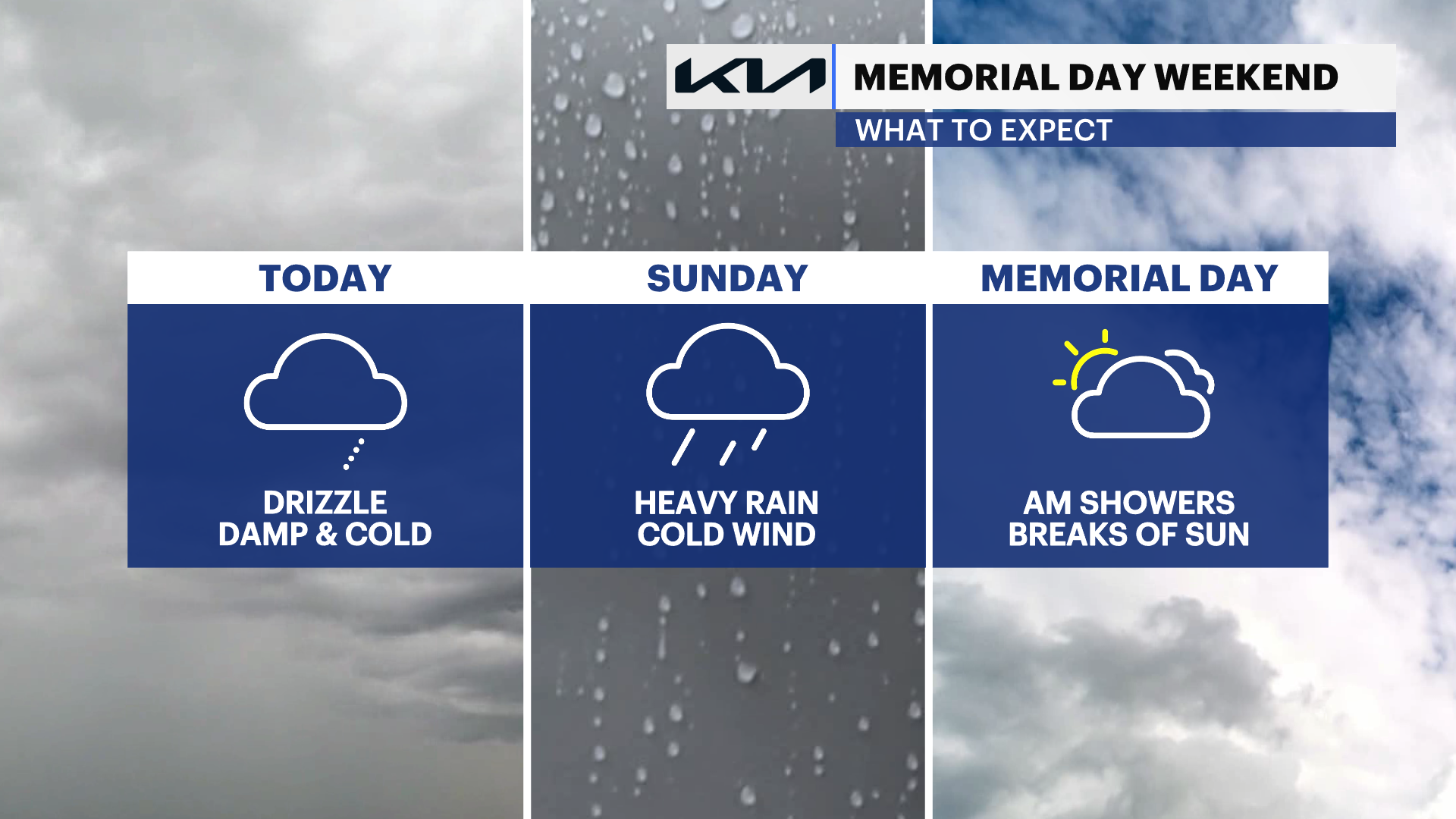
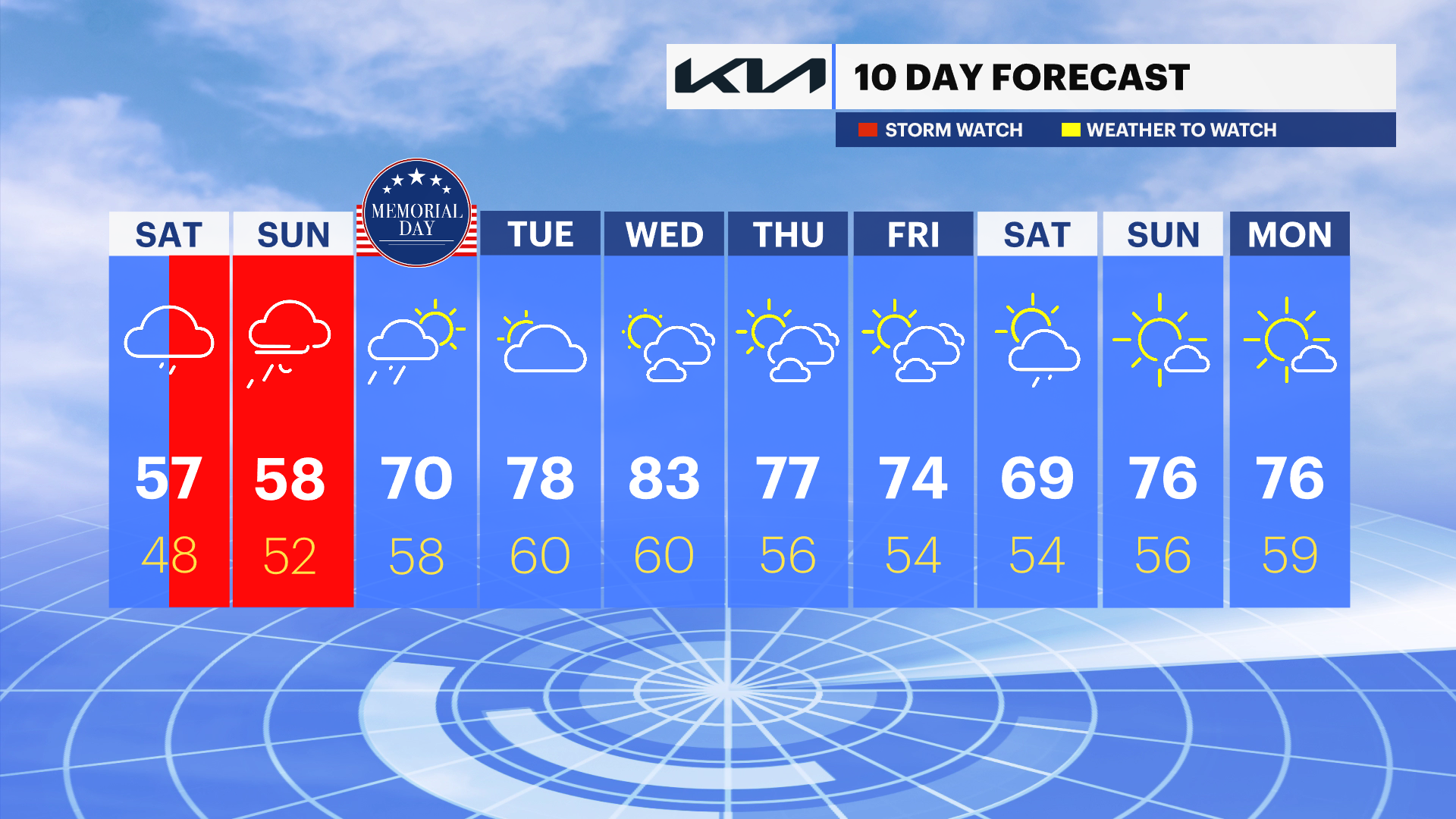
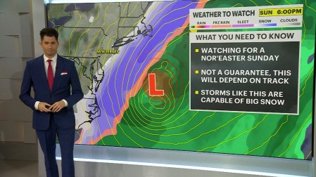
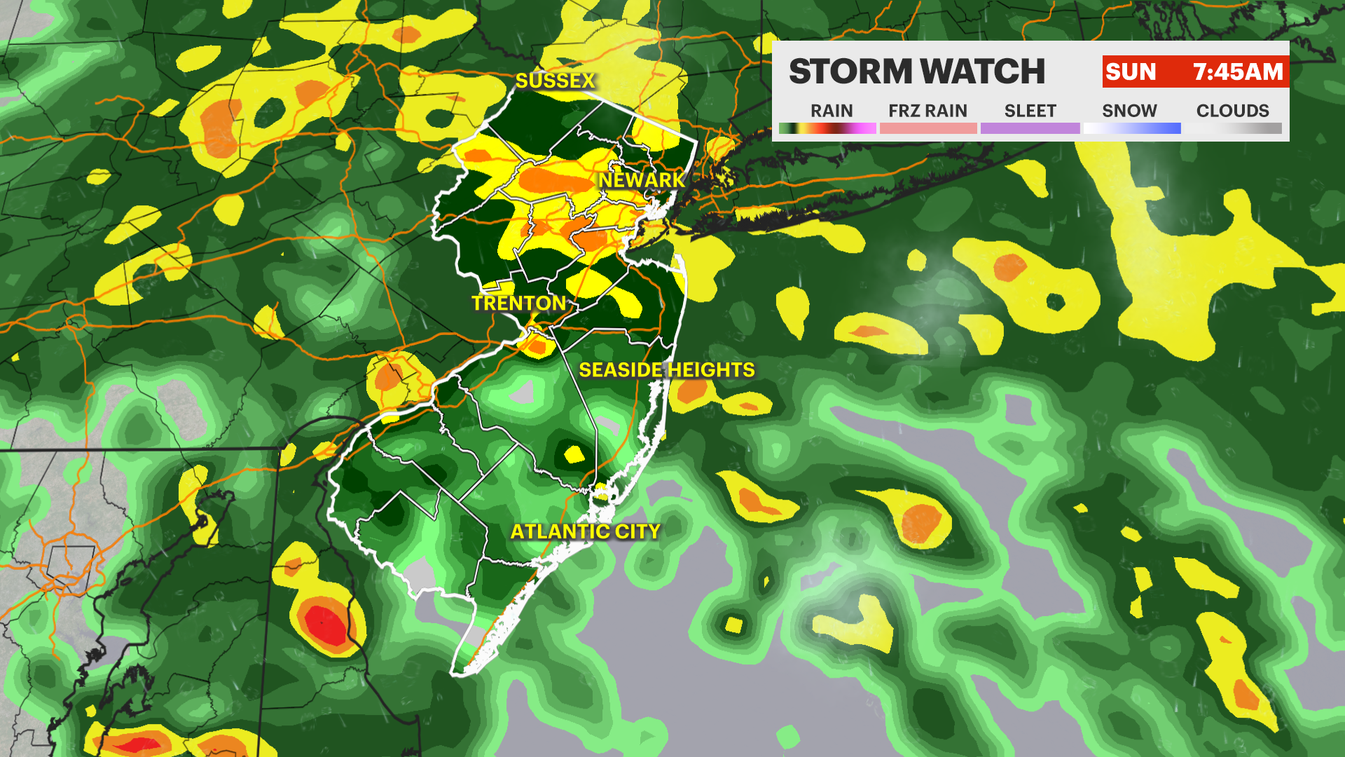
STORM WATCH: Cloudy, cold and wet for most of the Memorial Day weekend
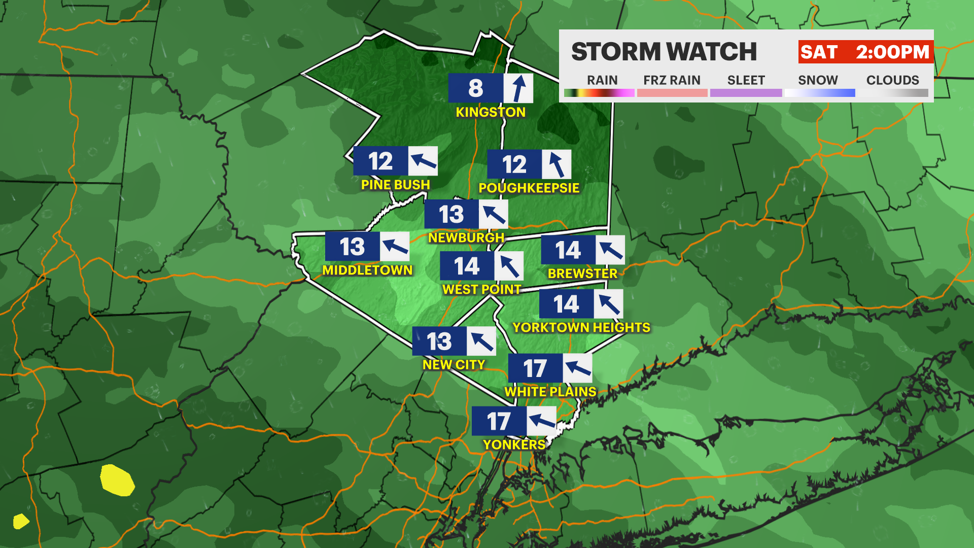
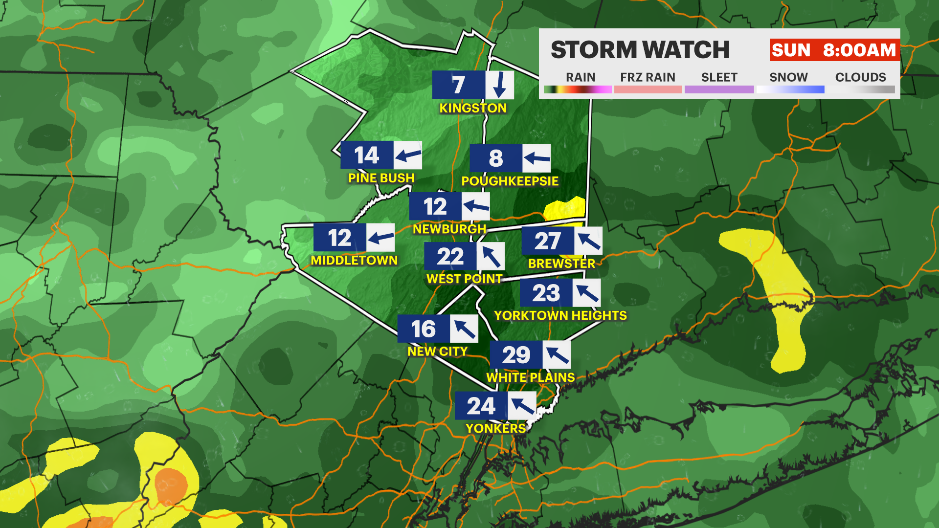
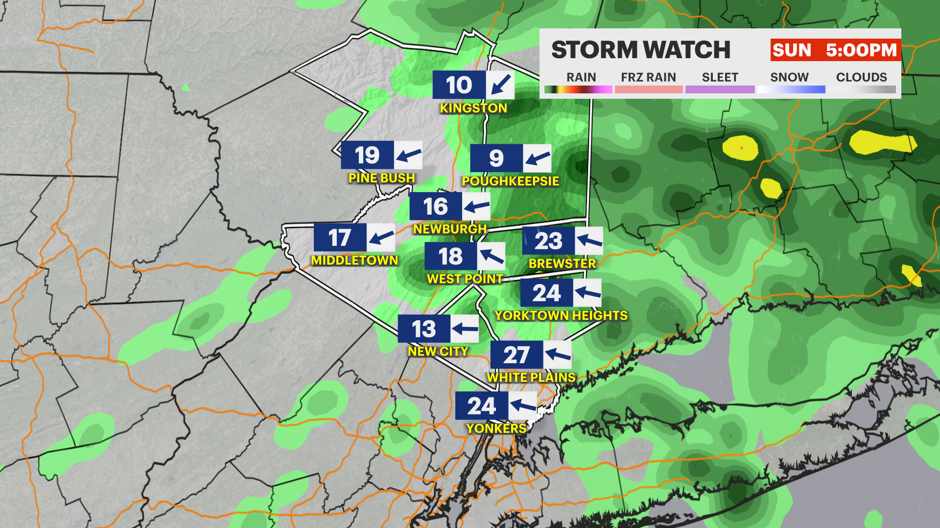
We are on Storm Watch for heavy rain and gusty winds this weekend. The heaviest rain is expected tonight and Sunday.
More Stories


The weather for Memorial Day Weekend will feel more like November than May. Instead of sunshine and warmth, expect cloudy, damp, and unusually cool weather with the heaviest rain setting up tonight through Sunday morning.
Today
Saturday looks gray and chilly with thick cloud cover and rain developing, especially later in the day. Temperatures stay in the upper 50s, which is well below what you would normally expect for late May. A stiff onshore breeze adds to the raw feel, making it a good day for indoor plans or a rain jacket if you head outside
Sunday
The heaviest rain arrives Sunday with heavy rain and gusty wind expected early becoming a light rain with less wind later in the day. High temperautres will struggle to hit 60-degrees.
Memorial Day
Memorial Day brings a slight improvement, but clouds remain the dominant feature. Rain is expected in the morning but will become more scattered later int he day. Temperatures trend warmer, climbing into the upper 70s, but the day still leans more partly to mostly cloudy.
Marine Forecast
Boaters and those near the Hudson River and Long Island Sound should expect a difficult stretch of weather this weekend. A steady easterly wind will strengthen, bringing choppy conditions with waves on the Sound building to around 4 to 6 feet and gusts approaching 30 knots at times. Periods of rain and reduced visibility will make navigation more challenging, especially late Saturday into Sunday, and Small Craft Advisories are in effect. Conditions begin to improve on Memorial Day as winds ease, though some lingering showers and unsettled water may persist early before a gradual calming trend