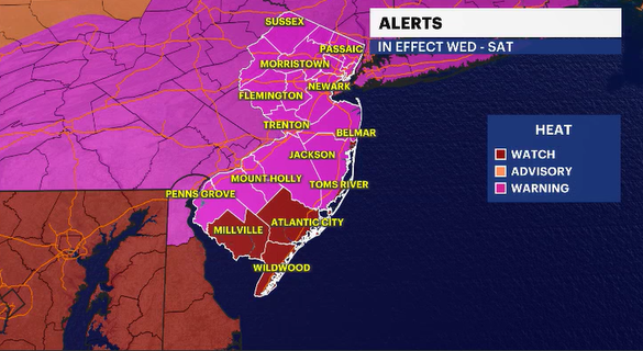
Heat Alert: Intense heat and humidity make for uncomfortable and unhealthy conditions through the holiday weekend
Tomorrow is the beginning of this intense combination of heat and humidity for the Garden State that will last through the weekend. We will also be tracking a few isolated strong to severe thunderstorms.
More Stories


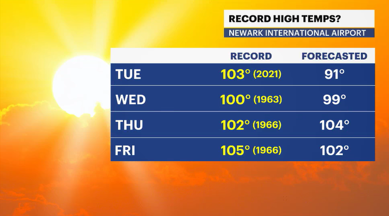
The afternoon high peaked at 91 degrees today, thus starting the expected week-long heat wave. Thursday and Friday will be the hottest days.
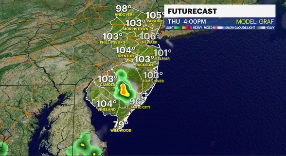
Thursday will be a record smasher. Afternoon highs are expected to peak at 104 degrees. The record is 102 degrees set back in 1966. Friday will remain in the triple digits for daytime highs but likely fall a few degrees shy of the record also set back in 1966 of 105 degrees.
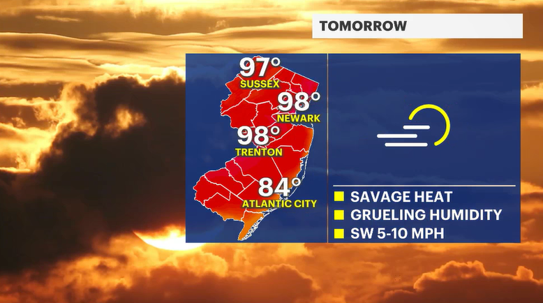
Please be more cautious during this extreme spell of heat. Drink more water. Eat more foods that have a higher water content. Stay away from alcohol and limit caffeine consumption if you are spending any time outdoors. The beach, lake or pool will be the place to be to cool off quickly. Limit your time in the direct sun. Get in the air conditioning as much as possible. In general, just slow it down over the coming days.
As for the storm chances - it is common when it gets this hot to have a few lone storms fire up. Any one storm could potentially become severe, with destructive winds and large hail. It does not look like it is going to be a statewide soaking. Very hit and miss. This 10% to 20% chance of late-day storms is in play through the weekend. Unfortunately, the better opportunity for more areal coverage of wetter, stormier weather looks to occur on Saturday, July 4 itself. We will have to see how the pattern evolves over the coming days.