STORM WATCH: Severe thunderstorms possible across New Jersey into the overnight hours
The main concern is flash flooding and damaging winds.
More Stories


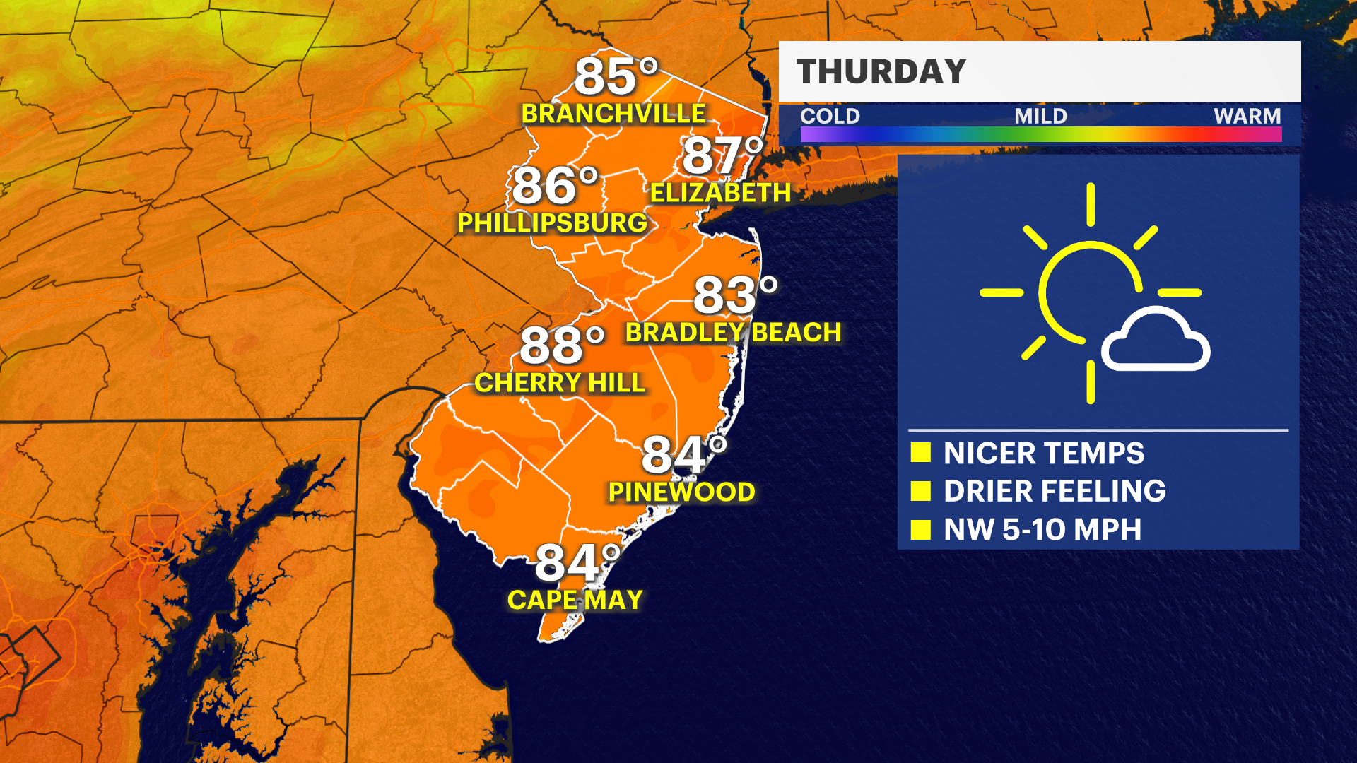
Wednesday was the last excessively hot day in New Jersey for a little bit. We return to the 80s on Thursday.
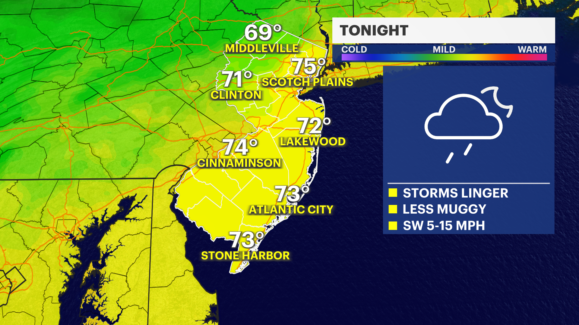
Severe thunderstorms crossed through New Jersey Wednesday afternoon and evening. These storms could linger into part of the early overnight hours.
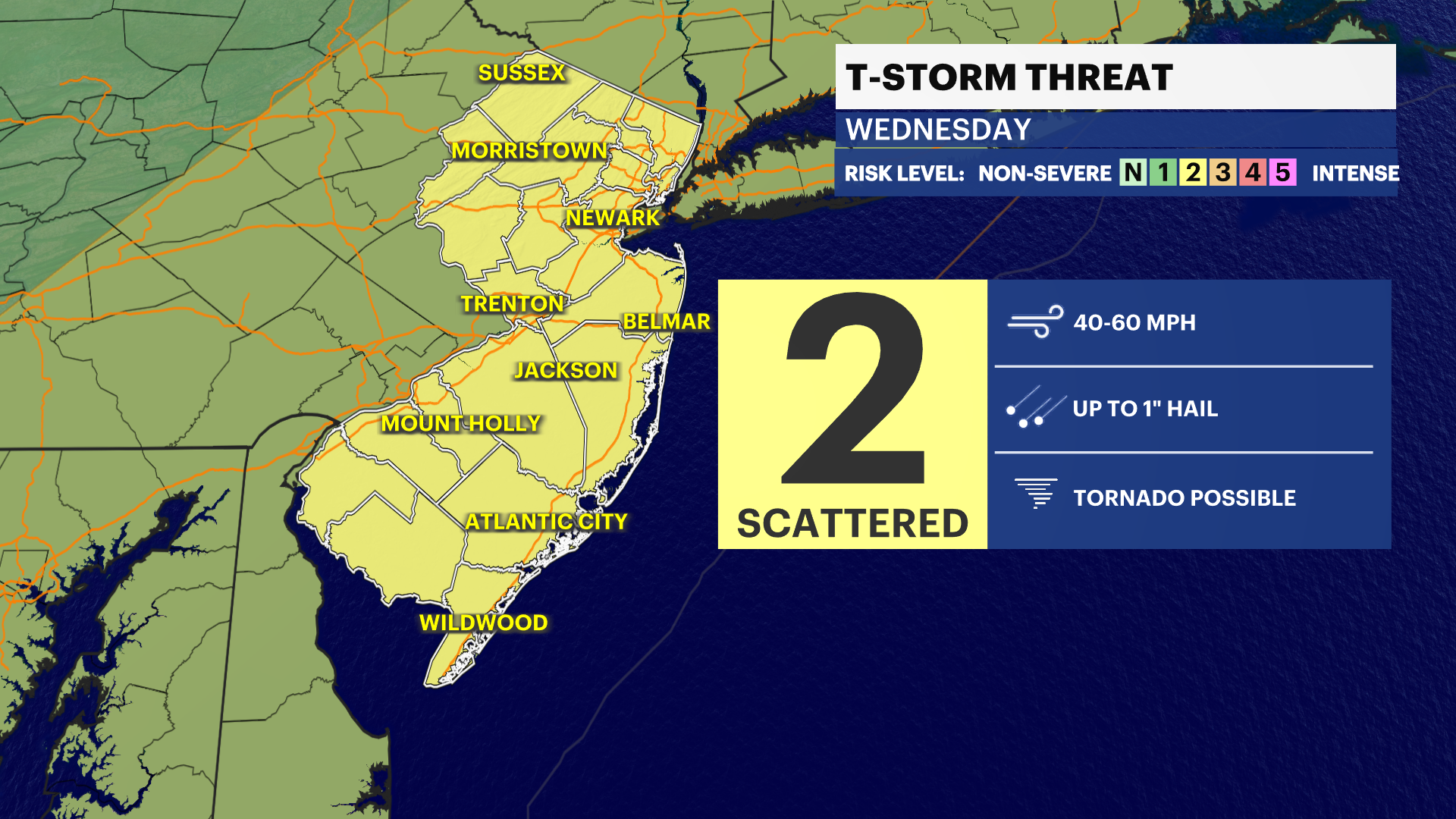
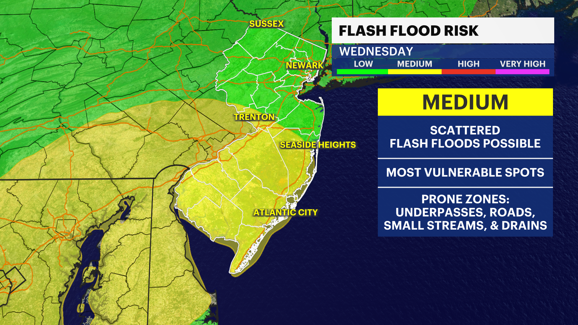
OVERNIGHT: Temperatures stay in the low 70s. We could see strong to severe thunderstorms through parts of the overnight. The main concern is flash flooding and damaging winds. But hail has been seen with some storms so far and the possibility of a tornado is not ruled out.
THURSDAY: Relief, sweet relief! Temperatures are in the upper-80s with lows in the upper-60s! Much better! Sun with some clouds.
MORE: News 12 New Jersey Weather Center
FRIDAY: Highs in the upper-80s, lows in the upper-60s. Mostly sunny!
THE WEEKEND: Looking very nice right now! Highs are in the upper-80s and low-90s, lows are in the low-70s. Looking relatively calm with a mix of sun and clouds on both days.
MONDAY: Highs in the upper-80s, lows in the low0-70s. Sun clouds and rain/storm chance.
TUESDAY: Highs in the mid-80s, lows in the low-70s. Rain chance
WEDNESDAY: Highs in the mid-80s, lows in the upper-60s. Rain chance as well!


