Morning showers exit before sunny and breezy Monday afternoon in New Jersey
New Jersey will see morning showers exit before sunny and breezy arrive for the rest of Monday.
More Stories


WHAT YOU NEED TO KNOW:
Sunday night's showers will linger into early Monday morning. This slow-moving system will eventually give way to a sharp cold front later Monday, ushering in a noticeable drop in temperatures.
Rainfall amounts should remain modest, with most communities seeing no more than a quarter inch once the system exits.
Temperatures on Monday will peak during the morning hours before steadily falling through the afternoon. Expect a brisk breeze to develop, adding a wind chill factor late Monday and into Tuesday.
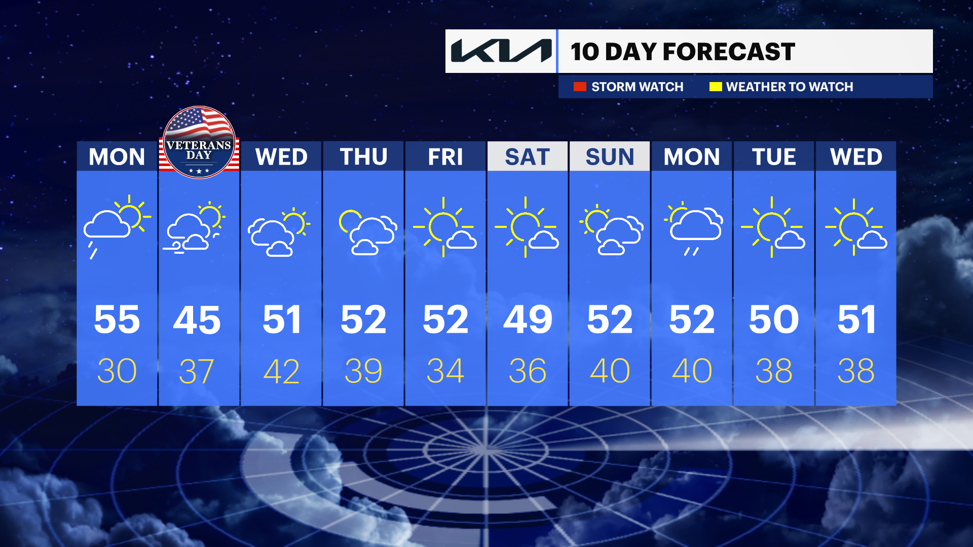
The chill will be felt throughout the week, with temperatures trending colder overall.
Veterans Day will be particularly brisk, with highs struggling to climb out of the mid-40s. While the week ahead looks predominantly dry, it will feel significantly colder, so be sure to bundle up.

FORECAST
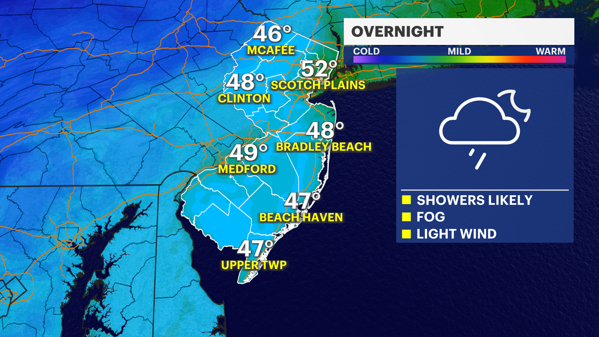
OVERNIGHT: Colder with showers and patchy Fog. Low of 50.
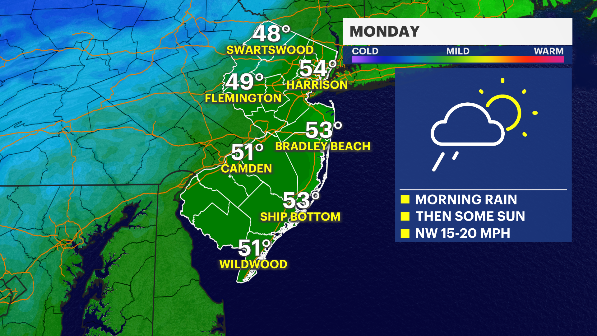
MONDAY: Early rain and clouds, then partly sunny and breezy afternoon. High of 52.
TUESDAY: Mostly sunny, breezy and cold. High of 45.
WEDNESDAY: Partly sunny. High of 52.
THURSDAY: Mostly cloudy. High of 51.