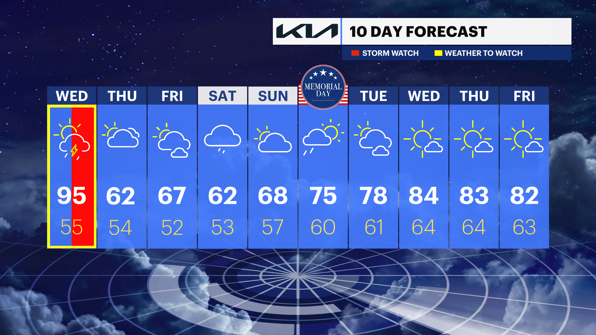
HEAT ALERT: One more day of extreme heat before thunderstorms bring relief
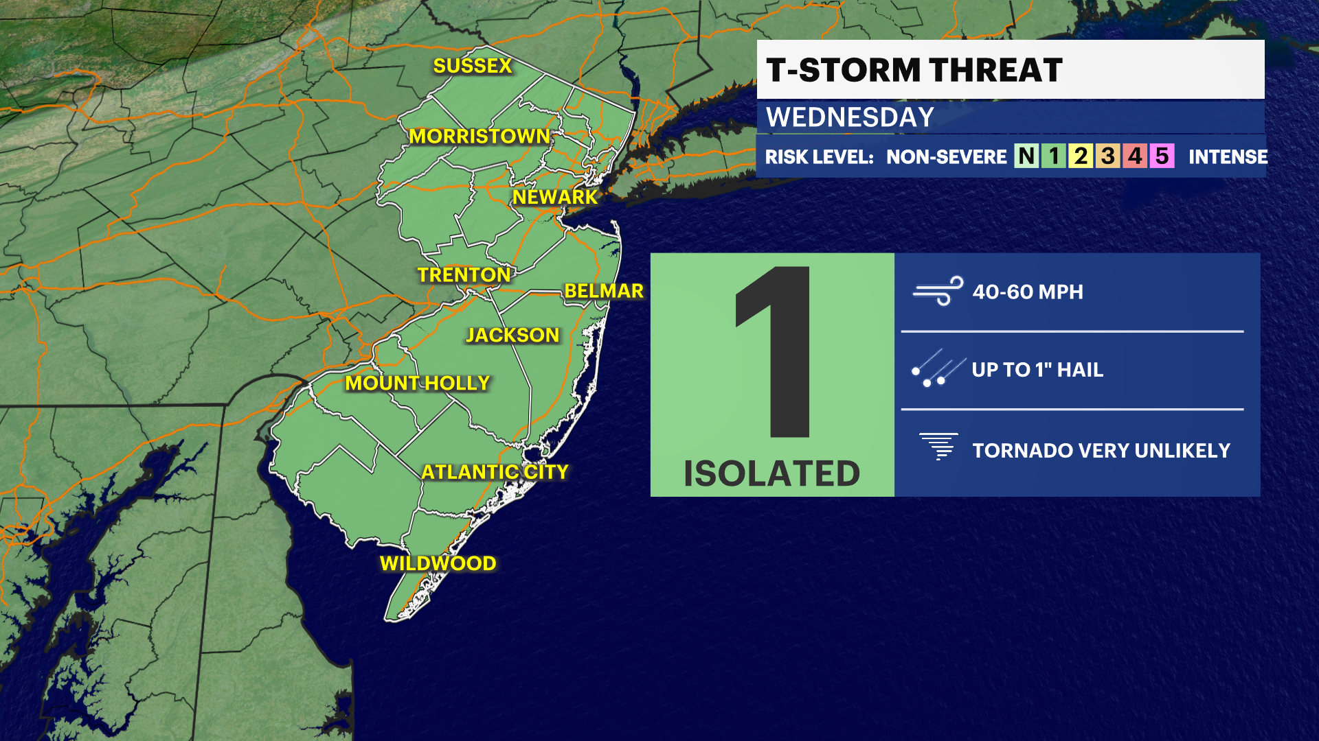
Thunderstorms that develop tomorrow could have gusty winds and hail, stay weather aware in the afternoon and evening
More Stories


It's official, it's a heat wave for parts of New Jersey. Newark Liberty International Airport, Newark's climate site, reported a high of 99 degrees today. That's a new temperature record for the day and also the third day in a row of 90 degrees or higher. The heat advisory continues for one more day.
New Jersey Weather Alerts
Temperatures will stay elevated again for tonight. There won't be much relief heading into Wednesday morning. The air quality remains poor as well.
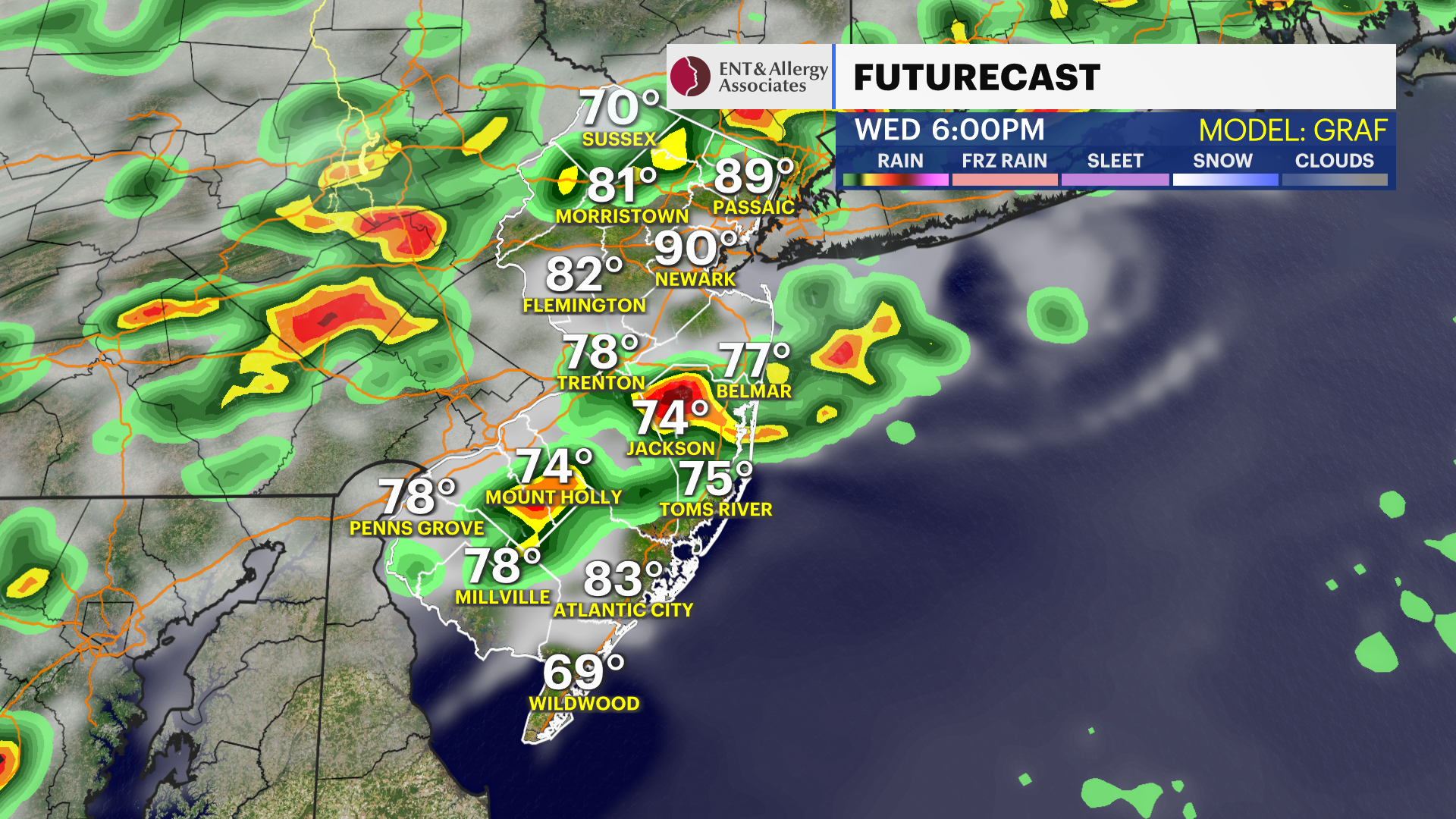
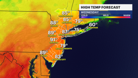
Temperatures will once again climb into the 90s for the afternoon, but this time around, they will start to fall as thunderstorms pop up in the afternoon. They will become more widespread in the early evening and bring some localized heavy rain along with lightning. Stay weather-aware and make sure you have shelter to run to if you plan on being outdoors.
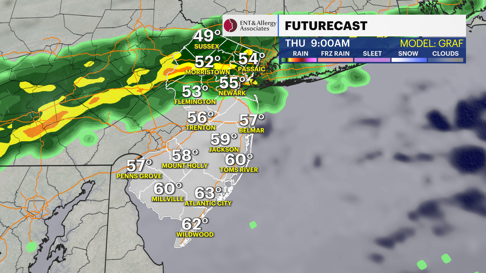
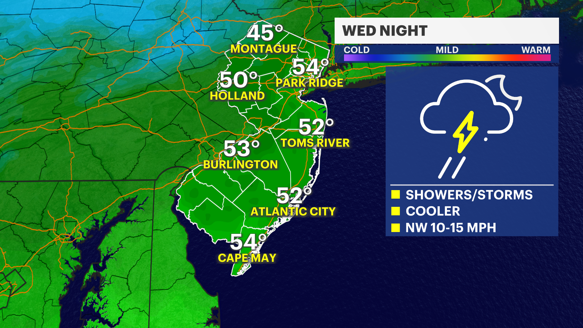
Temperatures will fall back into the 50s on Wednesday night. The rain will likely linger for parts of the state into Thursday. The rest of the week will feature cooler temperatures with highs in the 60s. Rain will start up again on Saturday and continue on and off through Memorial Day.
Stay with News 12 New Jersey for more on the Memorial Day weekend.