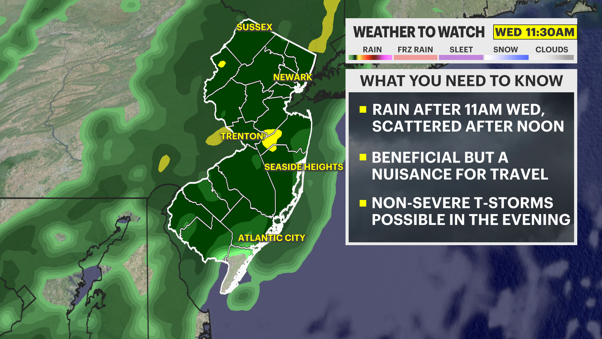
Midweek 'interruption' of weather douses New Jersey with beneficial rain after 11 a.m. on Wednesday
Rain is expected to be good for the dry environment, but a nuisance for travel.
Share:
More Stories
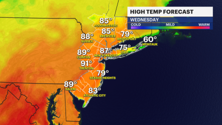


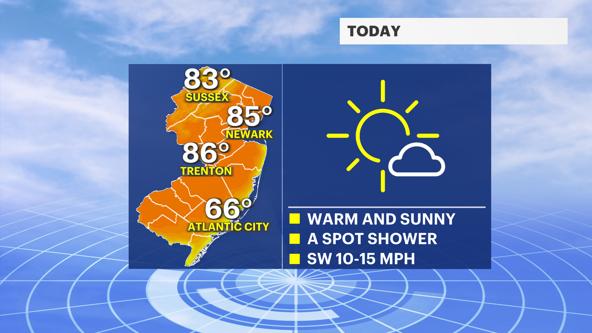
It's nice today with highs in the mid-80s for this afternoon. It remains mostly sunny all day with a possibility for a rogue, unplanned pop up shower northwest toward sunset. Clouds build overnight tonight ahead of the arrival of a front for tomorrow,
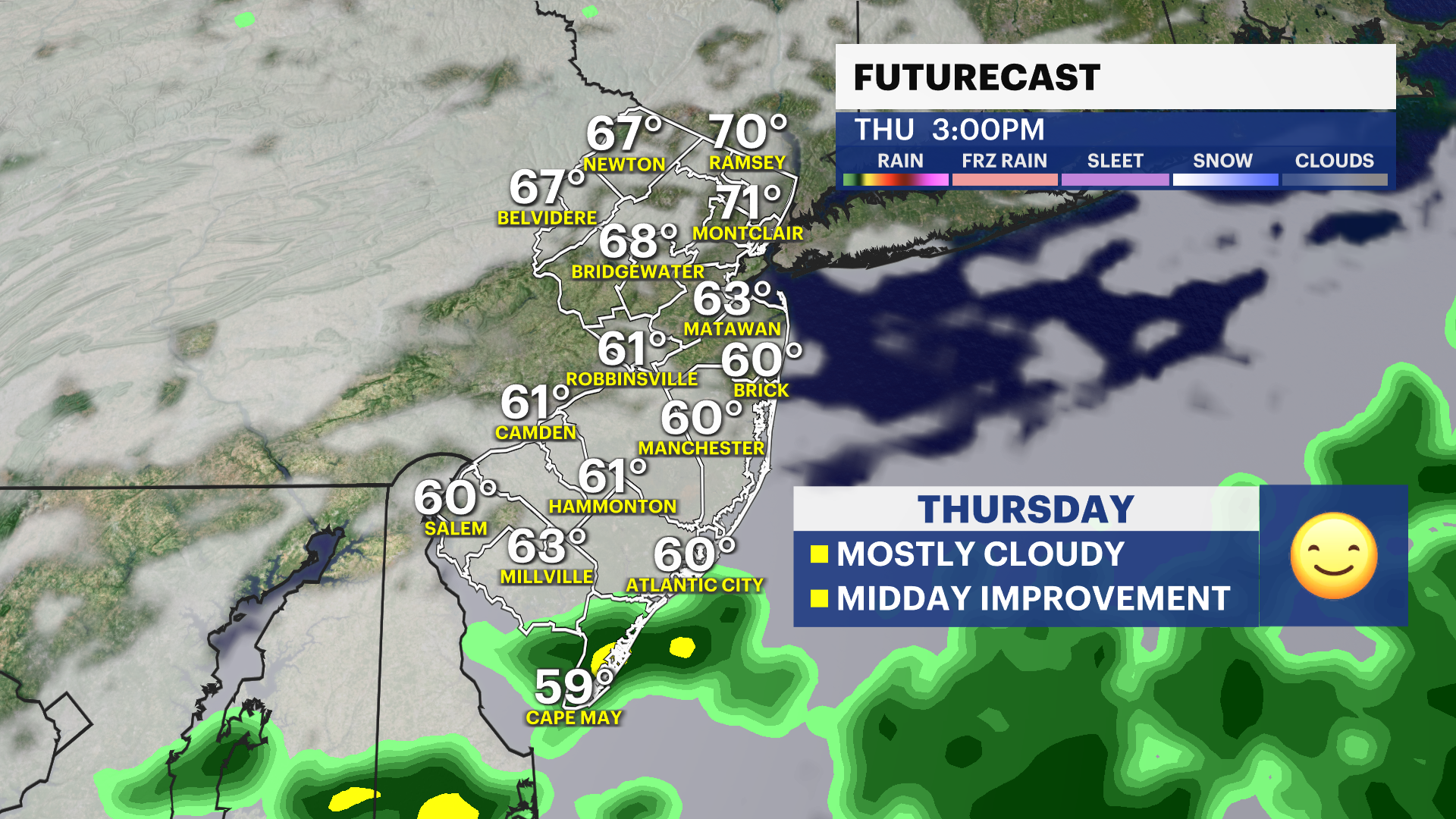
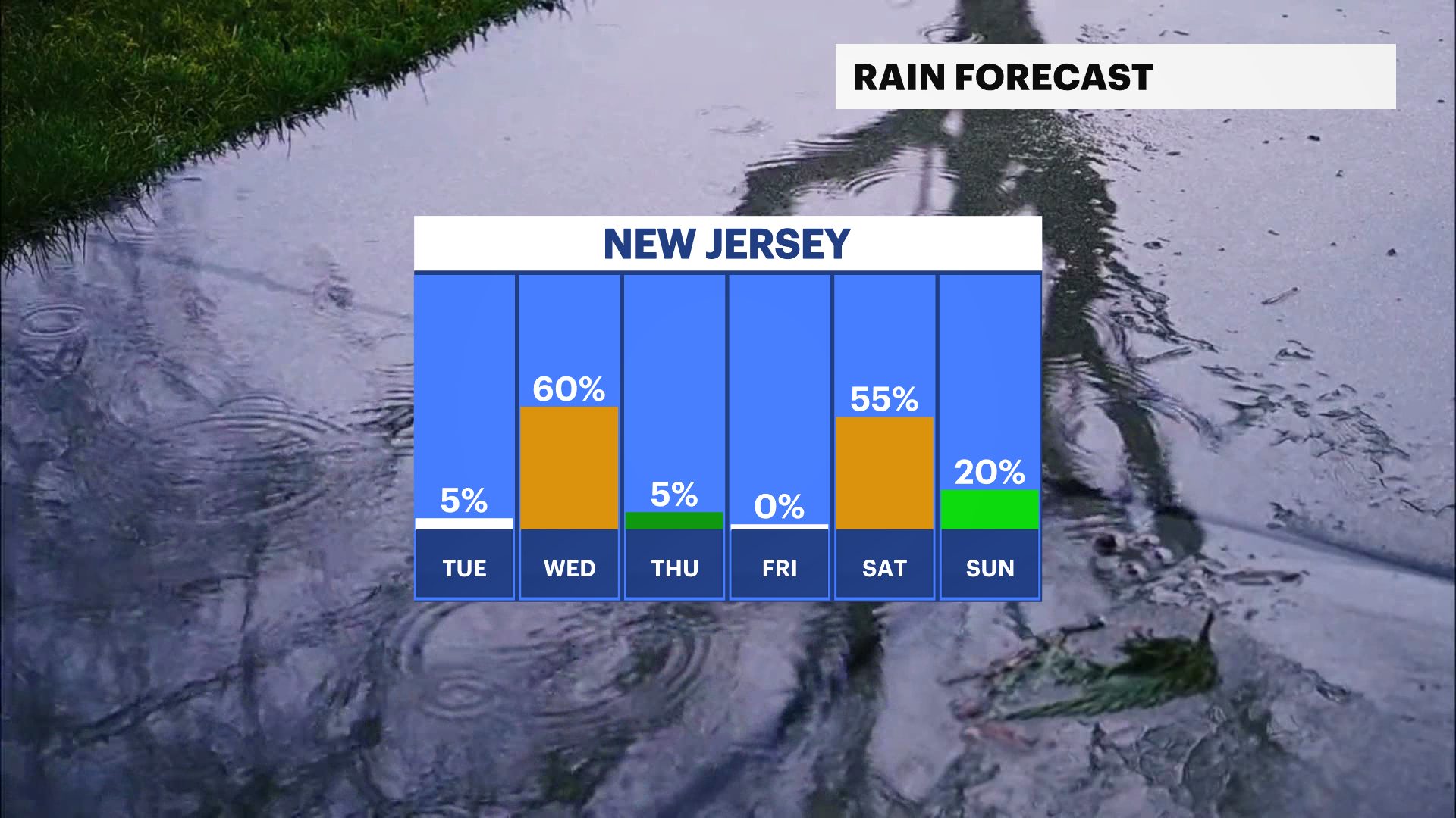
Tomorrow's rain will start in the late morning, but then it will be mostly scattered for the afternoon. It will be soggy through the day, and a nuisance to travel in. There isn't an expectation for severe weather, but a few thunderstorms are possible. Rain showers linger into Thursday morning, but only near sunrise. Conditions improve Thursday afternoon.
Friday is mostly cloudy and pleasant. Showers are likely again sometime on Saturday. Sunday looks fair.