Rain wraps up to a weekend warmup!
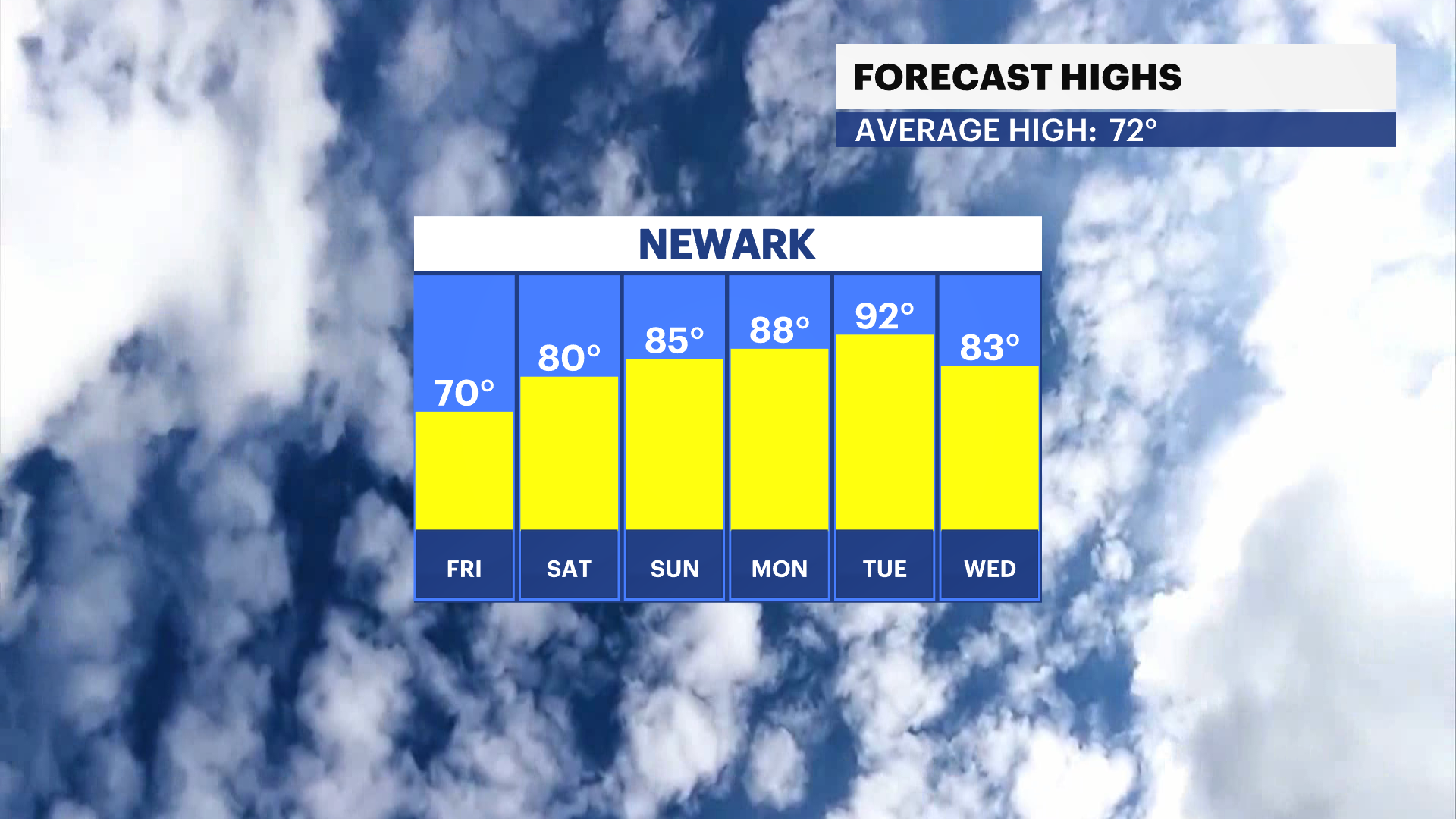
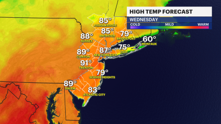
Highs jump into the 80s for the weekend and reach 90 by Tuesday.
Share:
More Stories


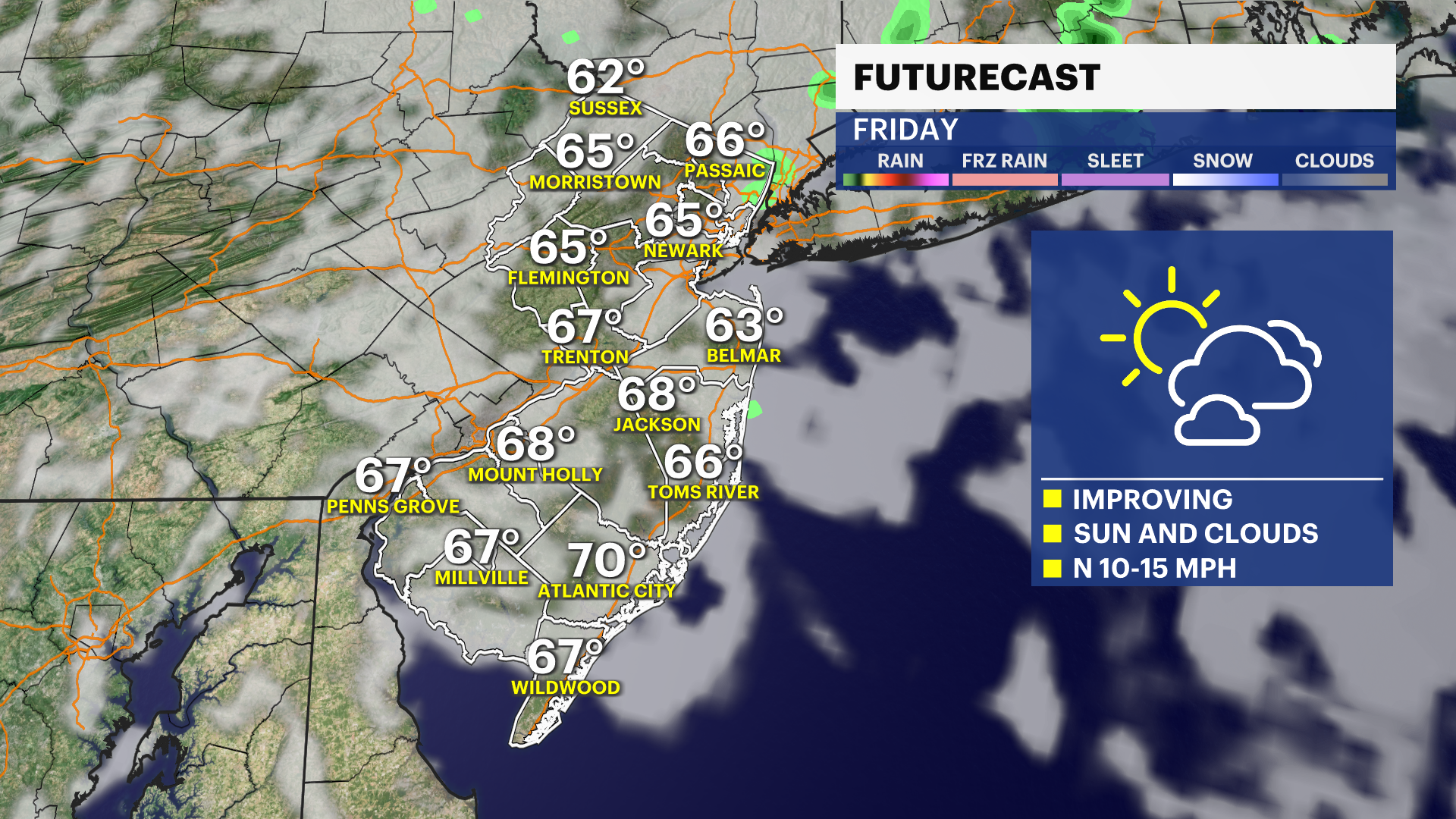
Rain showers arrived overnight and a few pass this morning. Conditions improve midday with breaks of sun where many clouds linger. Clouds improve by the afternoon. Highs will be in the upper 60s, and in some places near 70.
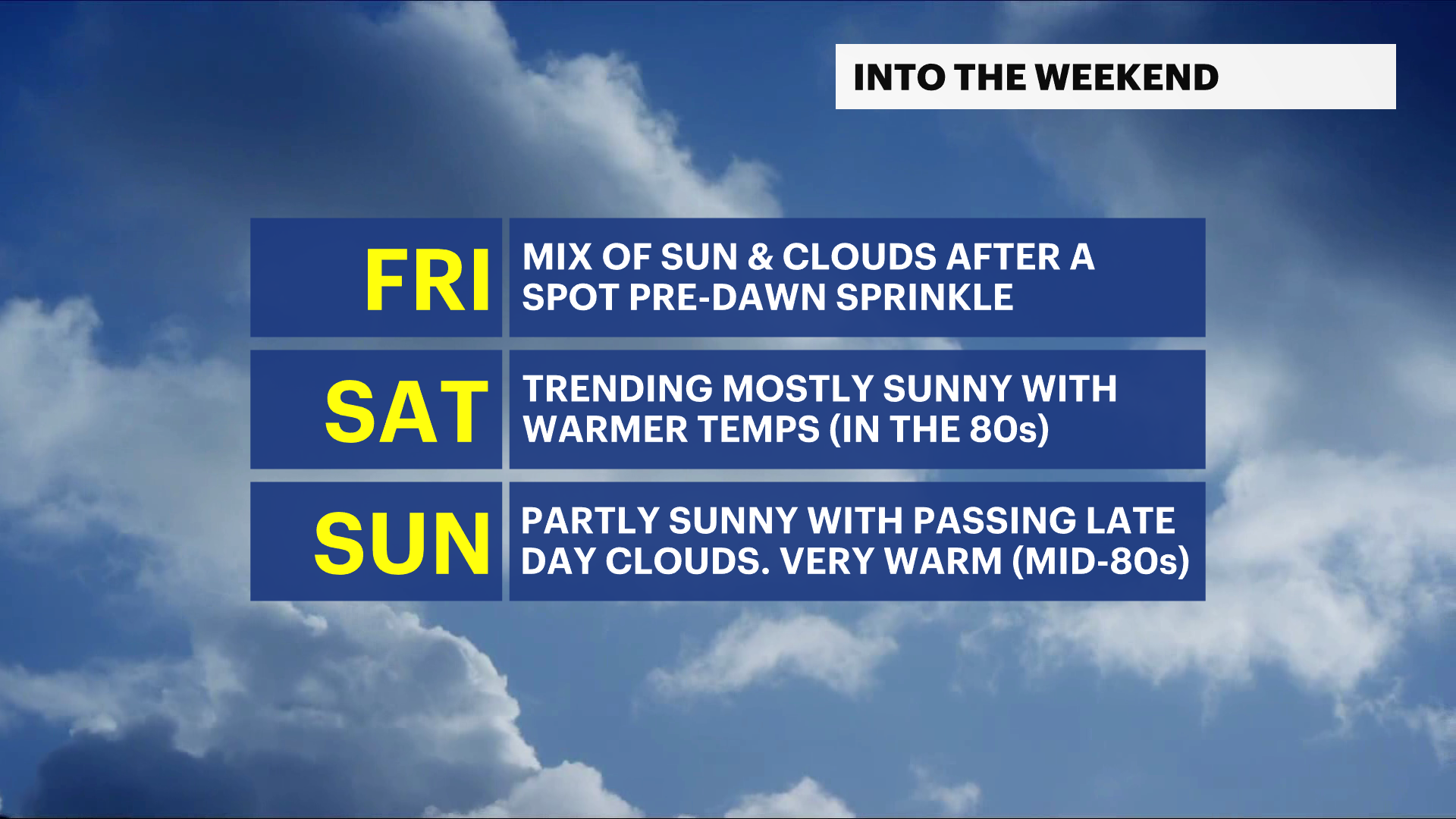
A spot sprinkle lingers for Friday morning before improving again for the midday. Highs will be near 70 with sun and clouds for the midafternoon.
Heat arrives for the weekend with a mostly sunny sky for Saturday. Highs reach nearly 80 degrees. Sunday's weather is hotter with highs near 85 but a partly sunny sky. Clouds pass for the late day. Monday and Tuesday will be the hottest days with highs reaching near 90 degrees. Showers are possible late on Tuesday as a result of the higher temperatures and some humidity.