Sunny and warm Sunday for New Jersey
Make sure those fans and air conditioners are working into next week.
More Stories


WHAT TO KNOW
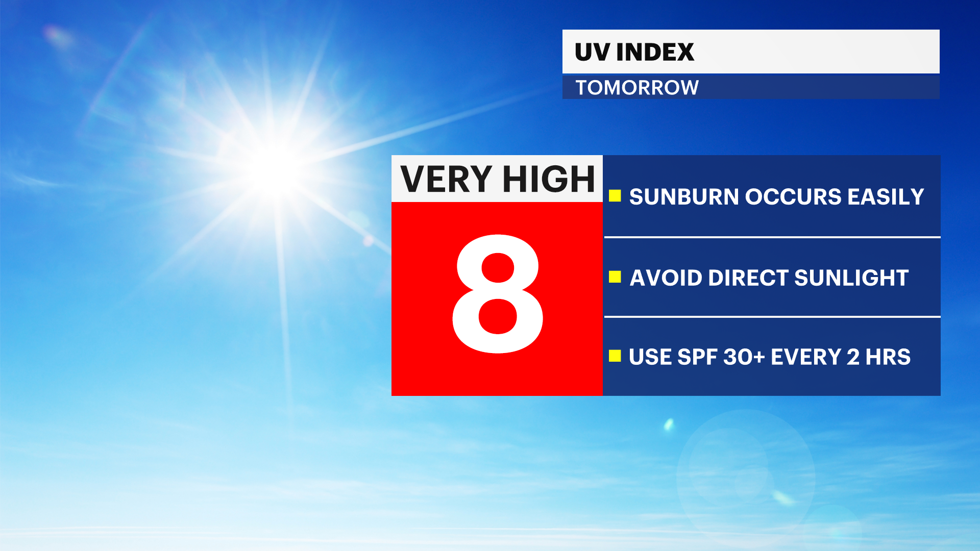
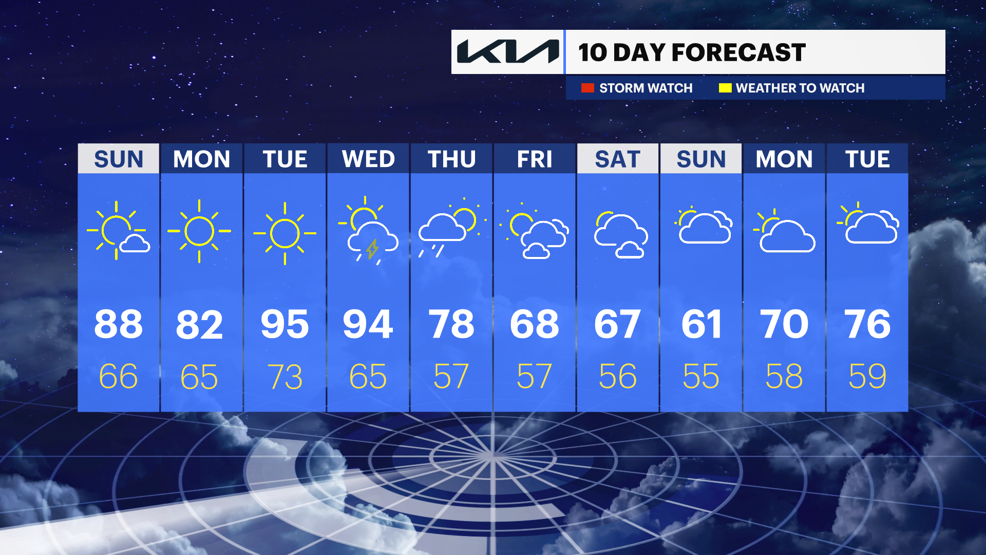
The UV Index will rise to level 8, which can cause skin damage and sunburn. It is important to wear sunscreen to protect your skin when outdoors this weekend. The sun will be strongest between 11 a.m. and 3 p.m. High temperatures push to the 80s and 90s for inland areas in New Jersey. Shore points will be cooler, with temperatures in the 60s and 70s because the ocean water temperature is in the low to mid-50s. Swimming is not recommended as the water temperature is dangerous and can cause hypothermia.
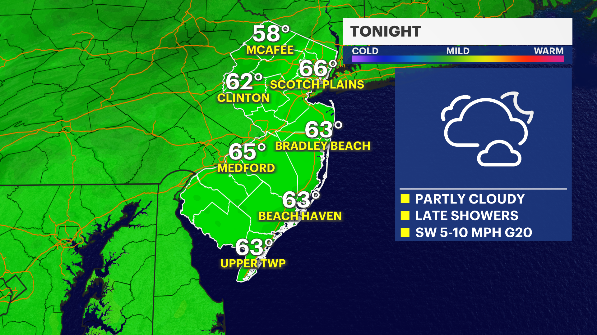
Clouds will roll through late overnight into early Sunday. There is a chance of seeing a light shower. Most of New Jersey will stay completely dry and the sun will return on Sunday. Sunday will feature extra clouds in comparison, but temperatures will get hotter.
The next chance for rain is Wednesday of next week. There is a risk of thunderstorms as a cold front brings relief, with cooler temperatures for the end of the week and next weekend.