Flooding remains a concern overnight: cloudy Tuesday ahead
Tides will be running about 2-3 feet above normal along the coast during the time of high tide tonight.
More Stories
The flooding along New Jersey rivers will continue to slowly recede this evening, dropping to the actionable stage. This means nuisance flooding will continue.
Tides will be running about 2-3 feet above normal along the coast during the time of high tide tonight around 9 p.m. or 9:30 p.m. Saltwater inundation will cover roads and some low-lying streets could be covered.
TONIGHT: Clouds will slowly begin to show up. Temperatures will drop into the low-30s.
MORE: News 12 New Jersey Weather Center
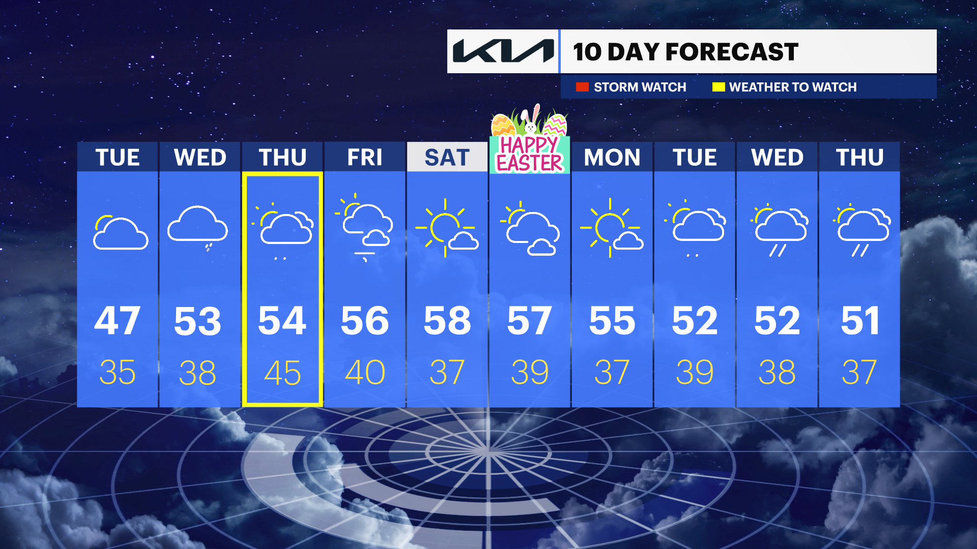
TUESDAY: Clouds return. On-shore winds will continue to push ocean water along the coast and into the back bays. Keep an eye on your local tide charts.
WEDNESDAY: Overcast skies could shake out a few showers. Temperatures are in the low-50s.
THURSDAY: On-and-off showers. Temperatures are still slightly chilly in the low-50s.
FRIDAY INTO THE WEEKEND: Drier, sunnier and warmer. Highs in the upper-50s.


