Shower chance overnight; warm Friday ahead of Sunday rain and cooler weather
It continues to be mild overnight with more clouds, patchy fog and a rain shower chance into Friday.
More Stories
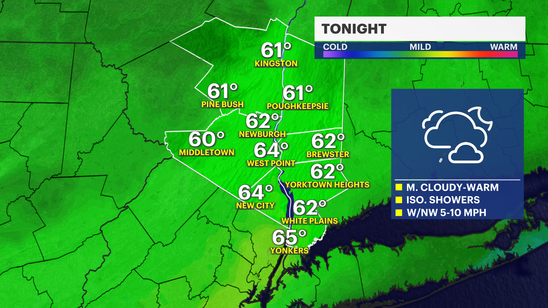

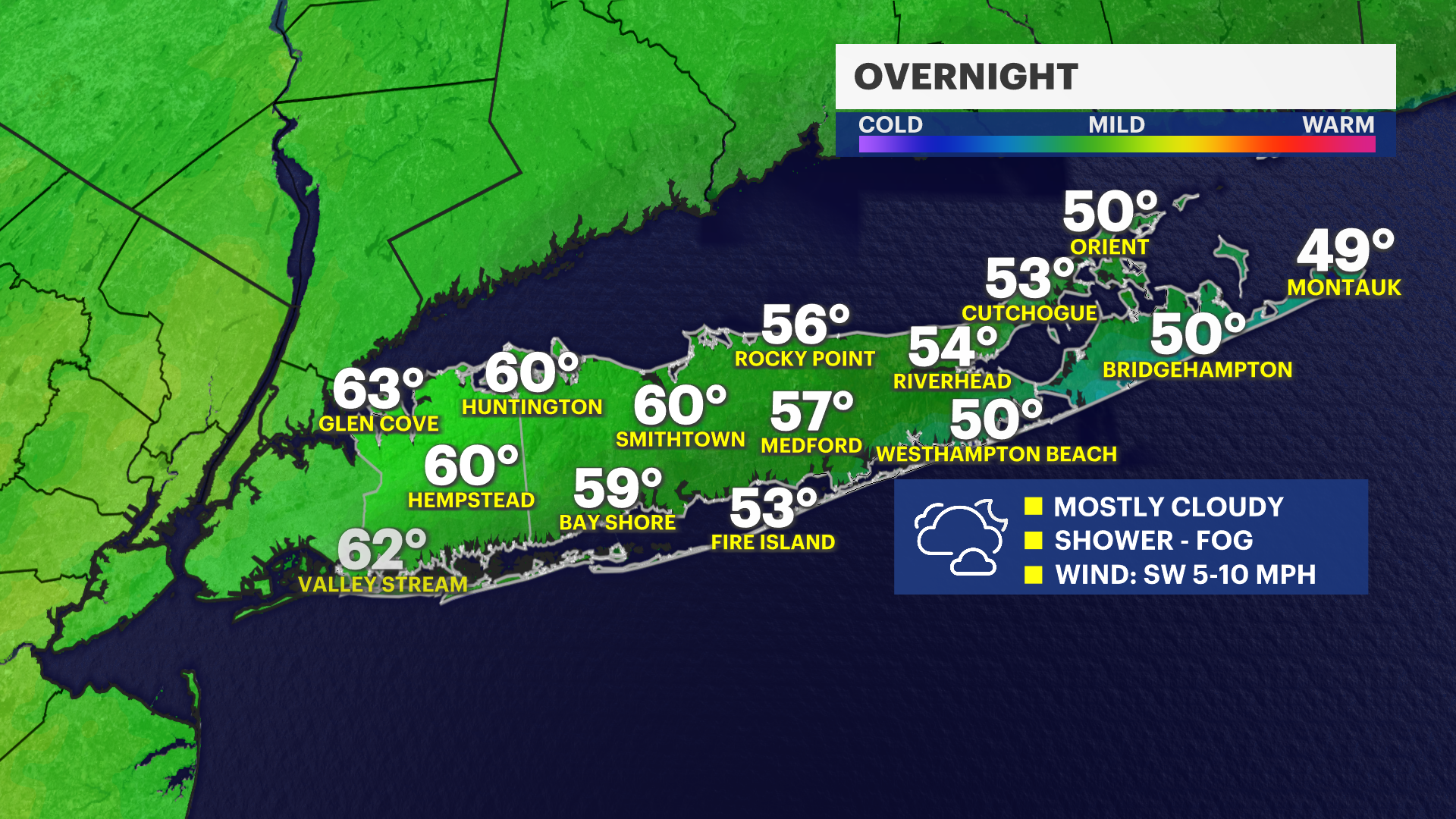
OVERNIGHT
Overnight lows will mostly be in the 50s to lower 60s with a mainly cloudy sky, some patchy fog and a brief passing rain shower chance from time to time. Parts of the East End will drop down into the 40s.
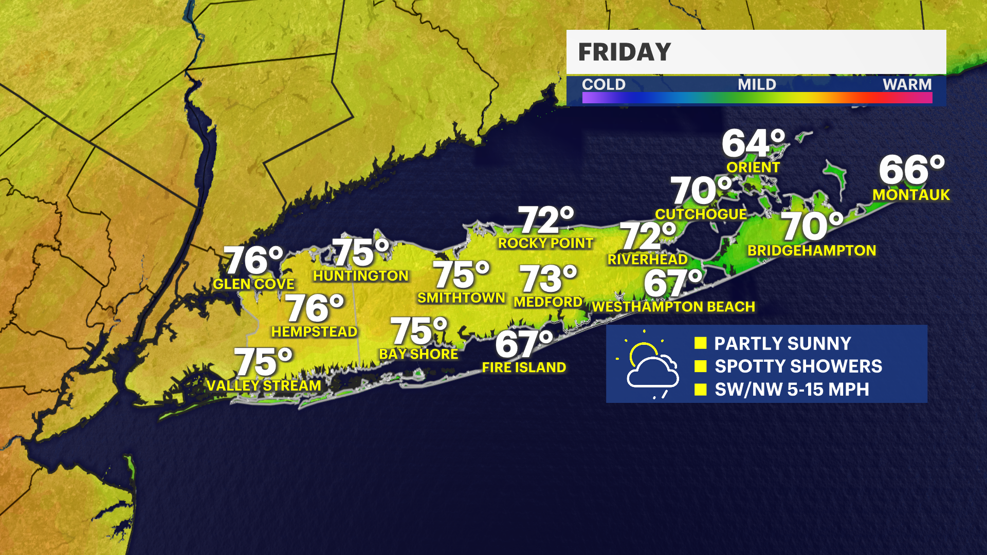
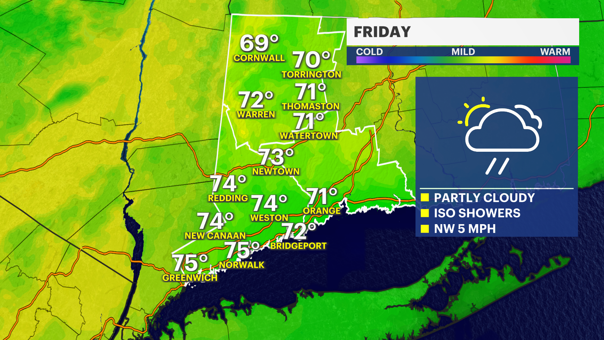
WARM WEATHER CONTINUES FRIDAY
It will be another much warmer-than-average day on Friday, but not as hot with temperatures mostly in the lower to middle 70s. It will be in the 60s at the beaches. There will also be a spotty shower and downpour chance in the afternoon and evening, but any rain will be short-lived and isolated. Much of the day is dry with more clouds than sun at times.
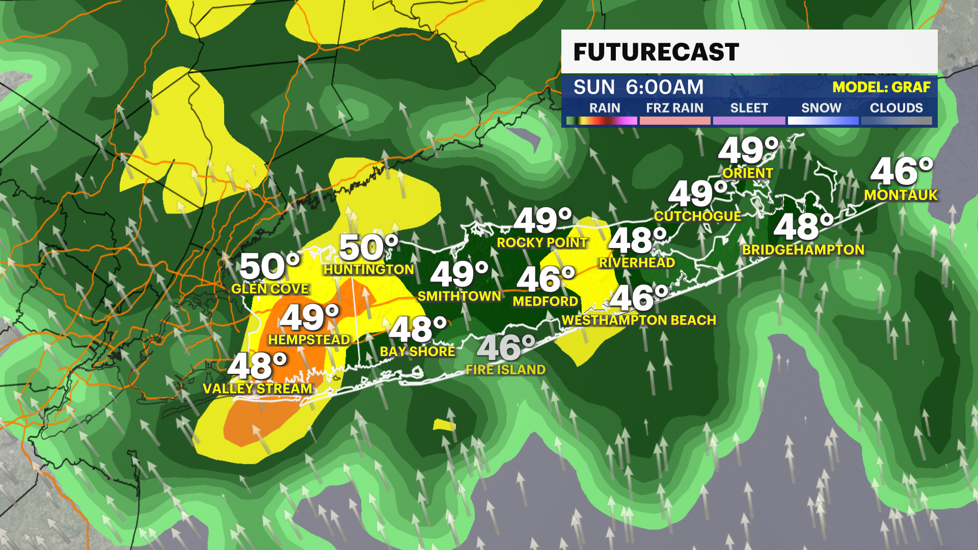
CHANGES ARRIVE THIS WEEKEND
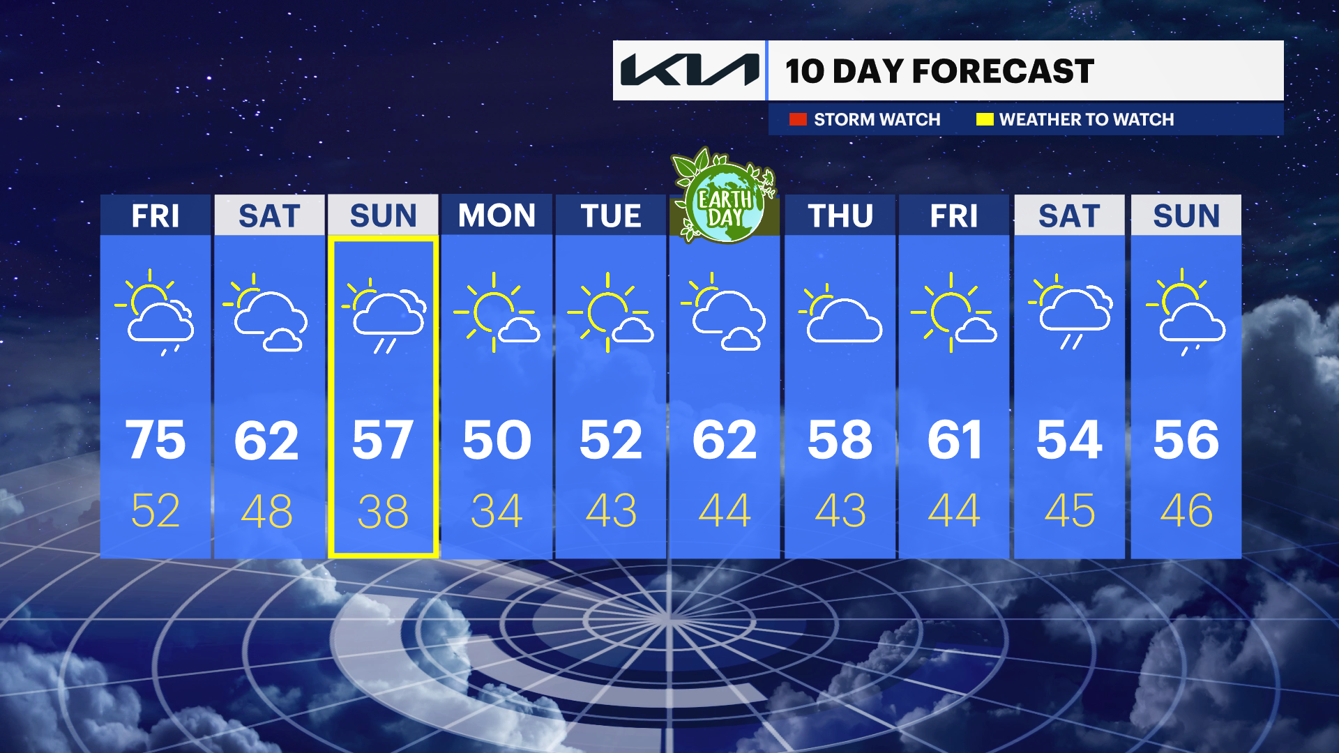
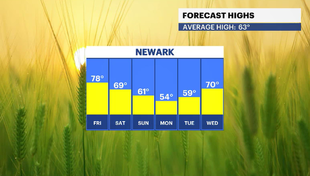
Much cooler air arrives over the weekend and into next week. Saturday will be more seasonable with high temperatures in the upper 50s to lower 60s under a partly sunny sky. Highs will be down into the 50s on Sunday, and there will finally be a chance of much-needed rain. Expect periods of moderate rain off and on through the day. Around half an inch to one inch of rain is possible.
After the weekend, we return to drier weather for most of next week, but also even cooler air. Highs will be in the upper 40s to lower 50s on Monday and Tuesday, with even some frost possible - mostly Monday night into Tuesday morning.
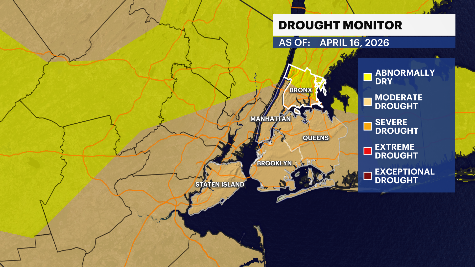
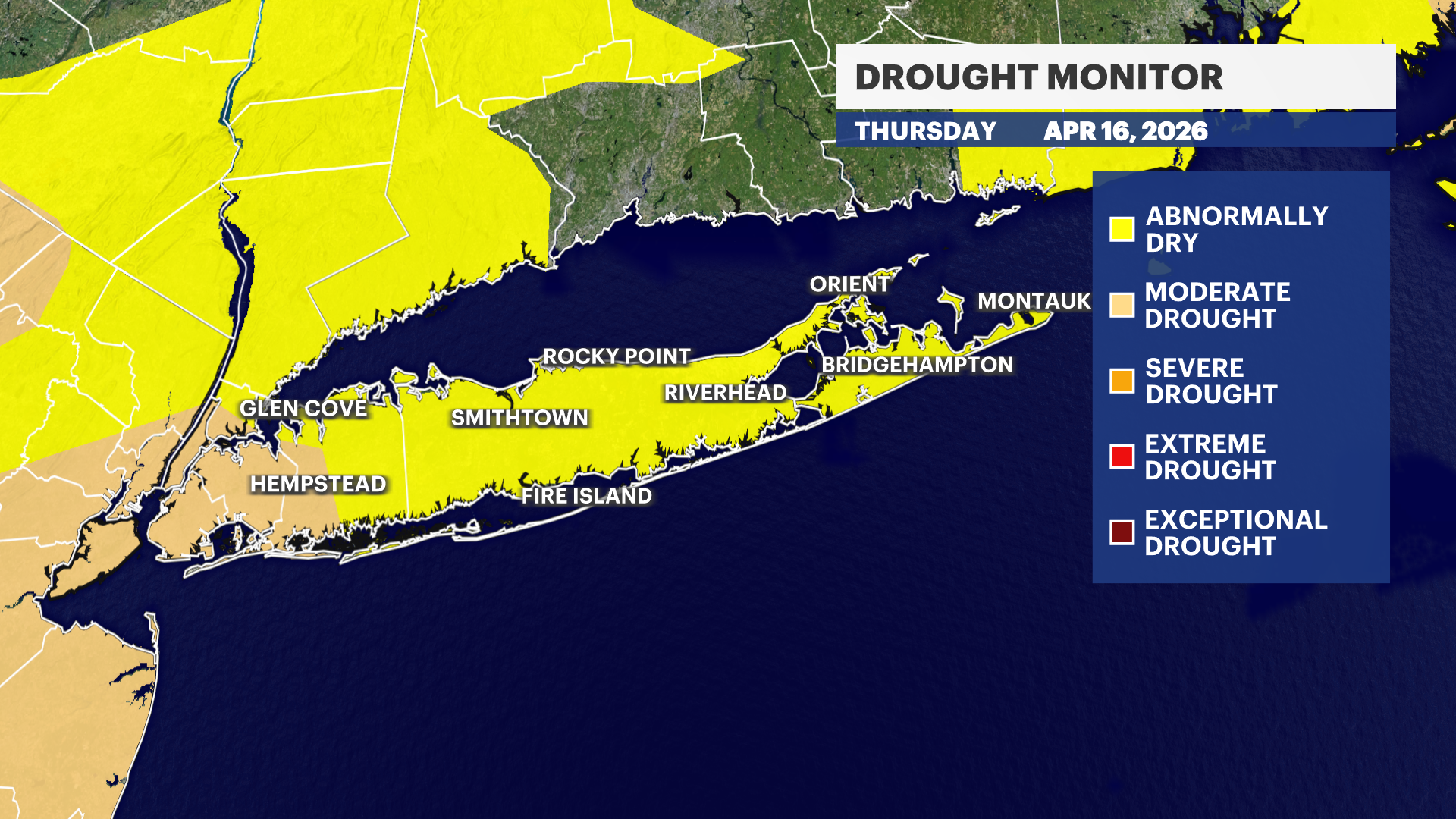
DROUGHT MONITOR UPDATE
Parts of Nassau County are officially in a moderate drought as of Thursday's drought monitor update. While the dry weather is great for outdoor activities, Long Island does need more rain. If not, the drought conditions will likely worsen, despite the rain on Sunday.
POLLEN LEVELS
Tree pollen levels continue to be very high and you are probably noticing that you are experiencing plenty of seasonal allergy symptoms. Sunday's rain should temporarily help with pollen before the dry weather returns for most of next week.
DAILY FORECAST
OVERNIGHT: Mainly cloudy with a passing shower and areas of patchy fog. Lows will be in the lower 60s in most of Nassau County and mostly in the 50s throughout Suffolk County.
FRIDAY: Partly sunny with a few spotty showers and even an isolated brief downpour in the afternoon. Much of the day will be dry. Highs will be in the lower to middle 70s for most of Long Island and in the 60s along the South Shore and East End. Lows near 52 degrees.
SATURDAY: BETTER HALF OF WEEKEND -- Partly sunny. Highs around 62 degrees. Lows near 48 degrees.
SUNDAY: PERIODS OF RAIN - Mostly cloudy with periods of moderate rain. Highs around 57 degrees. Lows near 38 degrees.
MONDAY: MUCH COOLER - Mostly sunny and chilly at times with highs around 50 degrees. Lows - colder - around 34 degrees.
TUESDAY: STILL COOL - Mostly sunny to partly cloudy with highs around 52 degrees. Lows near 43 degrees.
WEDNESDAY: EARTH DAY -- Partly sunny with highs around 62 degrees. Lows near 44 degrees.
THURSDAY: Mostly cloudy with highs around 58 degrees. Lows near 43 degrees.