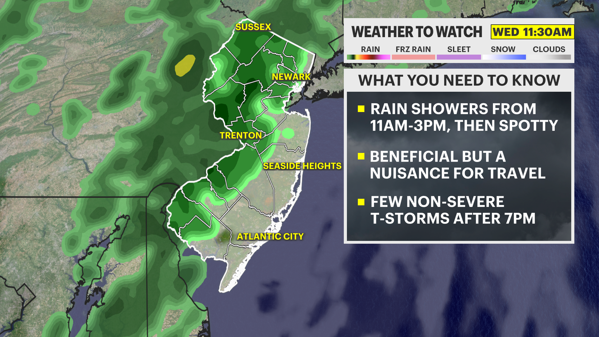
A somewhat rainy and damp midday is expected with a round of non-severe thunderstorms tonight.
The rain is beneficial to the dry environment but a nuisance for travel.
More Stories
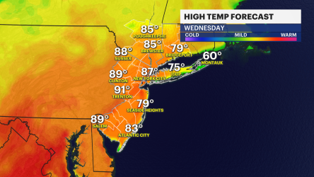


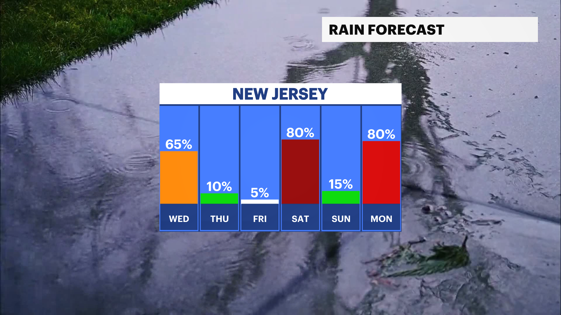
Showers are expected to pass through the state today after 11am and last through the afternoon. Rain will be on and off after the initial steady batch. A round of weak thunderstorms is on the way for the evening near 7-9pm. These storms are not expected to be severe, but a quick burst of rain is likely. Temperatures reach a high of nearly 70.
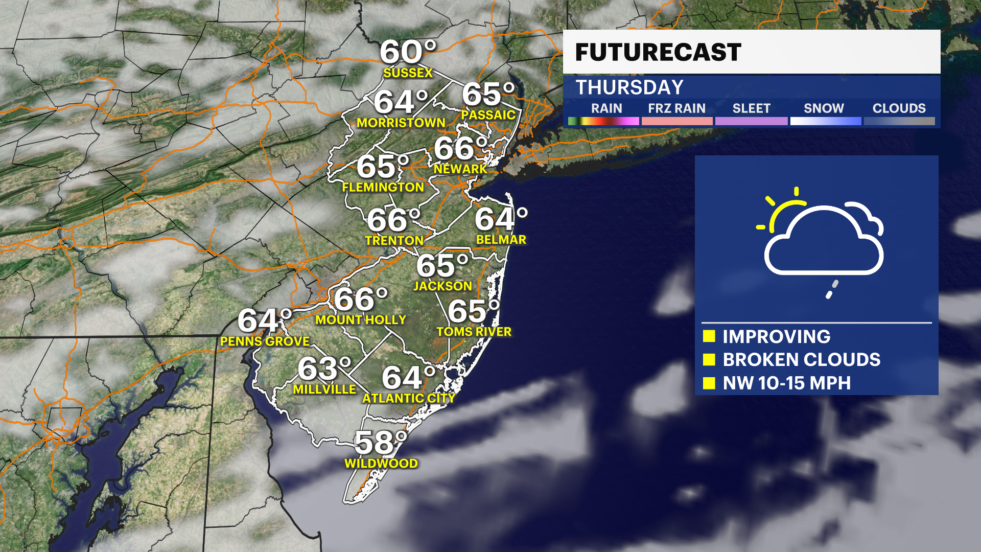
Conditions improve gradually Thursday morning near sunrise where sun begins to break through some of the mostly cloudy conditions. Highs will be in the upper 60s. Friday is good with windswept clouds capable of producing a sprinkle or virga.
Saturday is fair before rain arrives for the evening. It clears up for Sunday. However, Monday is shaping up to be very rainy based on latest trends. This will need to be followed carefully for some impacts that may result in minor area flooding.