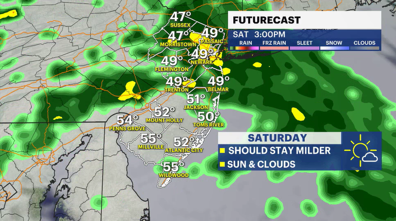
Rain returns for Saturday to dampen outdoor plans
The weather remains favorable for Friday with sun and clouds. The temperatures stay near or slightly above average. Showers move in late Friday night and blanket the area for Saturday.


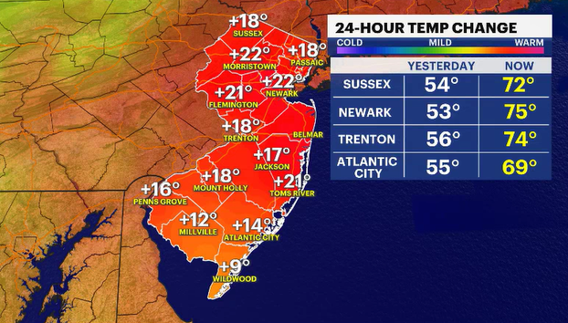
Thursday brought picture-perfect weather to New Jersey. You couldn't have asked for a better weather day. Sunny skies, light breeze, and temperatures that were pleasantly warm in the 70s. We'll eke out another nice day to end the work and school week, but rain returns to make a mess of Saturday.
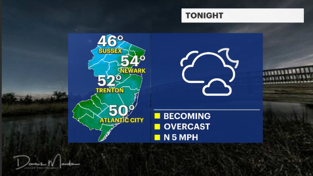
Skies will cloud over tonight. We do not anticipate any shower chances. Just skies being blanketed by clouds. Nighttime lows will fade to the mid- and upper 40s.
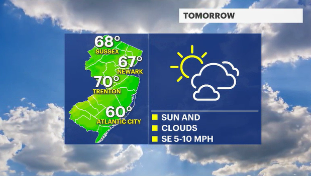
Friday feels fine with daytime highs rebounding to near 70 degrees in many locations under sunny skies. The clouds will begin to collect after 4 p.m. as a weather system begins moving closer to the state. This piece of energy drops from the Great Lakes through Pennsylvania and dives just to our south. The storm's close proximity and movement will allow rain to develop Friday night and fester for much of the day on Saturday.
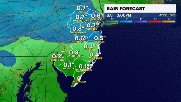
Saturday's rains will be good for the gardens and lawns. It's possible that a solid half to full inch of water will collect and gradually soak into the ground. It's a beneficial rain. Inconvenient rain, yes, but beneficial. The water will not collect quickly in the streets, so flooding will not be an issue. It will, however, be an issue for any outdoor activities. Baseball, softball or lacrosse games the kids may have planned will likely have to be cancelled and rescheduled.