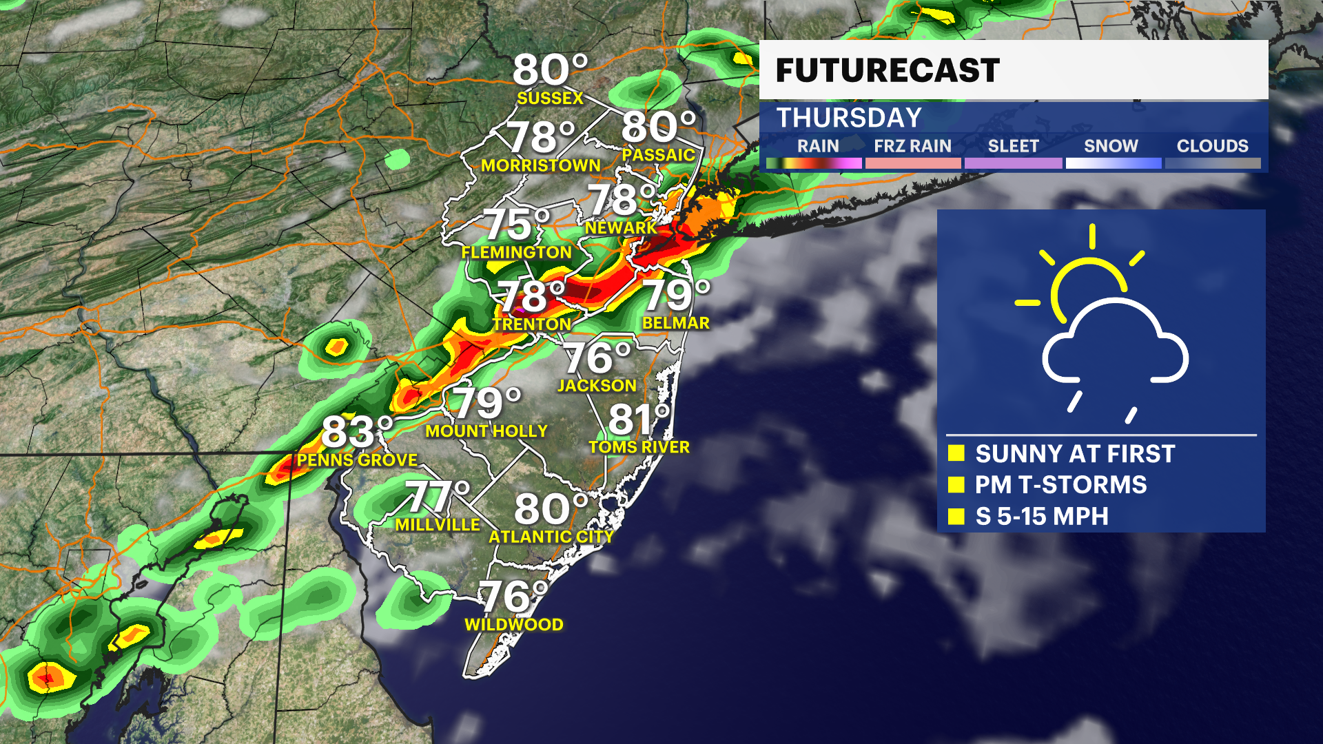
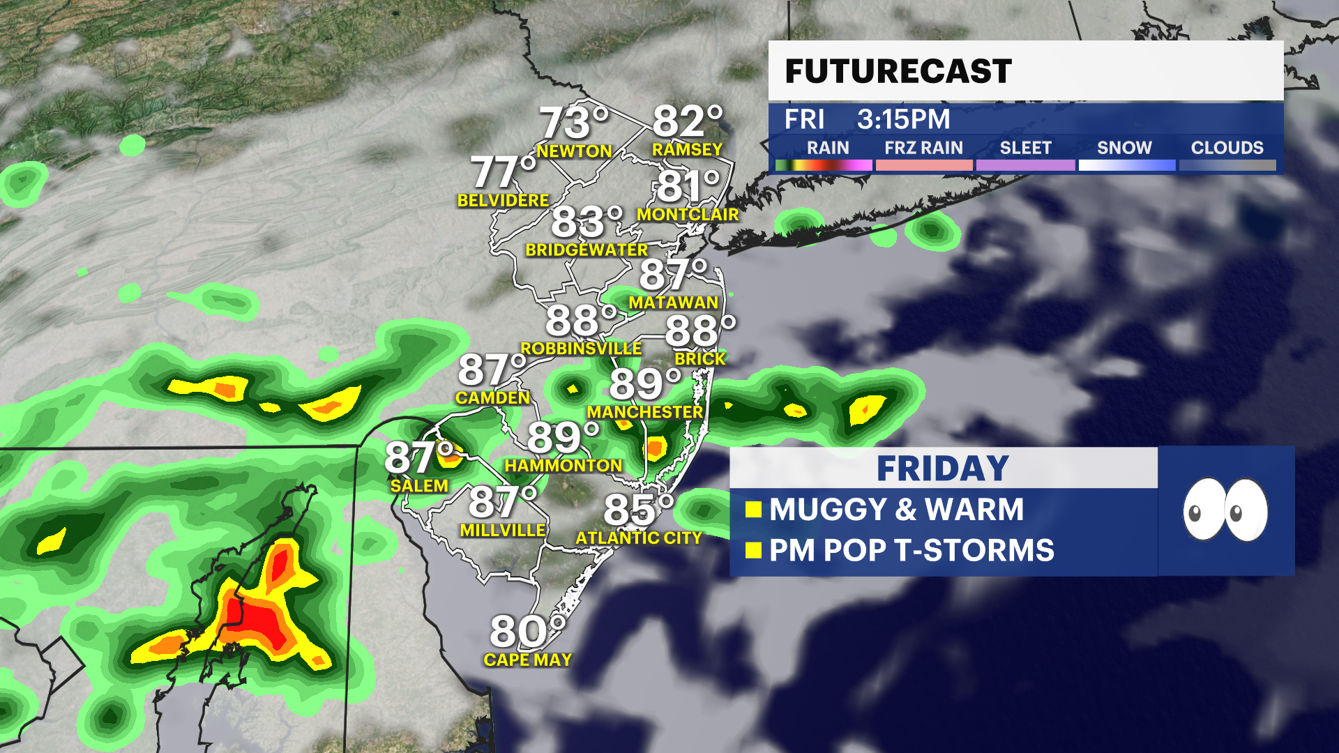
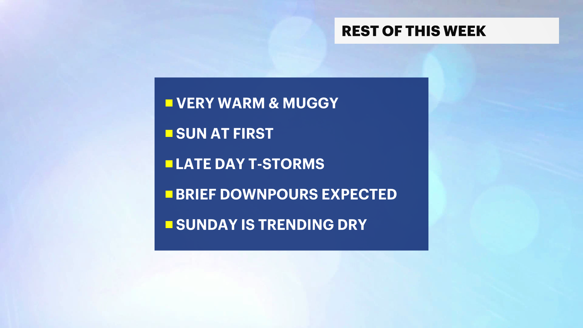
More Stories


A weekend nor'easter is still in the forecast and should pass to the east of New Jersey with impact chances increasing for the NJ coastline. These impacts would be in the form of snow, coastal flooding, and strong gusts on Saturday night into and through Sunday. The questionable part of the forecast is about whether or not the snow reaches far inland.
One of the scenarios is for the storm to stay far enough east to keep the heaviest of the snow offshore. However, a slight adjustment to the track and slide this storm closer to the coast, creating very heavy snowfall statewide.
The chance for 5" of snow is increasing to moderate levels, which suggests that people living in Monmouth, Ocean, Burlington, Atlantic, and Cape May counties should begin to consider how snow would affect them this weekend. Areas inland have a low to very low risk of snow based on current trends. However, the trends this season have been favoring a more west or north track that could push snow chances higher inland.
As storms develop, they don't move in a straight line and they wobble. This storm can intensify in that same way and push closer to the coast last minute. This is a critical detail that can be the difference between a little snow and a lot of snow.
Aside from the nor'easter threat, the bitter cold is here to stay and it will last for at least another 5 days before jumping to the freezing mark or above on Monday.