HEAT ALERT: Sunny Tuesday with summer-like temperatures for New Jersey
Heat relief won't arrive until mid-week, with potential for thunderstorms.
More Stories


WHAT TO KNOW
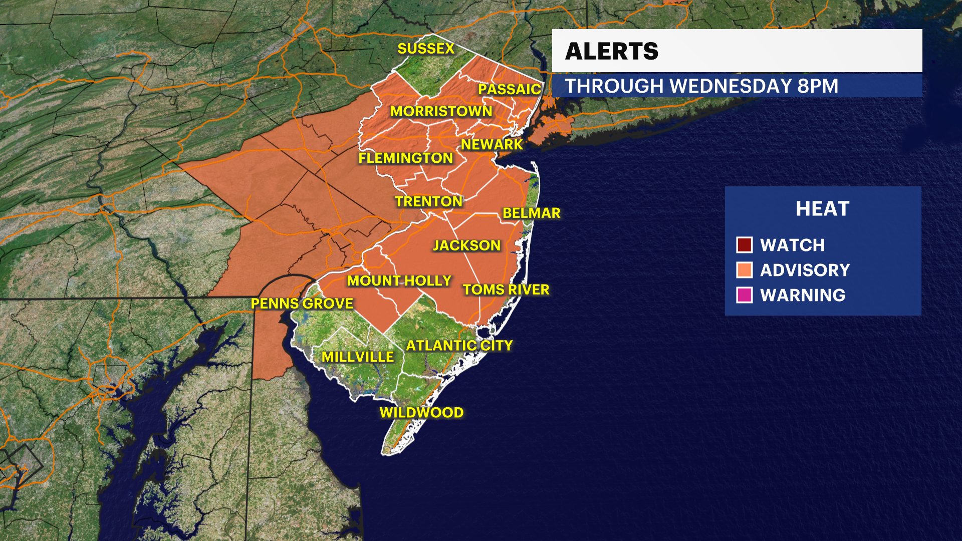
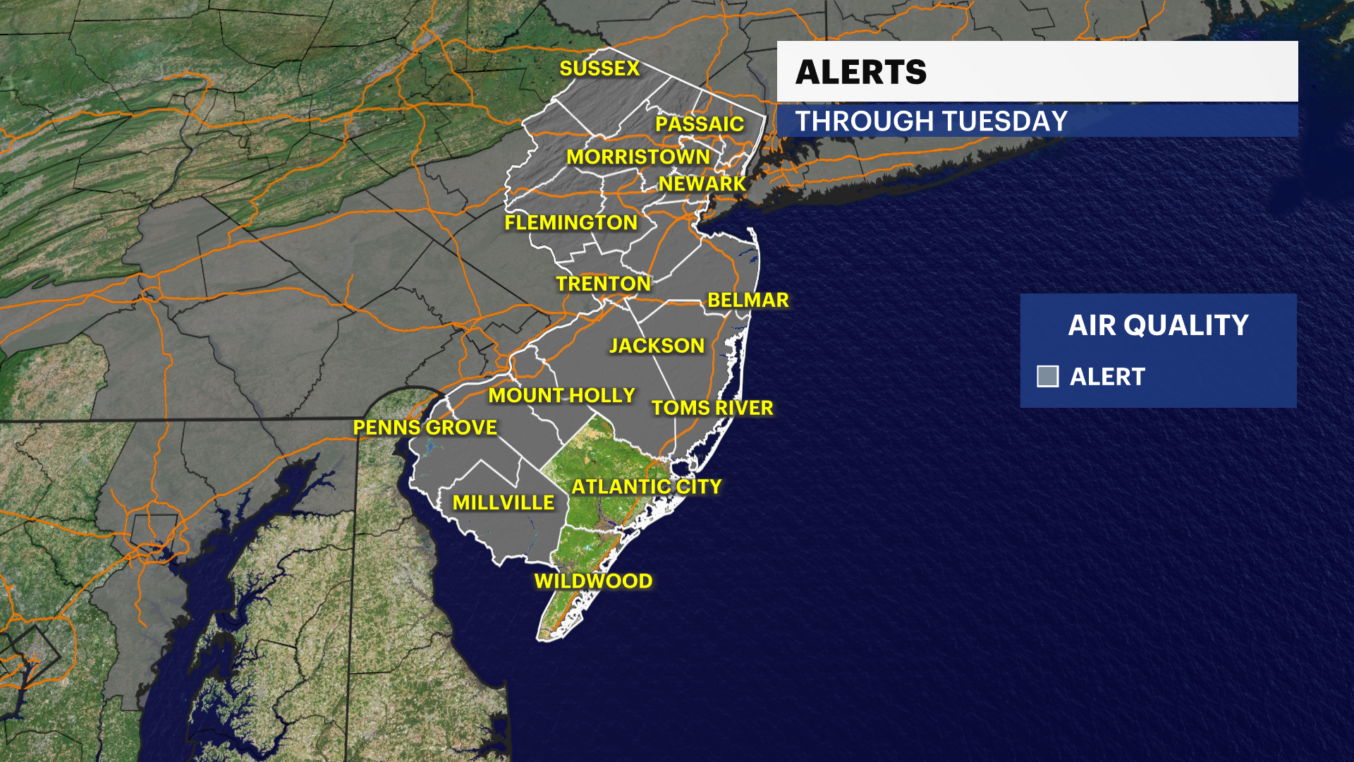
There is a heat advisory in effect for most of New Jersey's 21 counties, with the exception of four counties in South Jersey (Salem, Cumberland, Cape May and Atlantic counties) and Sussex County in North Jersey.
There is an air quality alert in effect until 11 p.m. and again on Tuesday from 11 a.m. to 11 p.m.
FORECAST
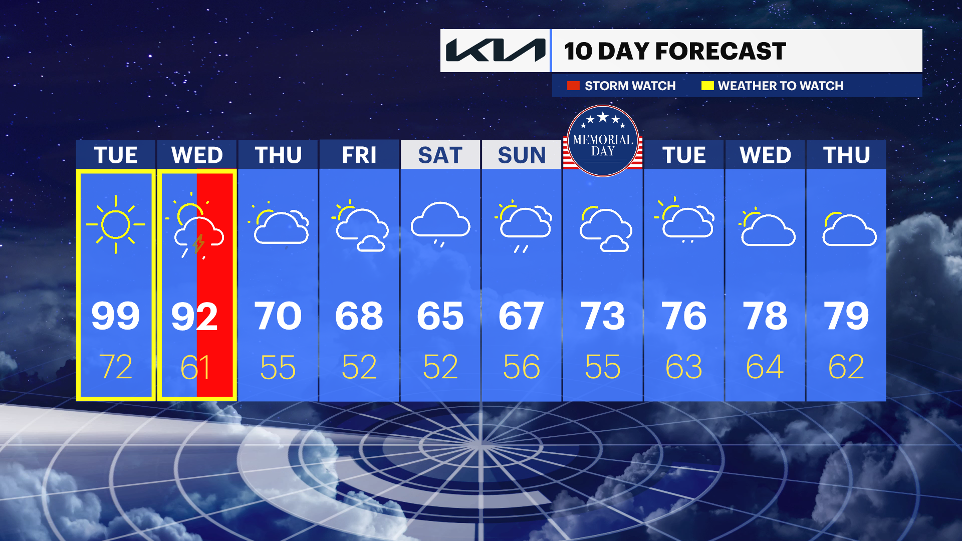
The heat wave began in Newark on Sunday with a high of 91. A heat wave means three consecutive days of 90-plus degree heat. Monday's temperatures were in the low to mid-90s.
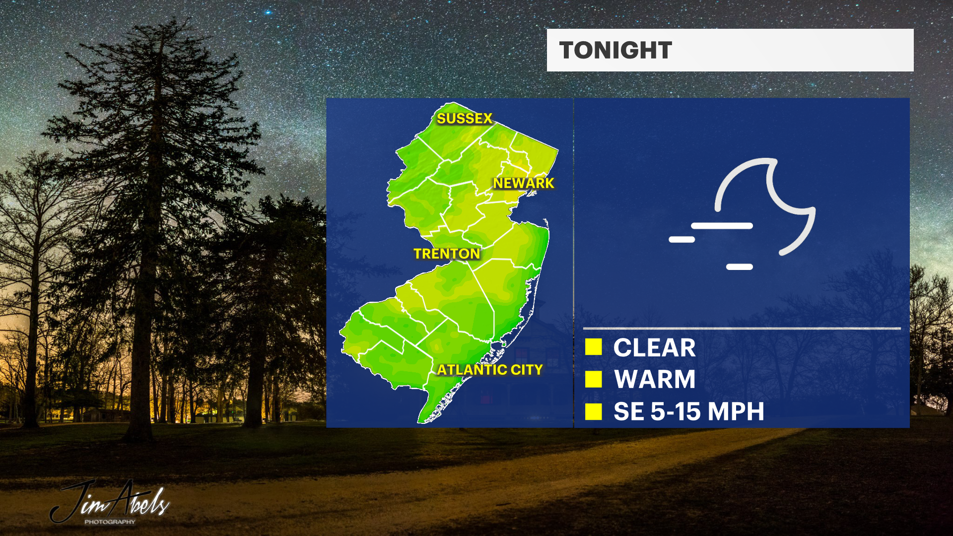
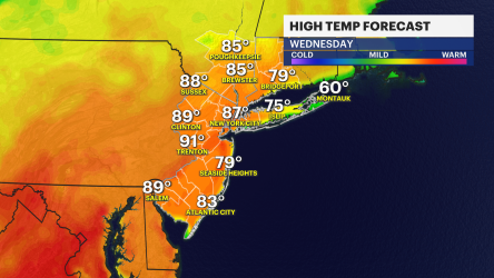
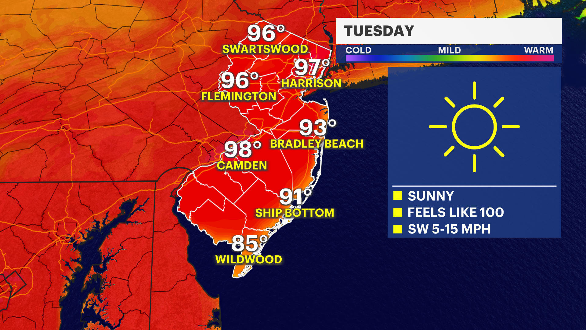
Tuesday's high temperature will be even warmer with higher humidity. It's still too cold in the ocean waters to find relief without potential shock to the system.
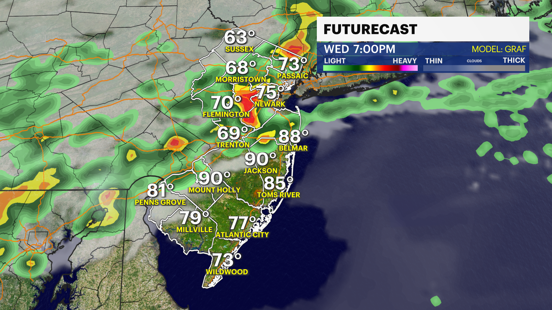
A cold front is expected to cross late in the day Wednesday that will trigger some thunderstorms and relief from the heat but not before some areas reach the 90-plus degree mark.
There will also be significant changes in temperatures on Thursday as high temperatures will drop about 20 degrees.
The Memorial Day holiday weekend appears to feature clouds and occasional showers as of Monday evening's forecast.