STORM WATCH: Connecticut tracks Thursday nor’easter as heavy rain, gusty winds and higher-elevation snowflakes loom
Rain will be heavy at times with totals reaching 1-2 inches. Turning colder Friday, changing some rain to wet snow for highest elevations.
More Stories



Bridgeport Information
FORECAST
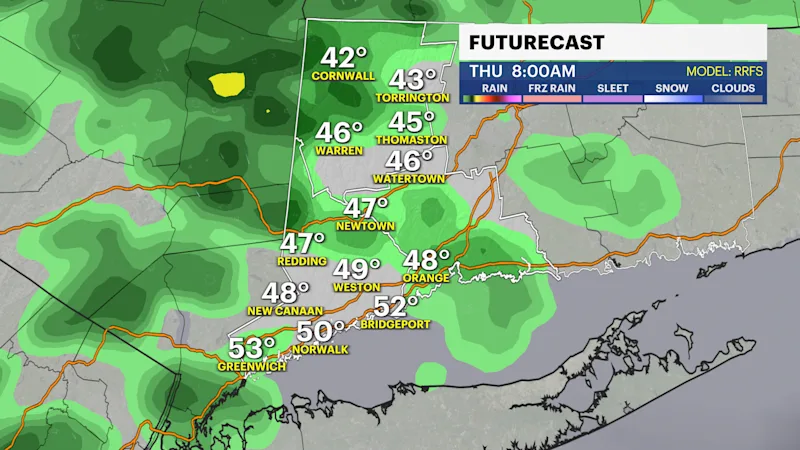
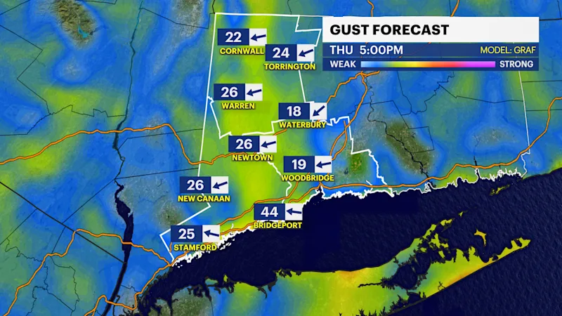
Clouds increase tonight, with a chance of showers developing overnight as our next weather system approaches from the west. This low pressure will eventually develop into a coastal storm by evening with some pockets of heavier rain and gusty winds reaching 30 mph.
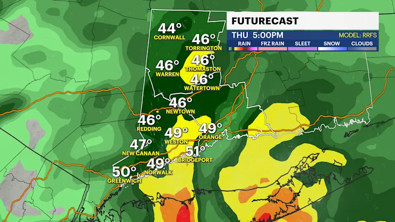
The heaviest rainfall is expected during the afternoon and evening hours, particularly between 2 and 8 p.m. Several rounds of rain and locally heavy downpours are possible, creating wet roadways and potentially difficult travel conditions.
Rainfall totals are expected to range between 1 and 2 inches across much of Connecticut, with locally higher amounts possible depending on how long the storm lingers.
Gusty winds will also accompany the system, with gusts generally between 20 and 30 mph and isolated gusts potentially approaching 35 mph.
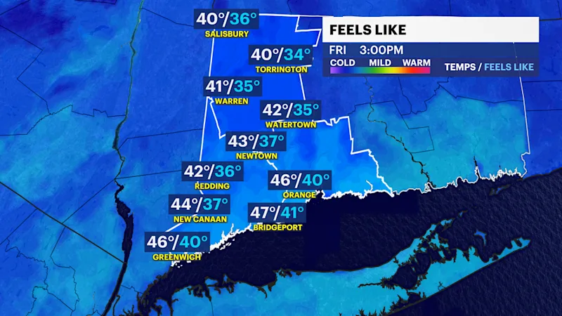
As colder air filters into Connecticut into early Friday morning, some areas could experience a transition to a wintry mix. The greatest potential for freezing rain, sleet and wet snowflakes will be across the higher elevations, particularly in Litchfield County and other elevated portions of western and northern Connecticut. Coastal communities and areas closer to the shoreline are expected to see primarily rain.
No significant snow accumulation is expected, although a few wet flakes could mix in across the interior before the storm gradually exits. Precipitation should wind down by Friday evening.