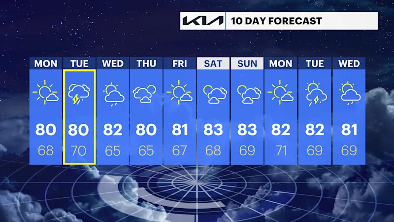
Sunny and warm Monday on Long Island before risk of strong storms, heavy rain Tuesday into Wednesday
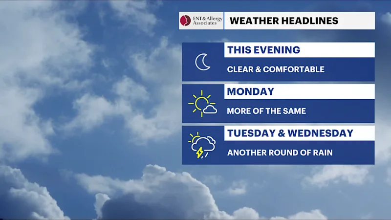
Dry, comfortable weather continues through Monday before a more humid pattern brings heavy rain, thunderstorms and the potential for localized flooding through midweek.
More Stories


What to expect:
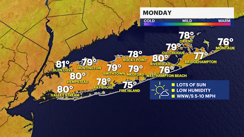
Pleasant, seasonable weather continues through Monday, with low humidity and sunshine.
Humidity increases Monday night as the next storm system approaches.
Showers and thunderstorms become likely Tuesday afternoon through Wednesday, with periods of heavy rain possible.
Drier, less humid weather returns for the end of the week and next weekend.
FORECAST
Overnight
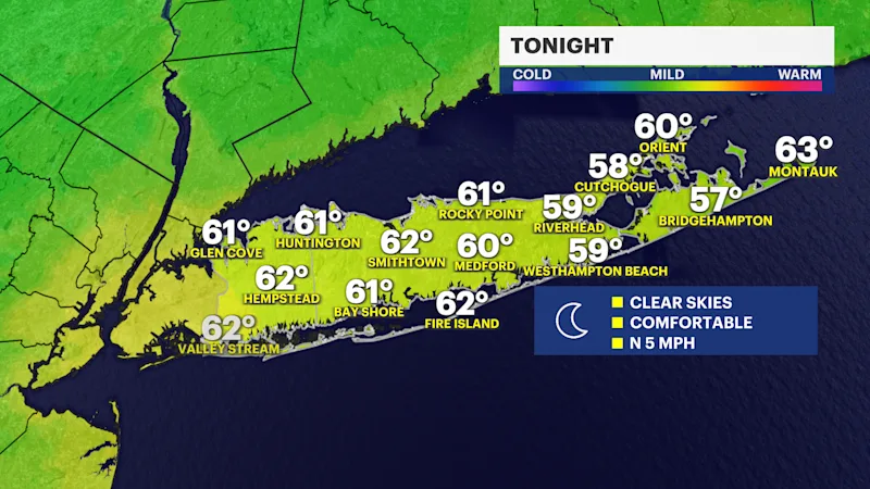
Mostly clear and comfortably cool, with light winds and low humidity—an excellent night for outdoor activities.
Monday
Sunny and seasonably warm, with comfortable humidity. Light southerly winds develop during the afternoon while dry weather continues.
Monday night
Increasing clouds as moisture begins returning from the south. Mild overnight with no significant weather expected.
Tuesday
Clouds increase, with scattered showers developing and thunderstorms becoming more likely during the afternoon. While severe weather appears less likely than inland locations, any storm could produce heavy downpours, frequent lightning and gusty winds.
Tuesday night
Periods of showers and thunderstorms become widespread. Heavy rainfall is possible, with localized flooding developing in poor drainage and low-lying areas if heavier bands move across the same locations.
Wednesday
Showers and thunderstorms continue, especially during the morning and early afternoon, before gradually tapering later in the day as the cold front moves offshore.
Wednesday night
Clouds gradually clear, with noticeably lower humidity returning overnight.
Thursday
Mostly sunny, pleasant and less humid, with comfortable summer conditions.
Friday
Sunny and seasonably warm, with dry weather continuing.
Weather alerts, watches, and hazards
No active watches or warnings are in effect for Long Island at this time.
Weather hazards
Heavy rainfall (Tuesday afternoon through Wednesday):
Multiple rounds of showers and thunderstorms could produce locally heavy rainfall. While widespread flooding is not anticipated as of Sunday evening's forecast, localized flooding of roadways and poor drainage areas is possible where heavier rain persists.
Thunderstorms (Tuesday through Wednesday):
Thunderstorms may produce frequent lightning, brief gusty winds and torrential downpours. While the severe weather threat appears lower than inland areas, a few stronger storms cannot be ruled out.
Reduced visibility in heavy rain:
Periods of torrential rain may significantly reduce visibility and create hazardous travel conditions Tuesday night into Wednesday.
Improving weather late week:
High pressure builds back into the Northeast Thursday through the weekend, bringing lower humidity, abundant sunshine and several days of pleasant summer weather.