STORM WATCH: Scattered, potentially damaging storms Tuesday on Long Island
Tonight's weather is nice, but scattered strong to severe thunderstorms are possible Tuesday - bringing threats of intense wind, flooding downpours, frequent lightning, hail and even a low tornado chance.
More Stories


TUESDAY'S STORM RISK
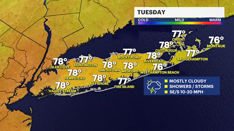
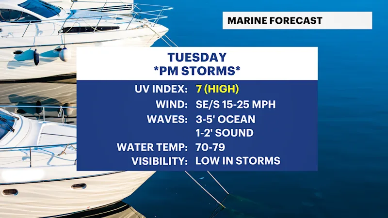
After a beautiful Monday, the risk of scattered strong-to-severe thunderstorms increases for Tuesday. Not everyone will see awful weather, but these storms can hit very hard where they do set up as well as the area they track across. Please have a way to get emergency alerts Tuesday and have a place of shelter nearby in the afternoon and early evening. A few showers can develop by mid-morning, but the threat for stronger storms will be from around noon to 9 p.m. News 12 will have additional live Storm Watch weather updates as needed all day on Tuesday. Remember to check the News 12 app for the latest updates anytime on the go.
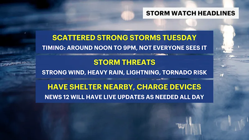
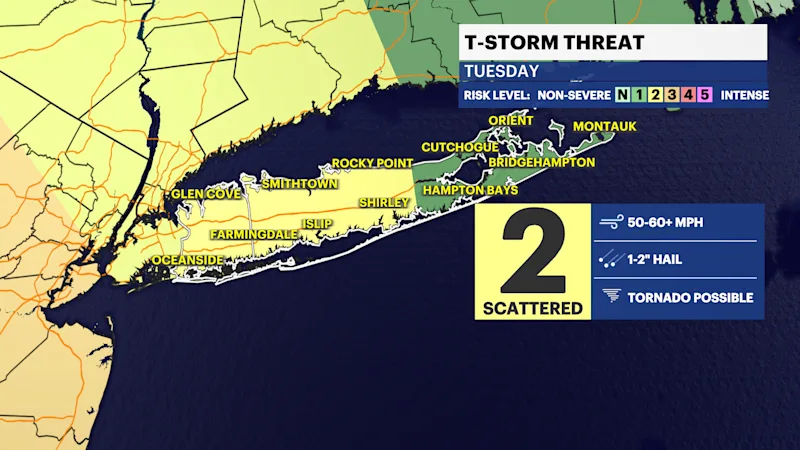
Scattered straight-line wind gusts of 40 to 60 mph or higher will be the main threat, along with instances of scattered flooding, low visibility from torrential downpours, frequent lightning and hail. A brief tornado cannot be ruled out, but that chance is low. If Long Island were to get a tornado, it would likely be with winds around 65 to 85 mph, which can easily cause damage. Again, that chance is very low, but cannot be ruled out. There will be parts of Long Island that do not see more than a few showers. That is why it will continue to be important to follow News 12 weather updates through the afternoon and evening.
THIS EVENING AND OVERNIGHT
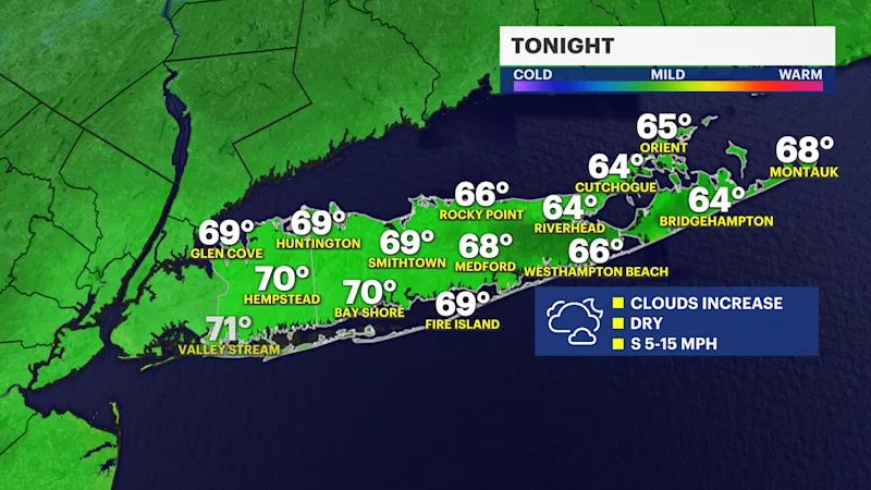
It will be mostly clear to partly cloudy this evening and comfortable with temperatures mainly in the 70s - enjoy! More clouds will gradually increase overnight, becoming mostly cloudy into Tuesday morning. Low temperatures into the morning will mostly be in the 60s.
QUIET WEATHER STRETCH ARRIVES LATE-WEEK
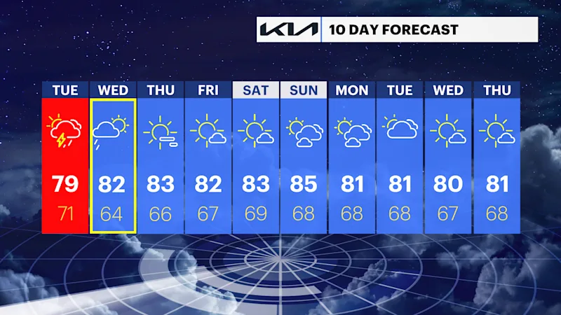
After we get through Tuesday's scattered storms and a passing shower or thunderstorm on Wednesday, the weather from Thursday through early next week looks great with sun and some passing clouds. Air quality also looks to be good, too, but this will continue to be monitored through the week.
EXTENDED FORECAST
TONIGHT: Partly cloudy this evening, with clouds increasing overnight. Lows in the 60s. Wind: south 5 to 15 mph.
TUESDAY: STORM WATCH -- Mostly cloudy with a few passing showers possible in the middle to late morning hours. Scattered strong to severe thunderstorm chances increase for the afternoon and early evening. Warm and humid with highs around 79 degrees. Not everywhere on Long Island will get bad storms, but where they occur - expect strong wind, frequent lightning, downpours with scattered flooding and even the chance for hail. A brief tornado with winds higher than 65 mph also cannot be ruled out, but that chance is low overall. The severe weather threat ends by 9 p.m. A spotty shower or non-severe thunderstorm chance will continue overnight with lows around 71 degrees.
WEDNESDAY: Clouds with hints of sun. A few showers or isolated thunderstorms possible, mostly in the morning through mid-afternoon. Highs around 82 degrees and still humid. Lows near 64 degrees.
THURSDAY: Sunny with highs around 83 degrees. Low humidity. Lows near 66 degrees.
FRIDAY: Mostly sunny and still comfortable with highs around 82 degrees and low humidity. Lows near 67 degrees.
SATURDAY: Mostly sunny. Highs around 83 degrees. Lows near 69 degrees.
SUNDAY: Sun and clouds. A bit more humid. Highs around 85 degrees. Lows near 68 degrees.
MONDAY: Sun and clouds. Highs around 81 degrees. Lows near 68 degrees.
TUESDAY: Mostly cloudy with scattered rain showers likely. Highs around 81 degrees. Lows near 67 degrees.