Storm Watch: Severe storms threaten the entire region on a hot and humid day today
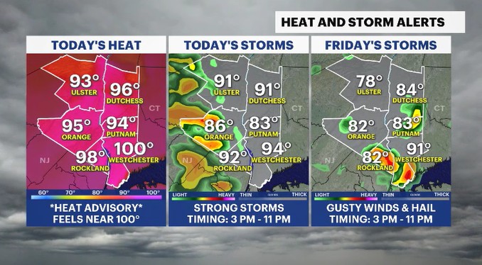
A heat advisory is in effect as temperatures climb to potentially record levels
More Stories


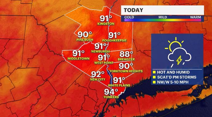
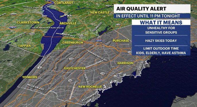
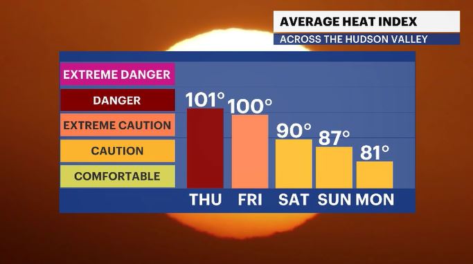
It will feel like a full-blown summery day today as temperatures move into the low 90s, and humidity climbs to tropical levels. A heat advisory is in effect now until Friday evening, at 8 p.m. There will be feels-like temps around 100 degrees for both today and tomorrow's afternoon hours. It is the type of air you want to stay inside for, right by the air conditioner. Another reason to stay inside, or at least take it easy outside, is with an air quality alert in effect for today in south Westchester County. The record high today is 92 degrees (set in 1964) and the forecast high is 92 for White Plains.
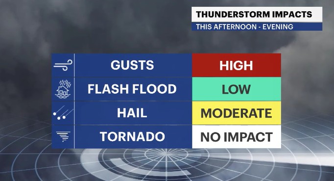
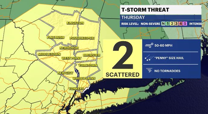
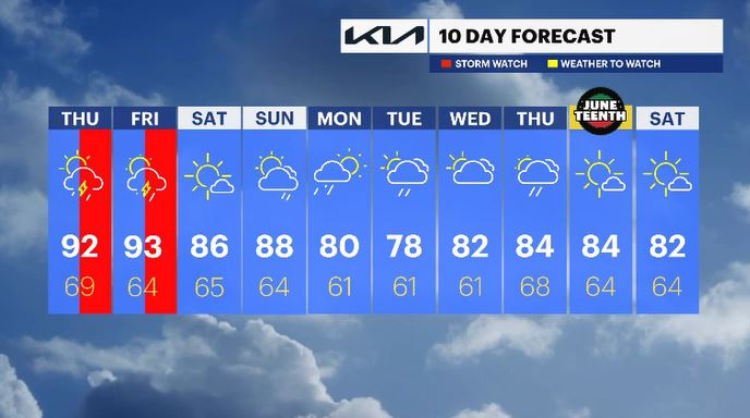
The heat and humidity will help fuel potentially severe thunderstorms through the rest of the day. The timing is roughly between 3 p.m. to 11 p.m. Any storms that turn severe can bring damaging wind gusts over 40-50 mph and penny size hail. This threat is widespread across the entire Hudson Valley region. There was a tornado potential for today, but that chance has backed down.
We will see these same conditions, that are around today, for Friday as well. The record high for Friday 92 degrees (set in 2017) and the forecast high is 93.
The heat and humidity will back down for Saturday, where temps will be into the 80s and it will feel a little easier to be out and about. We can expect fair skies through most of the weekend. There is a late day shower chance on Sunday.
ALMANAC:
Average High: 77 | Average Low: 58
Record High: 92 (1964) | Record Low: 39 (1980)
Sunrise: 5:22 a.m. | Sunset: 8:27 p.m.
THE FORECAST:
TOAY: STORM WATCH (PM) - HEAT ALERT - Partly cloudy with an afternoon to evening severe storm threat. Highs: low 90s.
TONIGHT: Mostly cloudy, stuffy, with scattered showers early on in the night. Lows: upper 60s to low 70s.
FRIDAY: STORM WATCH (PM) - HEAT ALERT - Mostly sunny to mostly cloudy with an afternoon to evening severe storm threat. Highs: low 90s. Lows: mid-60s.
SATURDAY: Mostly sunny, less humid but still warm. Highs: mid-80s. Lows: mid-60s.
SUNDAY: Mix of sun and clouds with a late day shower chance. Highs: upper 80s. Lows: low to mid-60s.
MONDAY: Showers fade in the morning hours with a mix of sun and clouds to follow. Highs: upper 70s to low 80s. Lows: upper 50s to low 60s.